Dave Cook Delves into Ecology’s Affordable Housing Cleanup Grant Program at MTCA Law Seminar

Senior Principal Geologist Dave Cook, LG, CPG, will be a part of a seminar on Thursday, December 7 focused on the Model Toxics Control Act (MTCA). First adopted by the Washington State Department of Ecology (Ecology) in 1991, MTCA is now in its 33rd year regulating cleanup of contaminated sites in our state.

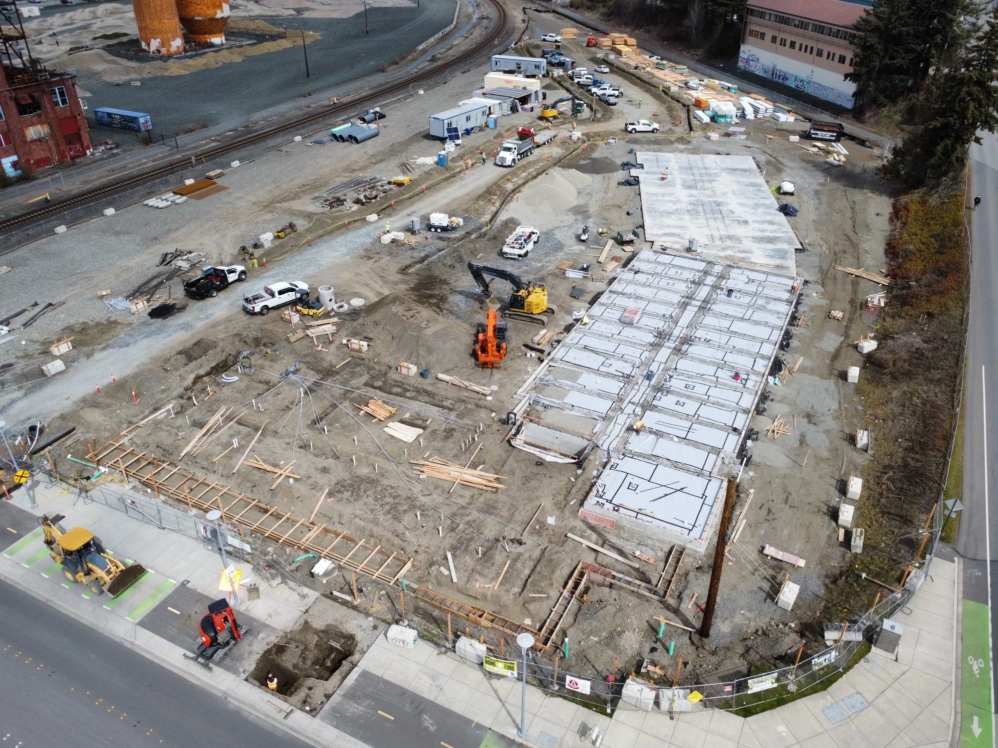
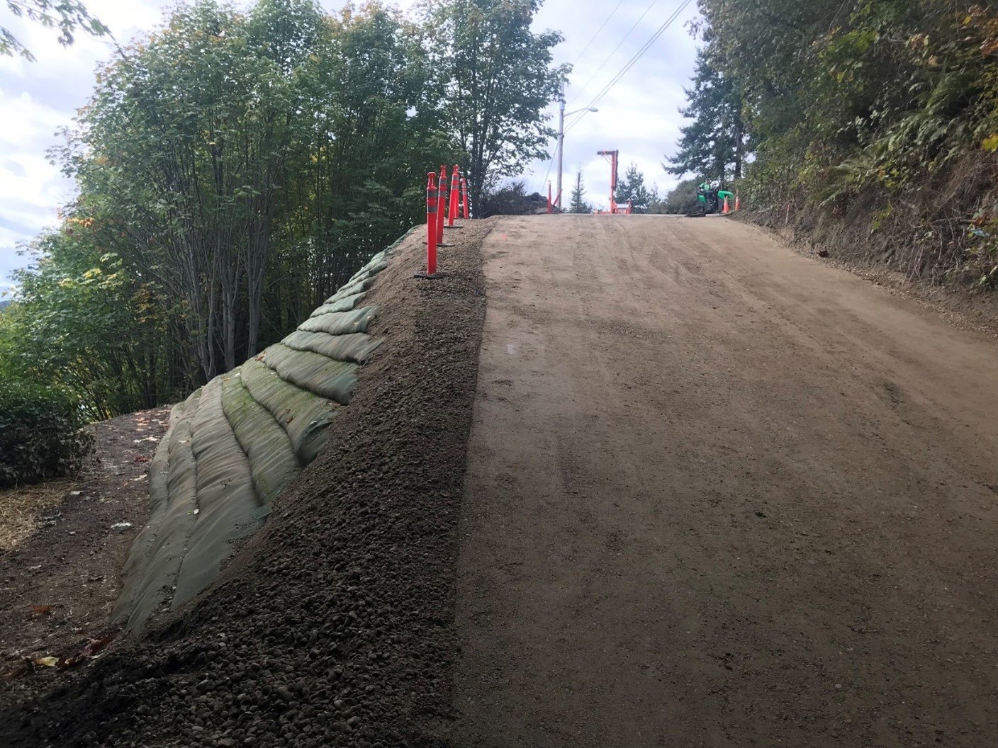
The site of the future Maddux North building being readied for redevelopment in 2020. The property formerly housed a dry cleaner, which left contamination in the surrounding soils. Cleanup of the site followed regulations per MTCA.

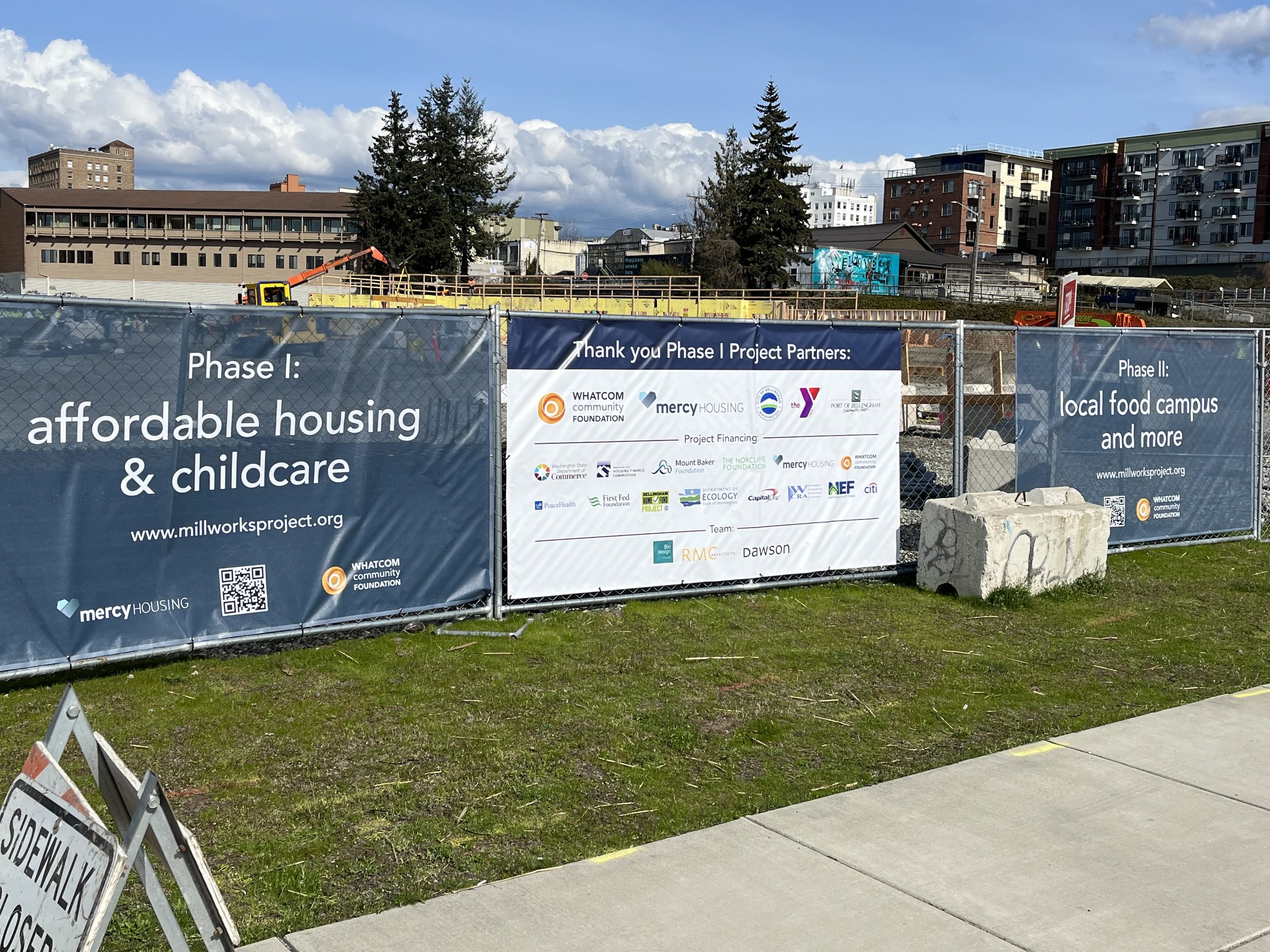
Dave and Ali Furmall, LHG, Brownfield Program Lead at Ecology, will present “Community Investment: Overview of Affordable Housing Cleanup Grant Program and Other Brownfield Program Resources.” Their talk will give an overview of Ecology’s Affordable Housing Cleanup Grant Program, which helps organizations purchase and remediate sites across Washington to build affordable housing.

Since the program’s start in 2016, Dave and Aspect have actively collaborated with Ecology, real estate developers, legal teams, and nonprofit housing groups to get projects funded and properties ready for cleanup. Our work now spans Bellingham, Ellensburg, and several sites in Seattle, including the launch pilot-project Mt. Baker Housing Association’s Maddux development. The project built two buildings with 203 total units on the site of a former dry cleaner and gas station/auto repair shop.

Maddux North, funded in part by the Affordable Housing Cleanup Grant program, welcomed residents in March 2023.

The day-long seminar hosted by Law Seminars International will spotlight other aspects of MTCA, including an overview of the recent updates—the first major updates in over 20 years—covering new decision-making criteria and other requirements that will impact future cleanup projects.

For the full seminar agenda and information how to register, visit the Law Seminars International website.

Dave Cook Honored as Volunteer of the Year at Northern Arizona University

Senior Principal Geologist Dave Cook returned to his alma mater, Northern Arizona University (NAU), in Flagstaff on Friday, October 27, to attend the 2023 Honored Alumni & Hall of Fame Ceremony. He was honored with their 2023 Jeff Ferris Volunteer of the Year Award, which “is presented to an NAU alumna or alumnus who has demonstrated sustained interest and loyalty to the NAU Alumni Association or the University as a whole.” The ceremony and Dave’s acceptance speech are available on the NAU Advancement | Foundation YouTube page.

I was given an incredible opportunity at NAU to learn from world-class geologists while completing a dream research project in the Grand Canyon. The place, people, and environment were game changers for my development. It’s important to me to mentor and give back to the place and people that helped put me in a position for an amazing career – hoping that they’ll have similar successes.
— Dave Cook on what drives him to give back to NAU.

Dave outside the NAU Geology building

Dave’s service to the university started shortly after he graduated with a master’s degree in geology in 1991. Over the years, he has spoken at various lectures and seminars and acted as a reviewer and commenter for NAU’s Annual Science Symposium. He has contributed to alumni-funded scholarships and was one of the launch funders for the Parnell Water Research fund, named after Dave’s master’s advisor Rod Parnell, in 2019. In 2022, he co-led a geology department alumni committee to envision new curricula. He is currently an affiliate professor for the School of Earth and Sustainability and serves on its Board of Advisors. Dave has also had three student mentors through NAU’s Thrive Externship program, two of which have traveled to Seattle to shadow Dave and meet Aspect staff to learn more about environmental consulting.

Dave on campus with past NAU mentees (left to right) Karen Vera, Natalie Pierson, and Caitlin Brogan in May 2023

Congratulations to Dave on his award and for his years of contributions to NAU.

Aspect Teams with Ecology on Innovative Conservation Effort

In a recent post, the Department of Ecology celebrated a successful pilot project with the Auvil Fruit Company in Vantage, WA. The project created two water banks and helped the orchard reduce their water demand by 50%. Aspect partnered with Ecology on the water rights permitting as well as the bank development efforts, but it was an innovative strategy developed by Auvil that led to this water-saving achievement.

Shade cloth installed at Auvil Fruit Company.

The solution was to cover Auvil’s orchards with shade cloth, which has multiple water savings, worker safety, and fruit quality benefits. Aspect and Ecology used two high-tech weather stations to monitor water loss: one in the area of the orchard covered by shade cloth, and one in an adjacent, uncovered area. According to Ecology, the effectiveness of the shade cloth was striking:

We found that shade cloth improved a number of growing conditions. The coverage greatly increased relative humidity, drastically reduced wind speed, stabilized soil moisture, and cooled the air temperature. Combined, all these changes now help Auvil use much less water to produce fruit. 

A weather station positioned beneath shade cloth at Auvil Fruit Company. 

The shade cloth was so effective that Auvil was able to remove windbreaks made of water-hungry poplar trees. The study also led to other water-saving strategies, such as installing soil moisture monitors and replacing overhead sprinklers with a drip system that delivers water directly to the root zone of the trees. Both of these systems communicate with one another to regulate water in real time. Water savings from the project are being used to reduce drought risk on Auvil’s interruptible water rights, and for instream flow benefit for fish. Auvil continues to be a leader and innovator in irrigation practices and Aspect’s permitting and technical skillset is making the most of these water savings.

For more details, check out Ecology’s website!

Aspect’s Geologists Converge in Portland for AEG 2023

Aspect’s Infrastructure Practice will be well represented at the annual meeting of Association of Environmental and Engineering Geologists (AEG), taking place September 20-22 in Portland. Here’s a roundup of our staff who will present over the course of the meeting.

Technical Sessions

Site Explorations on the Swinomish Bluffs

Chip Barnett, LEG, and Aaron Fitts, LEG’s presentation Application of Sea Level Rise Estimates to Slope Stability Evaluation of Marine Bluffs, Swinomish Indian Reservation, La Conner Washington covers Aspect’s collaboration with Blue Coast Engineering and the Swinomish Indian Tribal Community to assess and understand geologic and slope conditions on over 100 residential lots on tribal land impacted by localized landslide failures. The project focuses on identifying the cause and mode of the failures, assessing coastal erosion, determining how those hazards will be worsened by rising sea levels, and prioritizing areas for monitoring and mitigation to protect the slopes and homes.

Aerial view of Swift Creek area

Aaron will also present on Managing Naturally Occurring Asbestos in Landslide Sediments and Debris Flows – Swift Creek, Whatcom County, Washington. Aaron is the lead geologist on this project for Whatcom County Public Works to address chronic sedimentation issues from landslide material containing naturally occurring asbestos within Swift Creek in rural Whatcom County.

Rock & Gravel quarry in the Wenatchee Mountains

Alec Melone, GIT, will also discuss naturally occurring asbestos in his presentation, Preliminary Naturally Occurring Asbestos Screening for Quarry Expansion: Field and Structural Studies in the Ingalls Ophiolite Complex, Central Cascades, Washington. Alec will share Aspect’s approach for assessing the contaminant and structural hazards within the Ingalls Tectonic Complex to support a 50-acre quarry expansion in the central Cascades’ Wenatchee Mountains.


Poster Presentations

Studying trees at Rialto Beach

Chelsea Bush, LG, and Monica Hill, GIT, are part of a group presenting a poster on the Landslides, Tectonic Uplift, and Coastal Erosion of the Past Several Hundred Years at Rialto Beach, Washington: Geologic Evidence and Implications for Geohazards along the Northwest Coast. The poster delves into some of the mysteries the group is trying to solve on this stretch of beach. When the project began in 2017, the main focus was the origin of a rapidly eroding terrace on the back beach, several feet above the modern beach surface, and whether it may have been formed during the 1700 Cascadia Subduction Zone earthquake. Part of that work centered on determining the age of Sitka spruces on the terrace. When they learned the trees were much younger than they expected, things got interesting. Their ongoing work will help geologists determine how shoreline forests react to and recover from large-scale storms and seismic events.

Chelsea and Monica both got involved with the project as part of their master’s studies at the University of Washington. Chelsea started in 2017, focusing on landslide mapping and carbon dating of wood in the beach and landslide deposits. Later, Monica joined the group to conduct shoreline change assessment as they studied the effect that a nearby jetty/dike system at the mouth of the Quillayute River has on the rapidly eroding terrace. The poster will present an overview of the work they and many other UW Ph.D. and masters’ students have contributed to the study.

Stabilization measures in place at Washington Boulevard

Chelsea also has a poster on Aspect’s Washington Boulevard Landslide Stabilization Project with Kitsap County Public Works. Aspect worked with the County for over a decade to assess, monitor, and ultimately stabilize a roadway—and sole access to services for over 22 homes— traversing a dead-seated landslide complex along a steep coastal bluff in Kingston, Washington. The project won the American Public Works Association’s 2022 Project of the Year Award in the Disaster or Emergency Construction Repair (less than $5 million) category.


Associate Engineering Geologist Mark Swank, CEG, LEG, is the AEG Secretary, a member of their Executive Council, and a co-chair of this year’s meeting. Chip Barnett was recently elected to the AEG Board of Directors for the Pacific region and coordinated the poster sessions as part of the meeting’s planning committee. Aspect is proud to sponsor technical sessions on Collecting Geologic Data for Assessment of Potential Hazards Using Multiple Surface and Subsurface Methods Symposium, the Young at Heart Student/Young Professional Event, and the all-important All Day Coffee on Tuesday.

The Path to Professional License: Chelsea Bush, LG

In the science and engineering industry, seeing a “PE”, “LG”, “PMP”, or other initials behind someone’s name shows that person went through years of work experience that culminated in a substantial test to confirm the right to practice their area of technical expertise. Many go through this licensing journey but few outside that group know what the process is really like.

We’re telling those stories here. Aspect’s professionals are writing a series of articles that capture the trials and successes of studying for and receiving these career-defining milestones.

Chelsea Bush, Licensed Geologist (LG)

Date you took the test: March 17, 2023

Date Awarded: May 4, 2023

Chelsea working at Rialto Beach.

Where did you start with your test prep?

I find that studying with a good friend is the best way to learn and retain information. I chose my bestie Mary Alice, who was taking the test at the same time, and we met up at a restaurant/bar every weekend for 3 months. Good food and a beer helped us relax and enjoy our study time, instead of dreading it.

Together, we went over the practice tests and graded each other, and we taught each other all of the different sections outlined in the Reg Review study materials. We decided that we should prepare our “lessons” on the material we are least familiar with, then go over our findings together.

What should a person gearing up to do this know about the mental, physical, and social challenges of test prep?

Studying for the test is stressful—at first it is very overwhelming and it seems like you will never get through all the study materials. But if you break down the sections and consider your comfort level with each subject, it helps put the test in perspective.

I focused heavily on hydrogeology and engineering geology review, and spent a day on each of the subjects (like economic geology, which I have no background in) reading through all of the material and attempting study questions. I suggest learning basic hydro equations, how to calculate weighted averages, and review your three-point problems (applicable to both structural and hydro questions). Don’t freak out if you don’t know some things! You only need a 70 percent grade to pass.

Chelsea with her cat, Elvira.

Walk us through the Big Test Day…

I was really nervous! To prepare for the exam I ate a solid breakfast, drank a lot of water, and took a few deep breaths.

When I got to the testing center in Mountlake Terrace, I ran into Bodie McCosby from Aspect and recognized a few other people, which made me feel less stressed out.

It is important to follow the instructions given by ASBOG (the National Association of State Boards of Geology) and make sure you have all required documentation and identification before entering the testing center. It is a little odd, but they use a metal detector and pat you down before you enter the testing area to ensure you aren’t cheating, so be prepared to feel like you are going to board an airplane.

How did you feel when you got the results?

Because this was the first year that the test was given online, we had a lot of questions about how the results would come out, and when. I know all of us were obsessively checking our emails. It took about 45 days to receive our test results, a slightly longer wait than previous years with the written test. When I got the email that I passed, I was at home after work—I was really excited and relieved! The first thing I did was call my mom and dad to share the news, and that evening my husband took me out to dinner to celebrate.

What lessons did you learn that you’d want others to know?

I think the best thing to do is study in a way that helps you—not everyone studies well with a friend and a cheeseburger like me. I reflected on the best methods I used during grad school, and relied on those. Reaching out to others who have taken the test and experienced it is also very helpful for understanding the level of effort you should take.

Aspect Consulting Joins the Geosyntec Family of Companies, Supporting Client Service in the Pacific Northwest and Beyond

Aspect Consulting (Aspect) has joined the Geosyntec family of companies. This transformative partnership will advance a shared vision between Aspect and Geosyntec for growing water supply and resilience, environmental, and geotechnical practice areas in the Pacific Northwest and beyond.

Geosyntec has been serving clients from offices in Portland, Oregon and Seattle, Washington offices for more than 20 years, and our combined capabilities and delivery capacity will enrich and enlarge our combined market presence in the Pacific Northwest and accelerate many strategic initiatives in the western United States and beyond.

With a combined staff exceeding 1,900 engineers, scientists, and related technical and project support personnel, Geosyntec serves clients from more than 90 offices in the United States, Canada, the United Kingdom, Ireland, Sweden, Spain, the United Arab Emirates, and Australia.

Tim Flynn, LHG, CGWP, CEO of Aspect, said, “Combining Aspect and Geosyntec’s earth and water expertise and geographic reach will enhance our ability to offer innovative and sustainable approaches towards solving today’s consequential water supply, water-related, and environmental issues. We are excited to join our new Geosyntec colleagues in providing advisory consulting services that positively impact our communities and help our clients achieve their goals.”

Peter Zeeb, PhD, PG, President and CEO of Geosyntec, characterized the acquisition as follows: “Joining forces with Aspect will dramatically advance our collective capacity for delivering integrated, multidiscipline expertise targeted at some of the most complex and critical environmental and water-related challenges facing our clients in the Pacific Northwest, arid Southwest, and other markets. We are excited about what we will accomplish together.”

AEC Advisors (www.aecadvisors.com) initiated the transaction and advised Aspect Consulting.

Learn More

Geosyntec: www.geosyntec.com

Groundbreaking Celebrates the Start of Affordable Housing Along the Bellingham Waterfront

May 7-13 is Affordable Housing Week, championed by the Housing Development Consortium to highlight the role affordable housing plays in stabilizing our communities. See a recent affordable housing story below and more of Aspect’s Affordable Housing work here.

Staff from Aspect’s Bellingham and Seattle offices were on hand for the ceremonial groundbreaking of the first phase of the Millworks development, which will bring affordable housing to the Bellingham waterfront.

Banners at the construction site announcing both Phases of the Millworks redevelopment

Millworks is a partnership between the Port of Bellingham, Whatcom Community Foundation, and Mercy Housing Northwest (Mercy). Phase 1 of Mercy’s development includes 83 units of workforce and family rental housing plus a YMCA early learning center. The development should be ready to welcome residents next year.

Mercy Housing Northwest’s project manager Ellen Lohe (left) emceed the groundbreaking event, and Port Commissioner Michael Shepard (right) delivered remarks.

The Millworks development sits on 2.3 acres at the corner of the larger 67-acre Georgia-Pacific West cleanup site. Once home to a pulp and tissue mill, the site has undergone massive cleanup and redevelopment over the last decade, including the City of Bellingham’s popular Waypoint Park. Aspect’s environmental, geotechnical, and stormwater teams have worked extensively within the former mill’s footprint.

The building’s foundation is in place with framing starting, only 4 months after cleanup completion. Photo courtesy of Mercy Housing NW.

For the Millworks project, Aspect completed a pre-design investigation, developed a cleanup action plan, oversaw a formal public comment period, authored the engineering design report, executed an excavation compliance monitoring plan, reviewed construction plans/specs, and provided bid support. We provided oversight on the soil removal project, which also accomplished the substantial grading and site prep needed to start work on the new building. All of this occurred within a highly expedited 12-month schedule to meet Mercy’s funding requirements.

Principal Hydrogeologist Steve Germiat, who attended the groundbreaking ceremony, managed Aspect’s project team, which includes Adam Griffin, Jane Gregg, Matt Eddy, Nikolai Carroll, and Baxter Call. They worked in close coordination with the Port, RMC Architects, and the rest of the Mercy team, as well as the Washington State Department of Ecology, to reach this key milestone.

Whatcom Community Foundation’s planned Phase 2 development will include more affordable housing units and a local food campus featuring a commercial kitchen for use by food trucks and nonprofits like Meals on Wheels. Phase 2 construction is expected to begin in 2025.

Kitsap County’s Washington Boulevard Landslide Stabilization Project Honored at AWPA’s Spring Conference

Aspect joined staff from Kitsap County Public Works (County) at the American Public Works Association (APWA) Spring Conference in Tacoma to celebrate the County’s Washington Boulevard Landslide Stabilization project, which earned the APWA’s 2022 Public Works Project of the Year award in the Disaster or Emergency Construction Repair (less than $5 million) category.

Members of the Washington Boulevard Stabilization team accepting their award (from left to right): Andrew Nelson, Kitsap Public Works Director; Tina Nelson, Kitsap Senior Program Manager; Joe Rutan, Kitsap County Engineer; Tim Beachy, Kitsap Project Manager; David Dinkuhn, Parametrix Civil Engineer; Andrew Holmson, Aspect Consulting; Steve Nichols, Kitsap Construction Manager; Tom Abplanalp, Sound Pacific Construction; Phil Struck, Struck Environmental; Paije Abplanalp, Sound Pacific Construction.

Washington Boulevard traverses a steep coastal bluff along the eastern Puget Sound shoreline in Kingston, Washington, leading into the town center and regional ferry terminal. Part of the road crosses a large deep-seated landslide complex that for decades suffered failures after heavy rains, frequently cutting off the sole access to the town and emergency services for 22 homes along the road. The Washington Boulevard Landslide Stabilization project constructed a horizontal drain system, stormwater improvements, and mechanically stabilized earth (MSE) slope to stabilize the roadway and provide a reliable path to the town and services for residents.

Roadway damaged after slope movement in 2011.

Temporary roadway protection measures in place.

In the winter of 2006, a period of extreme rainfall triggered significant landslide movement and damage to the roadway. Kitsap County engaged Aspect to complete detailed geologic investigations to characterize the nature of the landslide, conduct emergency monitoring, help the County decision-makers understand the risks the landslide posed to the roadway, and to develop viable stabilization alternatives. After over a decade of active monitoring and management, the increasingly frequent road closures and need for repairs due to landslide movement prompted County decision-makers to start design and construction of the preferred stabilization alternative.

Horizontal Drain Drilling (HDD) near the steep bluff.

Aspect led design of the horizontal drain system to dewater the body of the landslide, roadway stormwater improvements to enhance collection and conveyance of stormwater on/near the roadway, and a mechanically stabilized earth (MSE) slope to achieve grade transitions at the landslide headscarp and support the roadway embankment. This solution struck an elegant balance between effective stabilization targeting the root cause of instability (elevated groundwater), an environmentally permittable, sustainable, and beneficial design, and cost.

Roadside Drainage Improvements and Roadway Base Preparation.

Final paving of road reconstruction with guardrail.

Aspect and the County worked in close collaboration with Parametrix for civil design and Struck Environmental for environmental permitting to deliver a pragmatic design meeting the project objectives, schedule, and budget. The project was successfully constructed by Sound Pacific Construction with key support from Jensen Drilling, Inc.

Senior Associate Geotechnical Engineer Andrew Holmson, PE, who has worked on the project since 2008 alongside over a dozen Aspect geologists and engineers, joined Tim Beachy, Tina Nelson, Andrew Nelson, and Joe Rutan from Kitsap County; David Dinkuhn from Parametrix; Phil Struck from Struck Environmental; and Tom and Paije Abplanalp from Sound Pacific Construction for the awards ceremony.

The full list of this year’s APWA Washington Project of the Year winners and project photos are available on their website.

The Path to Professional License: Hannah Cohen, LG

In the science and engineering industry, seeing a “PE”, “LG”, “PMP”, or other initials behind someone’s name shows that person went through years of work experience that culminated in a substantial test to confirm the right to practice their area of technical expertise. Many go through this licensing journey but few outside that group know what the process is really like.

We’re telling those stories here. Aspect’s professionals are writing a series of articles that capture the trials and successes of studying for and receiving these career-defining milestones.

Hannah Cohen, Licensed Geologist (LG)

Date of Test: October 2022

Date Awarded: November 2022

Hannah sailing a wooden boat (sloop-rigged Blanchard Junior) on Lake Union.

Where did you start with your test prep?

I had kept my study manual from my Fundamentals of Geology (FG) exam (the exam one takes to gain Geologist-in-Training [GIT] status) that I took back in 2017 as well as many of my course readers and notebooks from school. Going over all the basics was a good start, but I found the LG exam required more specific knowledge in each of the topics, which can often be found in textbooks and regulatory publications.

One of the next things I did was take the Reg Review weekend online course in August. It was a good way to figure out exactly how the test was structured, what topics were emphasized, and which subjects I knew the least about (it was Economic Geology for me). I would recommend people take the course more like 6 months before their test instead of when I did…which was only 2 months before. Oops.

What should a person gearing up to do this know about the mental, physical, and social challenges of test prep?

You’re going to feel stressed about it and you will probably have to decline or cancel many of your weekend plans (sorry). I noticed the stress of the exam bleeding into all the other parts of my life, no matter how hard I tried to prevent it. It happens! When I felt myself getting tense and anxious, I would try to go for a walk or watch some terrible reality TV (Love Island always gets me to laugh and relax).

Test prep is going to occupy all your time for a few months, but if you give yourself some grace and find ways to positively motivate yourself to study, you can—and will!— make it through.

Walk us through the Big Test Day…

I took the test at the Greater Tacoma Convention Center. I tried to sleep in as much as possible (I couldn’t) and made sure to have coffee and eat some breakfast. I remembered packing a few snack bars for me to have just before or during the test, but I was way too nervous to eat them.

The test was scheduled for 1 pm, after the FG test was administered. I arrived at the test center around noon, planning to go over some flash cards before heading into the test (I didn’t; I was too jittery). When I found the right floor in the convention center, I checked in with some very nice middle-aged ladies, got my sealed test booklet, and went into a large, brightly lit conference room. It’s notable that I took the last paper test that ASBOG is offering for the LG; it will be a computer exam starting in March 2023.

It’s a four-hour exam and it took me (and many of the other candidates in the room) about three and a half hours to complete. I remembered feeling pretty confident for the first 5 to 10 questions, but by the time I reached the halfway point, all of that was confidence gone. When I finished the exam and left the convention center, I felt almost certain I didn’t pass.

I drove home in complete silence, wondering desperately what had happened to me and how in the world they thought up some of those questions (try not to do this). When I got home, my partner was very supportive and encouraged me to have some wine, pat myself on the back for being done, and then think about literally anything other than the test (I would recommend doing this).

How did you feel when you got the results?

Forty-one days later, I was shocked, surprised, delighted, and relieved. I received two back-to-back emails informing me that I had “successfully completed the ASBOG exam(s) and all requirements for [my] Washington State geologist license” with the PDF license attached. I was so stunned that at first, I couldn’t quite parse if I had passed the exam because neither email say so explicitly. I was also in the middle of the 8-hour HAZWOPER refresher course with a dozen or so of my fellow Aspect folks, so it felt very surreal. I turned to my right, showed the email to (Aspect Senior Geologist) Ali Cochrane, and asked her, “Does this mean I passed?” She said yes, obviously. Thanks, Ali! 

What lessons did you learn that you’d want others to know?

  • Don’t spend time fretting over your practice test scores or trying to calculate the final score of your real exam. I remember pacing around my house trying to figure out if my scores on the practice tests I took would be considered passing scores—don’t do this -it doesn’t matter!! The exam review process is complicated and a little mysterious, and every exam is completely different from the one before. I’m a big overthinker, so I struggled with this. Feeling nervous and stressed is totally normal, but try not to let it eat you up. Use your stress to motivate you to get a few more hours of studying in.

  • I found the Reg Review practice tests to be much different (and less difficult) than the real exam, so if I hadn’t passed the first time, I would have used what I could remember of the exam to study for the next one.

  • Study with at least one other person. It’ll keep you focused during study sessions, and you won’t feel as alone. I usually studied along, but when my partner could help with the flashcards, it felt better. And when you feel your mind wandering or you get stuck on a practice question, you’ll have someone to turn to for help and support.

The Path to Professional License: Henry N. Haselton, PE

In the science and engineering industry, seeing a “PE”, “LG”, “PMP”, or other initials behind someone’s name shows that person went through years of work experience that culminated in a substantial test to confirm the right to practice their area of technical expertise. Many go through this licensing journey but few outside that group know what the process is really like.

We’re telling those stories here. Aspect’s professionals are writing a series of articles that capture the trials and successes of studying for and receiving these career-defining milestones.

Henry N. Haselton, Professional Engineering (PE) License

Date of Test:  October 2021

Date Awarded: December 2021

Henry at a residential reconnaissance site.

When did you start with your test prep?

I think around July, but I didn’t hit it too hard until August.

What were your study tactics? How did you get started?

Lots and lots of practice exams was my study tactic. I started by talking with Aspect folks and other friends that had just taken the exam to see what worked for them in terms of studying techniques and planning. A big first step I did in July was to outline on a calendar what days I would study and the number of hours I would spend each day to get myself up to 100 hours of study time. I don’t think I hit my exact goals, but this gave me a good outline and schedule to hold myself to.

What should a person gearing up to do this know about the mental, physical, and social challenges of test prep?

Just try to not get stressed out about the test prep and studying. At first it is intimidating because a lot of the material you review is on topics you haven’t seen since college, but in reality most of the material in the general civil category involves very simple calculations.

Walk us through the Big Test Day…

I don’t have any unique tips for the big test day, just the classics of get a good night sleep, try to stay relaxed and not stressed, and trust your studying and intuition. Test day for me was pretty funny as I showed up in a dark parking lot to see people with wheelbarrow-sized carts full of books walking across the street like zombies while I just had a little bag of books. Once I got signed into the test center and placed at my desk, I went to the bathroom while we were waiting for them to pass out tests and got scorned for doing that without permission. So overall not the best start, but it still worked out.

How did you feel when you got the results?

New PE Henry in Mexico.

It was a huge relief for sure, because you take the test and afterwards it is hard to gauge how you did or what the passing grade will be, then a couple months go by before you know anything. It’s worth mentioning though that there is no shame in not passing it on your first go; it’s just a reminder to study a little more next time around and come in more prepared and relaxed. My great friend from college who is an excellent engineer ended up failing the same test I took but passed it the next time around and is better for it. 

What lessons did you learn that you’d want others to know?

For many of us, academic life was a huge series of tests that determined your grades and continuation in school. This is just one more test in a long series, and possible the last major one you ever take. So enjoy that feeling of walking out of a big exam that you were well-prepared for. That amount of closure can be hard to find in the professional world.

Perspectives on Stormwater Design and Climate Change in the Pacific Northwest

During the 2022 NEBC Stormwater Conference, which focused on emerging stormwater practices in the Pacific Northwest, a city engineer asked if the next update for Western Washington’s Hydrology Model (WWHM) will consider global warming factors. Climate change has been a prominent topic of conversation in the stormwater world recently, prompting industry professionals across all levels to ask similar questions in how tools like WWHM will accurately model future conditions so stormwater designs effectively protect water quality, communities, and habitat.

Floodwaters covered Iowa Street in Bellingham after historic rainfall in November 2021. (Image Credit: City of Bellingham)

Stormwater engineers design and size facilities using past hydrologic event models and observations – for example, western Washington uses precipitation records starting in 1948 through water year 2009 to estimate total rainfall and peak events. While this calculation method was suitable in the past, the impact on stormwater runoff due to more recent changes in precipitation and air temperature suggest that drainage infrastructure designed to manage storms based on historical data may be undersized for future storm scenarios.

According to the April 2022 Stormwater University “Climate Change Impacts to Stormwater” webinar led by Clear Creek Solutions, Inc.’s co-founder Doug Beyerlein, engineers should consider the following factors when calculating stormwater runoff in order to effectively design for future climate conditions: (1) expected changes in rainfall intensity, frequency, and duration, and (2) expected changes in evaporation and evapotranspiration. Anticipating future climate conditions at the design phase will help reduce the risk of unmitigated stormwater causing flooding, erosion, and threatening the health of aquatic species and their habitat.

Stormwater in Washington State

Stormwater management is heavily scrutinized in Washington state. The state helped jump-start the nation’s development of municipal stormwater permit programs in the 1990s and continues to be at the forefront of modern stormwater management approaches. The Washington State Department of Ecology (Ecology) issues water quality permits to cities, counties, and the state’s department of transportation (WSDOT) to ensure that stormwater runoff is being regulated and managed. These public agencies are then responsible for making sure that projects comply with permit requirements through the development and enforcement of flow control and stormwater treatment standards. Stormwater experts routinely use hydrologic models (such as WWHM) to help permit applicants and public agencies monitor stormwater conditions and forecast how stormwater will behave in the future.

Current Stormwater Calculation Methods in Washington State

From a stormwater perspective, Washington state is a tale of two lands. Western Washington (defined, regionally, as land west of the crest of the Cascade mountains) gets annual precipitation between 30 and 200 inches per year depending on location. Within this area is the Puget Sound region, home of the state’s densest population and urbanization. It receives a lot of rainfall, thus impacting runoff and stormwater management codes that influence water quality in receiving waters like the Puget Sound. Eastern Washington, the state’s more arid region, receives from less than 10 to 60 inches per year depending on location.

Washington State Annual Precipitation Map. (Image Credit: Washington State Department of Commerce)

Due to the unique climate and rainfall pattern differences between western and eastern Washington, two separate stormwater design manuals were developed for each region outlining different stormwater calculation methods (i.e., continuous simulation (applying to western WA) vs. single-event hydrology (applying to eastern WA)). Analysis of precipitation data and patterns within Washington define these two methods:

Click to Enlarge Summary of Commonly Used Hydrologic Analysis Methods and Software in Washington State

  1. Rainfall in western Washington often occurs over longer (multi-day) time frames and with relatively moderate intensities compared to eastern Washington. To accurately model and compare pre and post development runoff, it is important to account for the influence of preceding storm events and longer durations of continuous precipitation. Therefore, continuous simulation modeling is required for designing flow-based stormwater quality treatment systems and flow control systems in western Washington. Conveyance systems and some erosion and sediment control systems in western Washington can be sized using either continuous or single-event modeling.  

  2. Rainfall in eastern Washington usually occurs in shorter (often under 1 day) time frames and with relatively high intensities (like during a thunderstorm) compared to western Washington. Therefore, single-event modelling is used to size all stormwater quality treatment systems and flow control systems in eastern Washington. Conveyance systems and erosion and sediment control systems in eastern Washington are typically sized using single-event modeling.

Current Challenges to Adding Climate Change Assumptions to Stormwater Design

The design of our current drainage systems is often based on a traditional assumption that storm events are static or unchanging (also referred to, statistically speaking, as ‘stationarity’ where assumptions for future events are based on past data). However, recent studies conducted by the University of Washington Climate Impacts Group (UW CIG) indicate that storms are expected to become more severe with climate change. These projected changes in extreme precipitation in the Pacific Northwest due to a changing climate can be visualized using UW CIG’s online tool, as shown below. The example here shows that a 6-hour-long, 25-year storm event in Seattle will likely increase in intensity by 27 percent by the 2080s relative to the 1990s, assuming a high greenhouse gas scenario.

This tool provides extreme precipitation projections as a function of decade, duration, and frequency.

In order to accurately capture changes in heavy rainfall events, engineers may consider the projected changes in extreme precipitation for single-event modeling. For use in a continuous stormwater simulation like WWHM, engineers may need to incorporate the climate model projections that have been bias-corrected to match the statistics of a particular rain gauge. Click here for hydrologist Jeff Burkey’s presentation about possible impacts to King County’s stormwater design standards from projected increases in storm sizes due to climate change.

What’s Next for Stormwater Prediction Methods in Washington State?

Engineers attempting to design conveyance, treatment, and flow control systems to account for future conditions are currently stuck in a gray area. With climate change, the assumption of stationarity and exclusive reliance on historical observations for estimating future conditions is questionable.

While updates to continuous and single-event modeling techniques can be implemented using UW CIG’s regional climate model projections, software developers and public jurisdictions have limited resources and funding to quickly do so. Therefore, the current pace of change will likely continue to rely on public agencies (like Ecology and King County) to update guidance for stormwater design manuals, evaluate the capacity of their existing infrastructures to focus on locations to prioritize needed upgrades, and find ways to optimize the effects of retrofit facilities to help mitigate climate change impacts to stormwater.

Contact Stormwater Engineer Cleo Pineda to learn more.

Aspect's Bodie McCosby Presenting at AEG's Chapter Meeting

Staff Geologist J. Bodie McCosby, GIT, will give a technical presentation at the Puget Sound Association of Environmental and Engineering Geologists (AEG) Chapter meeting in Seattle on Thursday, October 27.

Looking across Eightmile Lake as the drilling crew sets up for geotechnical explorations.

Bodie’s talk, “Eightmile Lake Restoration Project - Characterization of a Landslide Dam,” chronicles his and Aspect’s ongoing geologic and seismic studies to modernize the dam infrastructure at the remote Eightmile Lake dam, which was built on an ancient landslide in the Alpine Lakes Wilderness Area of the Cascades.

The meeting is at 6pm at Art Marble 21 in South Lake Union, with an online attendance option available.

A New Perspective for Conservation Districts in Washington State

On a recent Sunday near Moses Lake, drones soared over Rocky Fork Creek, one of the few riparian habitats in the Columbia Basin area and home to a variety of native animal and fish species. The drones, taking pictures of the meandering waters below, were being guided by members of conservation districts around the state. The districts are seeking to add drones to their data collection tool kit for a variety of uses—from collecting eye-catching footage to share with project stakeholders and the community, to collecting multispectral and thermal imagery over farms to support irrigation efficiency efforts. Aspect Project Geologist Kelsey Mach, LG, is teaching them how to do it.

Kelsey is a licensed FAA Part 107 drone pilot and an adjunct professor at Big Bend Community College (BBCC) in Moses Lake for their Uncrewed Aircraft Systems (UAS) Certification Program. BBCC recently partnered with the Columbia Basin Conservation District (CBCD) to put on a week-long hybrid virtual/in-person class to help conservation district employees get prepared to take their Part 107 drone license exam, learn some drone basics, and get resources for starting and maintaining a drone program.

Representatives from several Washington State conservation districts took part in the class, including employees from the Grays Harbor, Pacific, Klickitat, Pend Oreille, Snohomish, Columbia Basin, and Cascadia conservation districts, the Executive Director of the Washington Association of Conservation Districts, and the North Central and Northeast regional manager for the Washington State Conservation Commission.

Aspect's Mark Swank and Bodie McCosby Presenting at AEG's Annual Meeting

Aspect’s Infrastructure team will be at the Association of Environmental and Engineering Geologists (AEG) 65th Annual Meeting this month in Las Vegas. Associate Engineering Geologist Mark Swank, CEG, LEG, and Staff Geologist J. Bodie McCosby, GIT, will present as part of the Dams and Levees Technical Symposium on Thursday, September 15.

Bodie’s talk, “Eightmile Lake Restoration Project - Characterization of a Landslide Dam,” chronicles his and Aspect’s ongoing geologic and seismic studies to modernize the dam infrastructure at the remote Eightmile Lake dam, which was built on an ancient landslide in the Alpine Lakes Wilderness Area of the Cascades.

Drill rig at the remote Eightmile Lake site

Mark’s presentation, “River’s Edge – The Story of a Levee Setback and Restoration Project,” is on Aspect’s recent project for the Jamestown S’Klallam Tribe to build a new levee setback and restore natural river processes along the Lower Dungeness River near Sequim. Earlier this year, the River’s Edge Levee Setback Project won in the Geotechnical category of the Seattle Section of the American Society of Civil Engineers (ASCE) Local Outstanding Civil Engineering Achievement Awards.

Aerial view of the new levee setback – photo courtesy of the Jamestown S’Klallam Tribe

Mark will also moderate the “Wild Problems, Unique Solutions, and Lessons Learned” panel on Friday, September 16.

Data Teams as Gatekeepers to Unlock Brownfield Cleanups

Environmental data teams methodically confirm cleanup levels and visualize the 'cleanup finish line' with the regulatory criteria and client end goals

What is the measure of ‘clean’ at brownfield sites? Before any digging of contaminated dirt or treatment of contaminated groundwater, there is much upfront work by regulators and project teams – chemists, data analysts, geologists, engineers, and more – to determine the appropriate cleanup levels to use for a given site. The cleanup levels are the north star that every brownfield cleanup team steers by.

To Succeed, Be Sure What ‘Clean’ Looks Like

Aspect’s environmental data team regularly keeps the finger on the pulse of regulatory databases and uses tools – such as the open-source programming language R – to streamline brownfield cleanup projects.

Using R to automate screening level updates allows project teams to:

  • Make changes quickly and confidently

  • Minimize the risk of errors and omissions

  • Provide much-improved process transparency

  • Streamline communications across the project team

Keeping up on the best available science gives project managers greater assurance that their sites are being appropriately measured against regulatory criteria, providing a smoother path forward in the management and remediation of contaminated sites.

A Peek into Regulatory Data World with CLARC

CLARC is the Washington State Department of Ecology’s (Ecology) Cleanup Levels and Risk Calculation spreadsheet that is the basis for calculating cleanup levels under Ecology’s Model Toxics Control Act (MTCA). MTCA is Washington state’s cleanup rule which governs over 13,000+ known or suspected contaminated sites. CLARC is a key measure of what defines success at these cleanup projects and a living document that is maintained and updated by Ecology, as needed, with major updates every six months to align with changes to state and federal regulatory (e.g., US Environmental Protection Agency (EPA)) criteria.

Aspect engineer evaluating a vapor intrusion system at Art Brass Plating – a South Seattle cleanup site. The measure of success for these systems — and projects — rely on knowing the correct and up-to-date cleanup level criteria

The data tables in CLARC provide the various input parameters used to calculate screening levels for a huge array of chemicals in soil, groundwater, surface water, soil gas, and air—as well as the resulting calculated cleanup level values themselves. The calculated values are routinely used by remediation project managers to screen analytical results (from samples collected in the field) against federal, state, or other regulatory thresholds.

What is R and How Does it Accurately Automate Away Manual Data Entry?

R is an open-source software environment used for statistical computing and graphics. Recently, Aspect’s data team wrote a package of R code to use CLARC’s input parameters to calculate a suite of specific screening levels. The same code can be run any time the input values in CLARC are updated, generating quality assurance tables to alert Aspect’s data team of potential issues, and providing summary tables for Aspect project managers to review cleanup level changes and consider their potential impact to their various environmental sites.

Various input parameters, including regulatory requirements, chemistry, site use, human safety and environmental quality are entered into our custom R tool to make and maintain a reliable, reproducible metric set for project success

Since there are usually screening levels for hundreds of different analytes at remediation cleanups  – e.g., petroleum and diesel, arsenic, tetrachloroethylene and more – when the CLARC database is updated by the regulator, it can be difficult to see if there have been any changes and which analytes may have been affected.

Aspect uses the industry standard EQuiS environmental data management system. The R tool helps us better use EQuIS to manage and screen environmental data against cleanup levels. Before using R, preparing CLARC-based screening and cleanup levels for upload to EQuIS required tedious data wrangling in Excel and institutional knowledge of what analytes should be compared to which screening levels. With R, the process involves little more than a click of a button

Data Problem Solving that Makes Remediation Easier

R simplifying the complexity of the brownfield cleanup level process

Brownfield remediation cleanups require imagining a range of scenarios for the future use of a ‘clean’ property. Will the site be used for residential, commercial, or industrial purposes? What pollutants are present and where? It all starts with the cleanup level criteria.

Overall, this work by Aspect’s data team – who are meticulous at knowing the state-of-the-science regulatory criteria – ensures Aspect’s project teams have the correct screening or cleanup levels based on the most current toxicity guidance, which helps avoid rework later on in the process and saves time and money for the client.

A Legacy of Aging Underground Storage Tanks in Washington

The Seattle Times recently focused on a long-simmering environmental concern unfolding in many states: aging underground storage tanks (USTs) (subscription may be required to preview the news article) on commercial properties. These USTs store gasoline and diesel fuel at gas stations across the Pacific Northwest and beyond. It’s not a question of ‘If’ but ‘When’ these tanks will leak.

With nearly 2,500 known UST sites in need of cleanup in Washington, and over 7,500 USTs either beyond or rapidly approaching the end of their useful life, there is likely a UST site in your area. Here’s a map from the Washington State Department of Ecology for finding out what is in your neighborhood.

Where are the Contaminated Properties?

Current status of contaminated sites in Washington State (includes UST sites). This WA Dept. of Ecology interactive map makes it easier to see where known cleanup sites exist.

While leaking USTs can be a threat to the environment, the good news is that they often do not pose an acute health risk to people. Once a site has been properly investigated for environmental and human health risks, there are strategies that will manage the risk and cost of cleanup over time—particularly if the property is going to continue to be used for commercial purposes.

This corner store in Forks, WA recently had an old UST removed, fortunately only a small cleanup effort was needed

For small business owners – for example, the people running “Mom & Pop” gas stations — the cost alone of replacing aging USTs before they leak can be too much of a burden. And that is before the cost of a potential cleanup of any contaminated soil, which can balloon into a big financial liability.

Tools for Managing the Cost of Cleanup

In addition to the costs involved, the regulatory and cleanup process involved in addressing a leaking UST can feel overwhelming.

An environmentally impaired property does not have to be abandoned – there are paths to continuing business operations while successfully navigating the complexities of the cleanup. If you own a UST site, consider these initial steps for managing the cost of cleanup and avoiding a big financial burden all at once:

  1. Complete a remedial investigation (RI) to define the extent of the contamination. If you don’t have insurance and you have questions about what this means for you financially, the Washington State Pollution Liability (PLIA) may be able to help through their revolving loan and grant program.

  2. Evaluate the cleanup standards to see how to keep business going. If you are willing to accept certain restrictions on the property (e.g., no residential use), consider whether less stringent cleanup standards would still meet your business objectives while safely limiting risk to workers and customers.

  3. Assess whether your site is eligible for the Washington State Department of Ecology’s Model Remedy process. This can streamline the cleanup selection process. If the USTs are still in the ground, removal of USTs and contamination to the extent practicable will still be required.

  4. Talk to your environmental consultant about lower-cost options like environmental covenants for the property, engineering controls (like capping), and long-term monitored natural attenuation (MNA) of residual contamination. These strategies can be an effective way to reduce uncertainty around the future cost of managing the long-term environmental liability attached to a property and improve marketability.

Looking Towards Thriving vs. Blighted Properties

While these strategies do not always result in a “100 percent” clean bill of health for a property, they are proven and effective ways to add value back into environmentally impaired sites – both for the local community and the economy. A thriving corner store provides much more benefit to the community than a blighted, unused property where contamination remains in the ground anyway. There are better options for maintaining the productive use of the land while keeping people and the environment safe.

Contact Associate Engineer Eric Marhofer to learn more about UST site remediation and management strategies.

Tips for Waterfront Homeowners: Promoting Shorelines and Protecting Property

Puget Sound has 2,500 miles of some of the most breathtaking shoreline and nearshore habitat in the world. From a geologic perspective, these shorelines are a dynamic environment – with the waves naturally eroding the base of the slopes above while carrying important, nutrient-rich sediment to build back up the beaches. For waterfront residents, the dynamic shoreline is often the reason they choose to live there.

Recent regulatory focus by the Washington State Department of Fish and Wildlife (WDFW) increasingly emphasizes nearshore habitat goals, which means waterfront homeowners frequently grapple with what can feel like competing interests:

  • Preserving and protecting the land between shorelines and homes

  • Allowing natural shoreline erosion and processes to occur to feed marine habitat

Example of a soft shoreline system along the Cornet Bay shoreline in Island County. Source: Washington State Department of Ecology

Photo Credit: Hugh Shipman

What’s New in Waterfront and Nearshore Habitat Permitting?

In July 2021, WDFW approved a revised code requiring an Alternatives Analysis for replacing waterfront structures. This analysis follows a prescribed flow chart that considers options ranging from complete bulkhead removal to installation of a soft shoreline to in-kind hard structure replacement

Graphic source: Aspect Consulting

Bulkhead removal and soft shoreline systems are increasingly favored by state and local jurisdictions, to emphasize nearshore habitat development. The soft shoreline systems emphasize strategically adding large woody debris (i.e., anchored beach logs); placement of beach sand; and planting native vegetation to keep slopes stable and help the shoreline environment. As WDFW and other agencies (both local and county) begin enforcing and implementing this new code, waterfront homeowners need to be aware of how to both protect their waterfront while also promoting shoreline health.

What Should Shoreline Homeowners Be Aware Of?

As waterfront residents consider how to maintain their property, it’s important to consider shoreline erosion as a benefit for ecological function so that the beauty and dynamic nature of the shoreline remains for future generations. If you own property along the shoreline, there are a few things that you can do to preserve this important habitat:

  • If you have a bulkhead, get to know it by inspecting it at low tide, take photos and measurements on a regular basis. Look for things like damage to the structure, undermining of the foundation, and signs of over-topping during high tides and/or wind storms. Don’t delay maintenance and document changes over time.

  • Know and understand your stormwater system, including the final outfall. This includes catch basins, yard drains, roof-gutter downspouts, foundation drains, curtain drains, etc. If these systems are not maintained or are poorly designed to begin with, they can increase the rates of erosion behind or on the shoreline.

  • Plant and maintain native vegetation to help control surface water and rain water, and resulting erosion.

  • Measure distances from the closest point of all structures (sheds, residences, utilities) to where the vegetation along the shoreline ends to:

    • Document changes over time

    • Comply with bulkhead maintenance requirements for your jurisdiction

To learn more, contact Engineering Geologist Ali Dennison.

Spotlight on Former Orchard Land Cleanup in Central Washington for New Housing

In Washington state’s agricultural hubs – Wenatchee, Yakima, and Chelan – former orchard land is being redeveloped to meet housing demands. Aspect has worked on several projects that are safely turning these brownfield sites into new housing for residents.  

As the Washington State Department of Ecology recently detailed, former orchard lands have a history of pesticide use, and the type of pesticides used has changed over time. Orchards that were active between 1900 and 1950 generally used lead arsenate, which left residual concentrations of both lead and arsenic in near-surface soil at concentrations above Ecology’s cleanup levels.

Example of former orchard land in East Wenatchee, where new housing now sits.

Snapshot of Former Orchard Land and Cleanup Process

Ecology has classified these former orchards with potential lead arsenate contamination and included them in their publically available ‘Dirt Alert’ program (based on historical aerial photo interpretation and other methods). As shown in the image below, orchard lands are generally concentrated in the Columbia, Yakima, Okanogan, and Wenatchee river basins throughout central Washington.

Using Ecology’s publicly available Dirt Alert mapping, see land (yellow on map) that Ecology delineated as orchard during the lead arsenic era: 1900-1950

Project Spotlight: Cleanup and 20 New Residential Homes near Chelan, WA

Aspect recently supported Chelan County to cleanly ‘cap’ the soil at a former orchard residential redevelopment in Manson near Lake Chelan for 20 new homes so it would protect human health and the environment. Chelan County Natural Resources Department used an Ecology grant to evaluate the costs associated with implementation of a Model Remedy (that is, a clean cap remedy) for this ‘trial implementation’. Aspect supported Chelan County by:

  • Sourcing and analytically testing clean soil cap sources

  • Sourcing and calculating soil amendment (compost) requirements for lawn support

  • Construction sequence and contractor coordination

  • Cost tracking

The trial found that the cost of implementing the clean soil cap model remedy amounted to approximately $5,000 per parcel.

Model Remedies Cleanup for Agricultural Owners and Developers

Model Remedies can guide property owners, developers, and consultants to clean up these lead arsenate properties efficiently and protect the community. Contamination is often limited to just the topsoil layer, thus reducing the complexity of cleanup. There are a few routes to cleanup:

  • Excavation and off-Site disposal is a conventional clean-up method that in most cases is too costly for a residential redevelopment.

  • Capping is a model remedy in which the contaminated soil remains on site and is “capped” with asphalt, building foundations, and delineated landscaping beds and is generally the most cost-effective model remedy.

  • Mixing is a solution where the soil column is mixed until contaminant concentrations throughout the soil layer are all below cleanup levels. A mixing model remedy could be applicable when contamination is limited to a very shallow depth.

Capping is the most commonly used cleanup method in the Model Remedy process. Capping keeps residential communities safe by providing a physical barrier (such as asphalt or colored demarcation fabric beneath the topsoil) between residents and the contaminated soil. Lead arsenate is generally contained within the near-surface soil, so there is no exposure risk related to drinking water or using groundwater. Also, because metals do not vaporize, there is not a threat of vapor intrusion into structures.

Contact Aspect’s Breeyn Greer and Adam Griffin for more information about the cleanup process for orchard redevelopment.

Jamestown S’Klallam Tribe’s Rivers Edge Levee Setback Project Wins ASCE LOCEA Award

The Seattle Section of the American Society of Civil Engineers (ASCE) honored the Jamestown S’Klallam Tribe’s (JST) Rivers Edge Levee Setback project with its 2022 Local Outstanding Civil Engineering Achievement Award (LOCEA) in the Geotechnical category.

The project replaced an aging, constricting levee on the Lower Dungeness River near Sequim with a new levee setback designed to meet modern flood protection standards and aligned to restore the area’s natural floodplain and salmon habitat. Work completed on a compressed, whirlwind schedule. JST acquired the land and started preliminary design in mid-2020, and by September 2021, they’d completed final design, successful navigation of a complex series of permit applications and design reviews, and substantial construction—a monumental feat in just 14 months.

The new levee was constructed in part with gravel from a nearby quarry pit, limiting the cost, time, and environmental impact of importing materials to the site. The project was done in tandem with an adjacent similar levee project by Clallam County, and together they will open up 143 acres of reclaimed floodplain and habitat. You can learn more about the Rivers Edge project in our previous blog post.

Aspect led geotechnical engineering design and construction of the levee as a subconsultant to Pat McCullough and his firm Engineering Services Association (ESA), alongside WEST Consultants for hydrology and hydraulics.

Aspect’s Project Manager and Lead Geotechnical Engineer Andrew Holmson and Project Geotechnical Engineer Mari Otto gave a short presentation on the project during the LOCEA virtual awards ceremony on Wednesday, March 9.  

Other LOCEA Winning Projects

Aspect was also on the winning teams for two projects as geotechnical subconsultants to our frequent teaming partner Osborn Consulting:

  • The City of Kenmore’s new boathouse on the Sammamish River won in the Small Projects and Non-Construction Studies category. We provided foundation redesign support and services during construction of the two-story prefab metal building that is the new home for the Kenmore Community Rowing Club and Northshore School District rowing programs.

  • The City of Sammamish’s Ebright Creek Fish Passage Culvert Replacement was honored in the Water Resources category. Aspect led the geotechnical evaluation for design and construction of two new 30-inch-diameter culverts along busy arterial East Lake Sammamish Parkway. Replacing the outdated culvert was a priority for the City of Sammamish to enhance fish passage and habitat for kokanee salmon. Construction was completed in fall 2021, and the City has already seen an increase in returning kokanee and other fish species passing through this stretch of the creek.

This year’s other LOCEA winners honored during the ceremony were:

  • Climate Pledge Arena Renovation (Thornton Tomasetti) – Structures

  • Northgate Link Extension (MJA) – Transportation and Development

  • 2021 Airfield Pavement Replacement + Infrastructure Upgrade Project (HNTB) – Transportation and Development

  • Seattle-Tacoma International Airport North Satellite Modernization (AECOM) – Transportation and Development