Information That Tells a Story
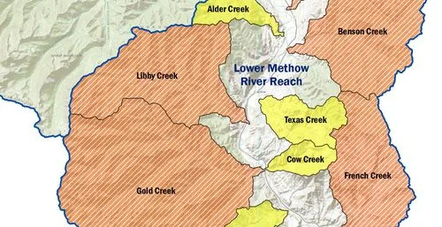
Data, maps, models, software, and information graphics are at the heart of nearly every project at Aspect Consulting. Our team of expert data scientists, geographic information systems (GIS) analysts, software developers, data managers, drafters, and cartographers help our clients and projects teams find insights in the rich data that drives our work. We’re as at home writing code and building applications as we are designing clear and accurate maps. The breadth and depth of Aspect’s technology expertise means that we’re able to tackle almost any problem at the intersection of DATA and EARTH + WATER science/engineering.
See Geosyntec’s full range of Information Management and Geospatial Data services.
Spatial Analysis and GIS
Site Suitability Modeling and Site Selection
Remote Sensing and Image Analysis
Geologic and Geohazards Mapping
Subsurface Environmental Chemistry Mapping
GIS Water Rights and Water Availability Investigations
Utility Mapping and Asset Management
Geospatial Data Management, Geodatabase Design, and GIS Workflows
Hydrologic Modeling
LiDAR Data Processing and Analysis
Aerial Imagery/Irrigation Analysis
Drafting and Cartography
AutoCAD, ArcGIS, and Open Source Expertise
Production Mapping
Engineering Drawings
3D Visualizations
Geologic Cross Sections and Other Subsurface Mapping
Scripting and Modeling
Mapbook and Poster Map Generation
Webmap Design
Database Design and Data Management
Custom Environmental Database Management Systems
Validation of Environmental Chemistry Data
Data QA/QC and Regulatory Limits Screening
GPS/Field Data Collection and Management
Data Management Best Practices Assessment
Automation and systems architecture
Software Application Development-Mobile/Web/Desktop
Database and User Interface Application Development
Business Systems/Compliance/Reporting Integration
Analytics And Data Visualization
Internet of Things
Remote Monitoring and Telemetry Systems
Automation
Technology Planning
Enterprise Geospatial
Cloud Consulting


