Aspect's Bodie McCosby Presenting at AEG's Chapter Meeting

Staff Geologist J. Bodie McCosby, GIT, will give a technical presentation at the Puget Sound Association of Environmental and Engineering Geologists (AEG) Chapter meeting in Seattle on Thursday, October 27.

Looking across Eightmile Lake as the drilling crew sets up for geotechnical explorations.

Bodie’s talk, “Eightmile Lake Restoration Project - Characterization of a Landslide Dam,” chronicles his and Aspect’s ongoing geologic and seismic studies to modernize the dam infrastructure at the remote Eightmile Lake dam, which was built on an ancient landslide in the Alpine Lakes Wilderness Area of the Cascades.

The meeting is at 6pm at Art Marble 21 in South Lake Union, with an online attendance option available.

Tips for Waterfront Homeowners: Promoting Shorelines and Protecting Property

Puget Sound has 2,500 miles of some of the most breathtaking shoreline and nearshore habitat in the world. From a geologic perspective, these shorelines are a dynamic environment – with the waves naturally eroding the base of the slopes above while carrying important, nutrient-rich sediment to build back up the beaches. For waterfront residents, the dynamic shoreline is often the reason they choose to live there.

Recent regulatory focus by the Washington State Department of Fish and Wildlife (WDFW) increasingly emphasizes nearshore habitat goals, which means waterfront homeowners frequently grapple with what can feel like competing interests:

  • Preserving and protecting the land between shorelines and homes

  • Allowing natural shoreline erosion and processes to occur to feed marine habitat

Example of a soft shoreline system along the Cornet Bay shoreline in Island County. Source: Washington State Department of Ecology

Photo Credit: Hugh Shipman

What’s New in Waterfront and Nearshore Habitat Permitting?

In July 2021, WDFW approved a revised code requiring an Alternatives Analysis for replacing waterfront structures. This analysis follows a prescribed flow chart that considers options ranging from complete bulkhead removal to installation of a soft shoreline to in-kind hard structure replacement

Graphic source: Aspect Consulting

Bulkhead removal and soft shoreline systems are increasingly favored by state and local jurisdictions, to emphasize nearshore habitat development. The soft shoreline systems emphasize strategically adding large woody debris (i.e., anchored beach logs); placement of beach sand; and planting native vegetation to keep slopes stable and help the shoreline environment. As WDFW and other agencies (both local and county) begin enforcing and implementing this new code, waterfront homeowners need to be aware of how to both protect their waterfront while also promoting shoreline health.

What Should Shoreline Homeowners Be Aware Of?

As waterfront residents consider how to maintain their property, it’s important to consider shoreline erosion as a benefit for ecological function so that the beauty and dynamic nature of the shoreline remains for future generations. If you own property along the shoreline, there are a few things that you can do to preserve this important habitat:

  • If you have a bulkhead, get to know it by inspecting it at low tide, take photos and measurements on a regular basis. Look for things like damage to the structure, undermining of the foundation, and signs of over-topping during high tides and/or wind storms. Don’t delay maintenance and document changes over time.

  • Know and understand your stormwater system, including the final outfall. This includes catch basins, yard drains, roof-gutter downspouts, foundation drains, curtain drains, etc. If these systems are not maintained or are poorly designed to begin with, they can increase the rates of erosion behind or on the shoreline.

  • Plant and maintain native vegetation to help control surface water and rain water, and resulting erosion.

  • Measure distances from the closest point of all structures (sheds, residences, utilities) to where the vegetation along the shoreline ends to:

    • Document changes over time

    • Comply with bulkhead maintenance requirements for your jurisdiction

To learn more, contact Engineering Geologist Ali Dennison.

Sitkas That tell a Story: Chelsea Bush to present at GSA conference in Portland

Rialto Beach, north of La Push along Washington’s active, dynamic Pacific coast, is home to a stretch of Sitka spruce trees that are teaching geologists about how shoreline forests react to and recover from large-scale storms. Staff Geologist Chelsea Bush, GIT, will present this at the Geological Society of America’s Connects conference in Portland on Wednesday, October 13.

rialto beach.jpeg

Her presentation, “Determination of Forest Age in a Coastal Setting Affected by Both Landsliding and Catastrophic Storm Events,” explores how she and her study group, part of her masters’ thesis at the University of Washington, started out trying to determine the age of the Sitkas in an effort to figure out when a landslide on site occurred. But after they’d researched Carbon 14 and LiDAR data, the results showed that the modern forest is younger than expected.

After further investigation, they determined that the diameter of the trees and the age of the trees weren’t related–most of the trees on site had been knocked down by the Olympic Blowdown of 1921 or had been shaped by other geomorphic processes. Understanding the true age of the trees will help geologist determine how they will respond to geomorphic or weather events and estimate how long it will take for the trees to succumb to erosion and fall to the beach below.

Chelsea and her team’s research shows that it’s easy to assume certain things about the age of a forest based on looks and the sizes of the trees – but when you look further, there may be more than meets the eye.

The Path to Professional License: Amelia Oates, LG

In the science and engineering industry, seeing a “PE”, “LG”, “PMP”, or other initials behind someone’s name shows that person went through years of work experience that culminated in a substantial test to confirm the right to practice their area of technical expertise. Many go through this licensing journey but few outside that group know what the process is really like.

We’re telling those stories here. Aspect’s professionals are writing a series of articles that capture the trials and successes of studying for and receiving these career-defining milestones.

Amelia Oates, Licensed Geologist (LG)

Test: Originally scheduled for March 2020 – test taken on October 20, 2020.

Awarded: November 25, 2020

Amelia Backpacking in Cispus Basin

Amelia Backpacking in Cispus Basin

Where did you start with your test prep?

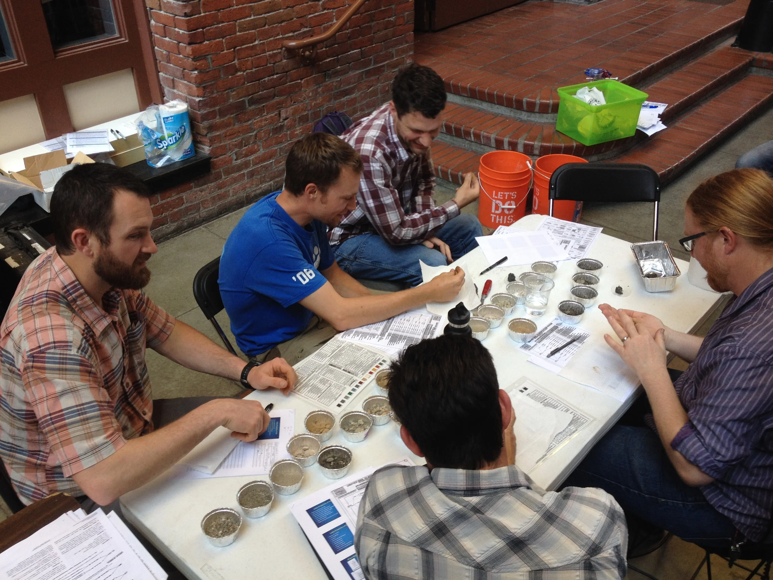
I was originally scheduled to sit for the test on March 20, 2020. I was lucky enough to sign up to take it with a couple of my friends from grad school and we formed a study group, which made the whole experience a lot easier.

My first step was to gather all that info and wrap my head around it. I had the review course the National Association of State Boards of Geology (ASBOG) offers and their review book and accompanying practice test booklets, which circulate around to the aspiring geologists in Aspect’s Seattle office. I was lucky to have it; it had a lot of personalized touches from those who’d used it before – old flash cards and other helpful pointers.

Next I took the practice tests to gauge where I was at with the material. If I was really deficient in one area, I focused on that for my studies rather than that material I already knew and was already practicing in my day-to-day work.

How did COVID affect your test prep?

March 2020 was a super unknown moment – we were just about to be in COVID lockdown. The week of the test, Washington State put into effect the mandate that no group over 50 people could meet in person. Uncertain about what would happen, we frantically emailed ASBOG, who also run the test.

Two days before the exam, they announced that the test had been cancelled until further notice. That was jarring. We’d just spent so much time studying; we had been at it every weekend from January to March. The test is only offered twice a year, so they moved us all to October 2020.

How did you feel when you found out you’d be taking the test months later than expected? How did it change your study tactics?

I was mad. I had scheduled my test intentionally so I wouldn’t have to waste a beautiful Seattle summer studying, but then I was forced to do that anyway. I put off studying until about August, when I resumed reviewing the material in earnest – every night of the work week plus one weekend day.

Most of the general concepts I quickly recalled from my previous round of studying, but I found I needed to brush up on some of the finer details. Also, in the time between March and October 2020, I’d done a lot more intense technical hydrogeologic work at Aspect, where I was actually using the calculations in the example problems in real-world situations. That really helped clarify and solidify some fundamentals I needed for the test.

What was the best piece(s) of advice you got from others who’d done this before?

There’s a great collective of people at Aspect and in my cohort of grad school colleagues that had gone through this before. Getting their take on the test was really helpful. I heeded their advice to take the practice tests to set my standard, then grade myself to see how I did, take another midway through studying, then take one more right before the exam. These were good check-ins to focus my studies.

I also learned there are people who I respect as geologists who didn’t pass the test the first time. That was a serious turning point in my studying journey and showed me the importance of giving myself some grace in the moment, especially with COVID. I was able to step back and not be too hard on myself, no matter the outcome. I reassured myself, “If you don’t pass in October, it’s ok. This year has been so much more difficult than expected, and at least you tried.”

What should a person gearing up to do this know about the mental, physical, and social challenges of test prep?

Mentally, you need to prepare yourself to ingest a lot of knowledge. Some of it you may be learning for the first time, some of it you might just be refreshing, but you have to make time and space for that in your life. Prioritizing the studying over backpacking or other trips was initially a let-down, but ultimately helped me stay focused. I also enjoyed making a routine of studying—it helped me say no to social engagements and focus on the task at hand.

I was definitely physically stressed out during my year-long studying endeavor. When I was doing the bulk of my studying, I had a lighter workload with more flexibility. But the second time around, likely as a result of general COVID stress, I could tell my body was tense. Prioritizing walks, bike rides and runs here and there to clear my mind, and nourishing my body with all my favorite study snacks made everything much better.  

Study Graphic_Amelia.png

Thankfully, I was able to socialize as part of my test prep with my friend group, which was so beneficial to me through all of it. Zoom study sessions took the place of our pre-COVID 3 to 6 hours Sunday sessions, and having people to commiserate about the COVID parts of the experience was especially helpful.

Walk us through the Big Test Day…

The test was at the Red Lion hotel in Olympia. We checked in, they took our temperature and went over the protocols—a combination of COVID considerations and not-cheating-on-your-test considerations. There were about 30 other people in the room with us. We had to wear our masks and we were socially distanced at long tables, more than 6 feet apart. The social distancing and mask wearing was a different level of physical tax I wouldn’t have considered before 2020, and it brought a heightened level of awareness to every sniffle or cough in the testing facility.

The test is a four-hour exam. You have a calculator, a protractor, a pencil, some scrap paper, and that’s it. You have those four hours to answer to answer around 150 questions, on a classic Scantron. A lot of the test prep resources tell you to go through the whole test first, answer the questions you know, then go back to the ones you struggled with. I did this, but if there was a problem that I could narrow down to two answers, I just picked the one that seemed most logical. There were a few I was really unsure of that I skipped and came back to. I ended up finishing the whole thing about 20 minutes from the end.

After the test, we waited for each other in the parking lot and hung out with others who had also just taken the test. It was weird standing in the parking lot debriefing about what we’d just been through and asking each other what questions others found easy or challenging versus our own experience, especially given we seen this many people in the same place in months.

How did you feel when you got the results?

When the test was over, I immediately felt like I had failed. I remember thinking, “Oh, that was terrible!”  and feeling really despondent knowing how bad it would be to have to take the whole thing over again, given all the time I put into it. There were some questions where I thought, “Oh, wow ok, I could probably have studied a little bit harder.” Questions on concepts that I had never taken classes in or had struggled with before seemed more frequent than I wanted them to be. So I thought for sure, 100 percent, that I’d failed. 

It took a little over a month to get the results. I was out in the field at an excavation, and my friends who I’d sat for the exam with started texting me. They released the results in alphabetical order, so my friend with a last name at the beginning of the alphabet got her results and was trying to temper our expectations. It was two hours of not knowing—but when we all found out and we all passed, it was such a relief.

Any parting advice for those getting ready to take the test?

Be patient and compassionate with yourself through the process. It’s tenuous, and there’s A LOT of material to get through. Setting aside dedicated time each week was really important for my overall success. I recommend being organized, find your routine, and stick to it.

The Path to Professional License: Mari Otto, PE

In the science and engineering industry, seeing a “PE”, “LG”, “PMP”, or other initials behind someone’s name shows that person went through years of work experience that culminated in a substantial test to confirm the right to practice their area of technical expertise. A professional license is a proof statement that communicates that the people charged with designing roads and buildings; solving water supply challenges; cleaning up contaminated soil and water; and successfully managing project quality are qualified and ethically accountable professionals. Many go through this licensing journey but few outside that group know what the process is really like.

We’re telling those stories here. Aspect’s professionals are writing a series of articles that capture the trials and successes of studying for and receiving these career-defining milestones.

Mari Otto, Professional Engineering License

Test: October 2020

Awarded: December 2020

Mari on the Skyline trail at Mt. Ranier

Mari on the Skyline trail at Mt. Ranier

Where did you start with your test prep?

I started thinking about my PE test early in 2020 when I was making my New Year’s resolutions (Item 1: pass the PE). I did a bunch of Googling to see what people were saying about the exam – there’s a lot out there (Editor’s note: including Aspect’s own License Prep Series!) Some people say you need 300-400 hours of study, some people say you barely need to study at all – it was a little overwhelming, but I figured I could find a happy middle somewhere.

I spent some time outlining everything I’d need for my test application and researching study materials. The Washington State Board of Registration requires you to submit an application with an engineering law review exam, proof of experience (including transcripts from school and an experience verification form signed by a supervisor PE), and pay an application fee before you are approved for the exam. I decided to get my application in and buy my study materials early (like, in July) so later on I could focus just on studying. I’m grateful that Aspect is very supportive of the PE process and I was able to expense all my study materials and application fee. Thanks Aspect!

I started studying in earnest in late August 2020 for my exam on October 23, 2020.

What was the best piece(s) of advice you got from others who’d done this before?

  • Do as many practice exams as you can.

  • Do the actual test in passes:

Pass 1 = Go through the entire exam and answer the questions you know how to answer quickly.

Pass 2 = Go through the exam again and answer the questions you know how to answer but will take more time.

Pass 3 = Review any remaining questions.

This strategy helped me because I wasn’t panicking during the exam. I could look at my answer key and have a good idea of what my percentage score would be for that portion of the exam. Building up my score early on helped reduce anxiety as the clock ran down.

What should a person gearing up to do this know about the mental, physical, and social challenges of test prep?

I initially tried studying after work so I could keep my weekends free. That plan unraveled pretty quickly. It just wasn’t sustainable for me to work a full day and then hit the books. If you can make that work for you, then great! But go into it knowing that unless you’re a superstar time manager, you’ll probably have to give up at least some of your weekends to studying. That being said, I found it was really important for me to rest between long study sessions.

My schedule generally followed this timeline:

  • Saturday: Practice exam (full 8-hour practice test)

  • Sunday: Rest day – go on a nature walk or do a water activity

  • Throughout the week: light practice problems if schedule allows

  • Saturday and Sunday: ~4 hours study sessions to review practice exam and study weak material. Prep for another practice exam the next week.

  • Repeat

I’m lucky that the people in my life had just the right mix of being understanding of my study schedule and being pushy enough to drag me outside every once in a while.

Walk us through the Big Test Day…

The test was in Puyallup, so I got a hotel nearby and got a good night’s rest before the exam. I woke up early and did some light stretches and ate some yogurt and fruits. I made sure that I had my lunch packed and that I had plenty of water and granola bar snacks.

I felt pretty well-prepared for the exam from all my practice exams, so I just took my time and did my best. It actually wasn’t too bad. During lunch, I had a great big salad and took a walk around the neighborhood and listened to a podcast. I made friends with a neighborhood cat on my lunch walk, so that felt auspicious.

After the exam, I drove home and had vegetarian burgers and beer and just chilled. It was great. I then took that Friday off for a long weekend trip down to the Oregon coast for some surfing.

How did you feel when you got the results?

I did my best to put the test out of my mind after taking it, knowing that it would be a couple months before I got my results. When I finally got my results in December and saw that green “Pass” icon, I felt a huge sense of relief and gratefulness – I could relax! It was the middle of a winter week during COVID-times, so I really went wild with my celebrations – I spent the evening drinking peanut butter whisky and watching Schitt’s Creek.

Mari study graphic.jpg

Any parting advice for those getting ready to take the PE?

  1. Lots of people love to talk about the PE and share their experience / give advice. I loved hearing people’s stories, but I found it important to not compare myself to others too much, ESPECIALLY when people talk about how many hours they are studying/have studied. You can listen to what worked for others, but in the end, you’ll have to find what works for yourself.

  2. I spent a lot of time at the beginning of my studies trying to do a deep dive into the subjects that would be on the breadth morning exam – it was NOT necessary. When I started doing practice exams, I noticed that the Geotech questions on the breadth exam were really basic. It’s reasonable to assume that the breadth questions for the other subjects would be considered really basic by someone who specializes in that particular subject. Realizing that helped me relax about the breadth exam – I identified common questions using the NCEES Examinee guide (use it - they tell you exactly what kind of questions will be on the exam) and used that to guide my breadth studying. It helped me to not get too into the weeds subjects that were not Geotech.

  3. Do lots of practice exams. The NCEES practice exam is the closest you’ll get to the actual exam. I did that exam at the beginning of my studies in late August and again at the end of my studies the weekend before the exam. I found other practice exams online. I took practice exams every other weekend and tried to simulate exam conditions – quiet environment, 4-hour morning exam, 1-hour lunch break, 4-hour afternoon exam. I even wore my facemask during my later practice exams to make sure I was used to having it on.

  4. In addition to the huge CERM book, I would recommend getting the little CERM Quick Reference. It has 99% of the equations you might need for the morning exam and probably like 60% of the equations you might need for the afternoon exam (at least for Geotech).

The Rainy Season Part 1: When Geohazard and Stormwater Specialists Shine

The end of 2019 and the first months of 2020 brought unprecedented rainfall across the Pacific Northwest—as just two examples, January was the third wettest Seattle month ever; areas in Northeast Oregon received 10 inches of rain in 3 days. This even-rainier-than-usual season has inundated the region with flooding and landslides. These events are a threat to the safety of homes, businesses, and infrastructure. In this two-part series, we’re highlighting how Aspect professionals have been helping assess earth and water challenges caused by the rain and help communities and clients problem-solve.

Our first part of the series looks at some of the scientific tools we use to track hazardous conditions during wet weather and how we respond to help local communities assess and repair damage from earth movement.

Landslides: When Water and Steep Slopes Don’t Mix

Landslides lie dormant and unseen to the untrained eye for years, and even decades. However, intense short-term or persistent long-term rainfall can waterlog steep slopes and awaken landslides triggering widespread damage. In February 2020, following a period of heavy precipitation, a landslide six miles south of Bellingham shut down half of Washington State’s main business artery – Interstate 5 – for half a day. 

Location of landslide across Interstate 5 south of Bellingham in February 2020

Photo Credit: Whatcom County Weather

One Tool to Understand Landslide Risk: Cumulative Precipitation Threshold 

Among other monitoring approaches, Aspect’s geohazard team uses a public tool created by the United States Geological Survey (USGS) to help continuously assess the level of landslide risk in the Puget Sound region.

This tool was developed after reviewing data on historical conditions from 1933 through 1997, including several notable intense rain events that triggered multiple landslides in the Puget Sound area—notably those in 1986 and 1997, which are two of the biggest landslide “years” in Seattle history because of the amount of rainfall (and for 1997, the rain fell on top of snow during the winter, creating significant soil saturation conditions).

The tool uses monitoring points near Puget Sound coastal bluffs to give a snapshot of rainfall intensity and duration in the area. From these data, the USGS developed “rainfall thresholds” to forecast landslide potential and risk along rail corridors between SeaTac and Everett.

From this data, the USGS developed an intensity (I) and duration (D) relationship (shown above).

For example, on the left side, the graph shows that 1/10th (0.1) of an inch of rain per hour, falling steadily for about 22 hours, is enough to enter the high-risk threshold (yellow area over the blue line). Similarly, about 1/20th (0.05) of an inch per hour falling over 45 hours will enter the threshold. This means short-intense rain AND less intense, but long-duration rainfall can both oversaturate the ground and cause a landslide.

How Wet Has Winter 2020 Been in the Pacific Northwest?

Thanks to recent data from the USGS’ Mukilteo monitoring station, Winter 2020 in the Seattle area has been a season of unrelenting precipitation. We’ve had two different periods where the Seattle area has been over the cumulative landslide threshold for two straight weeks.

This is a snapshot of Jan 29, 2020, landslide threshold graph. Any symbols to the right of (or above) the red line indicates heightened landslide risk. Taking about a 2-month period, from Dec 1, 2019 – Feb 11, 2020, the Seattle area has been to the right of the line twice for significant, extended periods of time (for about two weeks straight each time—Dec 20, 2019, through about January 7, 2020, and from January 28, 2020, through Feb 11, 2020.) Special thanks to Rex Baum of the USGS for the recent Seattle-area 2020 data.

That is a substantial amount of time for soils to stay wet because, well, water is heavy. And when water saturates soil over longer-than-normal periods it adds enough weight that can cause the soil to move on steep slopes. Think about the difference between a box of feathers on a sloped bed of marbles versus a box of wet feathers on that same sloped bed of marbles. The heavier that box becomes it starts to move. Here are some additional technical factors involved in this kind of landslide:

  • A buildup of groundwater can pressurize the soil’s pore spaces, which reduces the strength of the soils causing the soils to fracture or slide.

  • Trees and their root structures can greatly reinforce shallow soils, but they have less ability to hold onto soils that have lost strength due to saturation, leading to loss of strength in the soil reinforced layer and toppling of shallow, rooted trees.

Responding to Geohazards

When active landslide hazard potential rises, Aspect’s geologists and geotechnical engineers prepare to support local agencies with whom we have on-call contracts. These contacts often include specific language that Aspect be ready to support public works staff as they respond to sudden or emergency geohazard events. During this last round of heavy precipitation, we were spurred to action with a call from the City of Kenmore—we provide geotechnical services as part of their team for an on-call contract—about a landslide impacting a roadway. We were on site to assess conditions within about one hour.

Result of a shallow surface landslide in Kenmore, which closed part of a road in the City.

Another view of the slide that resulted from heavy rains, which Aspect responded to within an hour.

The City wanted Aspect to assess potential risks. Are the residences atop the slope safe from further movement? How will removing the weight of the slide debris affect the slide? Our assessment concluded the slide posed a low risk to the residences and we were able to assure the City that removing the debris would not create further concerns for the slope.

Stay tuned for Part 2 of our Rainy Season series – where we learn how stormwater and water quality experts “storm chase” to track storms and perform water monitoring in wet conditions.

Carla Brock Chairs WA’s Geologist Licensing Board

Associate Geologist Carla Brock was recently appointed as Chair of the Washington State Geologist Licensing Board by her fellow board members. The board is comprised of six licensed geologists and one public member and is responsible for licensing geologists; updating the rules and regulations governing the practice of geology in the state of Washington; and investigating violations of the regulations. Carla is starting her second year of a four-term appointment to the board.

Washington State is a member of the National Association of the State Boards of Geology (ASBOG), which develops standardized written examinations for administration by the 32 member states and Puerto Rico, assessing qualifications of applicants seeking licensure as professional geologists. In addition to her duties on the state board, Carla participates as a Subject Matter Expert (SME) on ASBOG’s Council of Examiners (COE). The COE is comprised of SMEs from across the country and convenes twice a year, immediately following administration of the tests, for examination development and validation workshops. The COE spends two days reviewing test questions and answers to maximize the fairness and quality of the examinations as measures of competency. The COE is not all work, each meeting includes lunchtime presentations by local experts on interesting and relevant topics and a third day in which local experts lead a geologic field trip.

Carla just returned from the spring COE, which was held in Nashua, New Hampshire and is proud to support ASBOG but also enjoys the opportunity to connect with colleagues from across the country and to learn about local geology.

Geologists love a good roadcut! A quartz syenite ring dike intrudes the pre-Mesozoic tonalite with mylonitization at the contact.

Geologists love a good roadcut! A quarts syenite ring dike intrudes pre-Mesozoic tonalite.

Geologists ogling an outcrop in central New Hampshire.

Geologists stomping through the snow in central New Hampshire in search of an outcrop.

Meet Bill Grimm and Isabellah von Trapp

Staff Scientist Bill Grimm and Staff Scientist Isabellah von Trapp recently joined Aspect -- Bill in our Bainbridge office and Isabellah in our Seattle office. Here are five questions we asked to get to know them better.

Bill Grimm, Staff Scientist

  1. Where are you from? If you’re not from the Pacific Northwest, what brought you here? 
    I’m from the suburbs of Chicago originally. I came to Seattle a little over a year after graduating from college to do a master’s program in applied geosciences at the University of Washington. My master’s program was a great fit for me, because it combined two of my passions: earth science, and giving back to the communities in which I live. Seattle, and the Pacific Northwest in general, are incredibly interesting geologically, and the program presented a great opportunity to study real earth science-related issues happening in our own backyards.
     
  2. What inspired you to pursue geology? What made you curious about it?
    I really fell in love with geology when I was on a family vacation to the Grand Canyon when I was about 10 years old. I had always loved maps and cross sections since I was a kid, and seeing the Grand Canyon in real life made me absolutely fascinated with the Earth and its natural processes.
     
  3. What do you like best about your area of expertise? What excites you and keeps you motivated? 
    My favorite part of geology is that it’s like a big puzzle. You start with what you know, and you try to fit the pieces together to make the problem make sense. Along the way, you discover new pieces of the puzzle that fit in to the whole, and the more you discover (generally), the clearer the bigger picture becomes.
     
  4. What do you like to do when you aren’t working? 
    I like to hang out with my wife, hike, play guitar, ski, and read. I’m also planning to start brewing my own beer sometime soon.
     
  5. Where in the world would you like to travel next? 
    I would love to do a trek from northern India through Nepal to the Mt. Everest base camp. I love knowing where I am in the world geologically and geographically and being able to picture myself on a map, and I think it would be awesome to walk from the flats in India across the plate boundary and all the way to the base of the highest mountain above sea level.

Isabellah von Trapp, Staff Scientist

Isabellah enjoying Death Valley geology.

  1. Where are you from? If you’re not from the Pacific Northwest, what brought you here? 
    I grew up in Salem, Oregon but I always knew I wanted to live in the Puget Sound-area. I attended college in Tacoma at PLU then set out for grad school in Missoula, Montana. But, after a couple years of cold-ish winters, I was ready to head back to my beloved, rainy PNW where I could easily access the mountains, ocean, and my family within a short arm’s reach. 
     
  2. What inspired you to pursue water resources? What made you curious about it?
    For most of my growing up years, I strongly believed I wanted to be a dentist…but after about 1 semester in college, I quickly realized that was not the life for me. After floundering around in some general education classes the following semester, I decided to take an introductory-level geoscience class and my mind was blown.

    Soon thereafter, I declared myself as a geoscience major. I took a wide array of geology classes but out of all of them, I loved hydrogeology and geochemistry the most.  After that, it only seemed natural to seek out a master’s thesis project where I could combine both of those things! Fortunately, I’ve been able to pursue a career that allows me to use those skills and develop new ones. 
     
  3. What do you like best about your area of expertise? What excites you and keeps you motivated? 
    Everybody needs water. Working in water resources is not only interesting but it allows me to solve real world problems that affect a lot of people. Any job that allows you to simultaneously do science and help people is a cool one in my book. 
     
  4. What do you like to do when you aren’t working? 
    Most of the time, I’m daydreaming about what I’m going to eat next. So, in my free time I enjoy perusing every item at Trader Joe’s, cooking, and baking. Aside from that – I  also love to camp, hike, swim, knit, try out new beers, and travel just about anywhere! 
     
  5. Where in the world would you like to travel next? 
    Iceland, Ireland, and Israel – apparently I have a thing for countries starting with the letter I. 

Meet Aaron Fitts and Jasmin Jamal!

Aaron Fitts recently joined Aspect's Bellingham office and Jasmin Jamal recently joined Aspect's Portland office.  Here are five questions we asked to get to know them better.

Aaron Fitts, LG, Staff Geologist

Aaron and 2 1/2-year-old son Arthur.

  1.  Where are you from? If you’re not from the Pacific Northwest, what brought you here? 
    I grew up in central Maine. The landscape in Maine and New England is a lot like the Pacific Northwest (PNW), except the mountains are smaller and the winters are colder. I spent all my time growing up in the woods or on the coast; I spent the summers racing bikes, surfing, and whitewater guiding, and in the winter I’d be climbing mountains, snowboarding, and cross-country skiing. It turned out that you could do all these things in the PNW too, but it’s also way more fun here!
     
  2. What inspired you to pursue geology? 
    At the end of my Junior year of college, I had completed most of the requirements for a degree in physics and found myself with just electives left for my senior year. I was a bit sick of being stuck in physics laboratories all the time and saw geology as an opportunity to spend some time outside. I took eight geology courses in one year and was able to get a dual-degree. Ironically, I ended up spending most of my time in a basement geochemistry laboratory, though, I got out enough to make it worth it. I decided that I wanted to go to grad school where I could be in landscapes a bit more exciting than the Northeast. My undergraduate advisor recommended that I contact his colleague at Western Washington University in Bellingham, telling me that it was near the coast but surrounded by mountains. That was literally all I knew about the area when I drove across the country to get here. It ended up being a good decision.
     
  3. What excites you and keeps you motivated? 
    Troubleshooting and problem-solving while working with clients, contractors, and co-workers is my favorite thing about working in this field. There’s something very satisfying about getting something complicated to work out in the end. Getting to do the type of science that I enjoy and seeing cool places at the same time is just a great bonus on top of it all.
     
  4. What do you like to do when you aren’t working? 
    Lately, my favorite activity has been reexperiencing childhood activities with my two boys (11-months and 2.5-years old). My toddler is obsessed with riding his bike and running on the trails and my infant is obsessed with anything his big brother is doing. My wife and I do our best to keep up with them, but they’re a handful. When we do find time for ourselves, we usually end up riding our bikes anyway.
     
  5. Where in the world would you like to travel next? 
    There are a lot of places around the world I’d like to visit; generally, any place with mountains, probably Chile or Argentina. Honestly though, even given the choice, I’d probably most like to just go to the Methow Valley. I really like it there.

Jasmin Jamal, EIT, Staff Engineer

Jasmin at the Trillium Falls near the Redwood National and State Parks in Humboldt County

  1. Where are you from? If you’re not from the Pacific Northwest, what brought you here?
    I am from a city called Orange, in a county called Orange, in a state called California. My life-partner Jonathon and I visited Portland a few years back and immediately agreed that this was where we needed to be. Last summer, I finished grad school, he requested a job transfer, and before we knew it, we landed in Portland!
     
  2. What inspired you to pursue environmental engineering? What made you curious about it?
    Growing up, my mom frequently took my sisters and me on camping, hiking, and biking adventures. I loved the outdoors as a kid but never imagined pursuing an environmental job as a career--I always wanted to be a teacher. During college, I stumbled upon the earth science program and fell in love. Around the time that I finished my undergrad, environmental engineering was introduced as a master’s program at my university. The variety of topics covered in the program were intriguing, so I went for it and fell in love for the second time! My interest in teaching hasn’t ceased but I envision myself now as more of a grey-haired professor.
     
  3. What excites you and keeps you motivated?
    I like the diversity behind environmental engineering and am motivated by the fact that the environment is ever changing. I hope to work in multiple areas of interest including wastewater and surface water treatment, solid waste management and design, fate and transport of chemicals, and soil and groundwater remediation.
     
  4. What do you like to do when you aren’t working?
    I enjoy hiking, biking, and camping, but I probably like all of that as much as I like being horizontal with my cat Carrie.
     
  5. What five people would be your dream party guests?
    I’m going to pick a mixture of living and dead:
    1. My Uncle Tom (deceased)
    2. Barack Obama (living)
    3. Carrie Brownstein (living)
    4. 011 from “Stranger Things” (fictional)
    5. John Muir (deceased)

How Will We Hold Up to The Cascadia Megaquake?

Two recent articles in The Seattle Times explore how the Pacific Northwest's infrastructure will be affected by the next major earthquake.

New Cascadia quake analysis shows building retrofits could save many lives

How to survive the Cascadia Earthquake? Tips from seismologist Lucy Jones, ‘the Beyoncé of earthquakes’

Back in 2015, our very own Dave McCormack chimed in with his thoughts in response to the now infamous New Yorker story, The Really Big One

A Geologist's Thoughts on the Pacific Northwest Mega-Quake Story

Source: USGS

The Geology of Central Washington's Rattlesnake Ridge Landslide

Geology is on everyone’s mind in Yakima County as officials grapple with the ongoing Rattlesnake Ridge slide and how to help the community below it. This drone footage captures the surface features of the slide in detail. 

Given the geology of the area, Aspect’s Principal Engineering Geologist Dave McCormack summarizes the likely forces behind the slide: “Geologic studies have shown that slides of this nature are fairly common on the flanks of the numerous anticlinal ridges in central Washington. While most are ancient and have not moved during recent history, there are examples, including the Nile Valley landslide of 2009, where old slides have reactivated, or new slides began. These slides occur where basalt flows are interbedded with sedimentary strata. While the basalt strata may be relatively strong, the sedimentary interbeds are often weathered and weak.

When the gravitational driving forces acting on these dipping strata exceed the resisting strength of the weathered sedimentary strata, they begin to slide. There are multiple factors in the delicate balance of gravitational forces versus resisting strength, including the properties of the rock, degree of weathering, groundwater levels, the geometry of the slope, etc. 

Triggers for activation of landslides can include increases in groundwater level, strong earthquake shaking, or changes in slope geometry from natural causes like river migration, or human-caused grading. Because of the multiple factors involved, teasing out the exact triggers of a slope failure can be challenging, and the expected type of failure (fast debris runout, slow creeping failure, rockfalls, etc.) difficult to predict.” 

Geologic insight will continue to be relied on as the slide keeps moving.
 

The Beauty and Power of LiDAR in Geology

Kudos to the good people at the Washington State Department of Natural Resources (DNR)/Washington Geological Survey for their absolutely incredible Esri Story Map, The Bare Earth.

Here at Aspect, we use regional LiDAR data treasure troves nearly every single day. From landslide hazard analysis, to stormwater infiltration feasibility, to fault identification and mapping–our team of geologists and GIS analysts are well familiar with the power of this incredible, rich data.  

However, we've never seen such a thoughtful, thorough, and beautiful presentation of LiDAR's role in geology as this. In addition to the breathtaking LiDAR visualizations, it's a wonderful example of the narrative and explanatory power of a story map

Bravo, DNR. Bravo.

...oh... and happy GIS Day/Post-GIS Day! This is a wonderful way to celebrate.

Evaluating Ground Movement from Outer Space: Annaliese Eipert Discusses InSAR satellite technology at AEG meeting

Many of the questions Aspect’s infrastructure staff have on a project revolve around soil movement. We may need to know how much a building’s foundation has settled, or if a steep slope is starting to fail, or the furthest extent of a sinkhole. A new technology— interferometric synthetic aperture radar (InSAR)—is helping us gather better information to answer those questions. Project Geologist Annaliese Eipert will share Aspect’s local experience with InSAR at the monthly Association of Environmental & Engineering Geologists (AEG) meeting in Seattle on Thursday, March 17.

InSAR measures the changes in ground surface elevation by recording the distance between the ground and a satellite over time, and it does so with accuracy down to the millimeter. It can pierce through rainclouds and cover of night to document conditions without interruption. Unlike Global Positioning System (GPS) technology, which covers conditions for a fixed point, InSAR can collect data on the movement of large parcels of land. It also acts as a time machine of sorts, with the ability to study data gathered in years past. InSAR’s functionality gives us more detailed data to find problematic changes in ground surface and formulate appropriate recommendations and solutions.

InSAR image showing accumulated ground motion in the greater Tacoma area. Image courtesy of TRE-Altamira.

Annaliese’s presentation will focus on how we used InSAR data to help determine the cause of an approximately five-mile-long swath of widespread apparent uplift on the order of one inch in the Federal Way area that was observed between 2007 and 2009. She will also explore the potential causes of observed subsidence along Puget Lowland river valleys and of ground surface deformation in general, as well as the applications and limitations of using InSAR analysis for geologic and geotechnical engineering investigations in comparison to high-resolution GPS and Light Detection and Ranging (LiDAR) technology.

Annaliese will be co-presenting with Giacomo Falorni from TRE-Altamira, a globally recognized firm with comprehensive expertise in applying InSAR data to large infrastructure projects. Giacomo will provide an introduction to the technology itself and discuss how it has been used on infrastructure and environmental projects around the world. 

A Geologist's Thoughts on the Pacific Northwest Mega-Quake Story

As the aftershocks of Kathryn Schulz’s article The Really Big One in The New Yorker continue to reverberate across western Washington, Aspect is fielding questions from concerned family members, friends, and clients. Will everything west of I-5 really be “toast”? Should I be worried about a landslide on the hill in my backyard? Is my house going to hold up against a 9.0 quake?

Read More

Geology Field Trip!

More than 30 members of Aspect’s technical staff participated in a regional geology workshop. The workshop was led by Puget Lowland geology guru Kathy Troost of the University of Washington and Troost Geosciences.  Friday morning was devoted to lectures and discussion of the geology of the area, and in the afternoon participants got their hands dirty practicing identifying and classifying samples of local soils. Saturday, Ms. Troost led the group to the classic field locations for regional geology: Alki Point, Mee-Kwa-Mooks Park,  Herrings’s House Park on the Duwamish, Discovery Park, and ended with an overview at Kerry Park on Queen Anne.