The Path to Professional License: Henry N. Haselton, PE

In the science and engineering industry, seeing a “PE”, “LG”, “PMP”, or other initials behind someone’s name shows that person went through years of work experience that culminated in a substantial test to confirm the right to practice their area of technical expertise. Many go through this licensing journey but few outside that group know what the process is really like.

We’re telling those stories here. Aspect’s professionals are writing a series of articles that capture the trials and successes of studying for and receiving these career-defining milestones.

Henry N. Haselton, Professional Engineering (PE) License

Date of Test:  October 2021

Date Awarded: December 2021

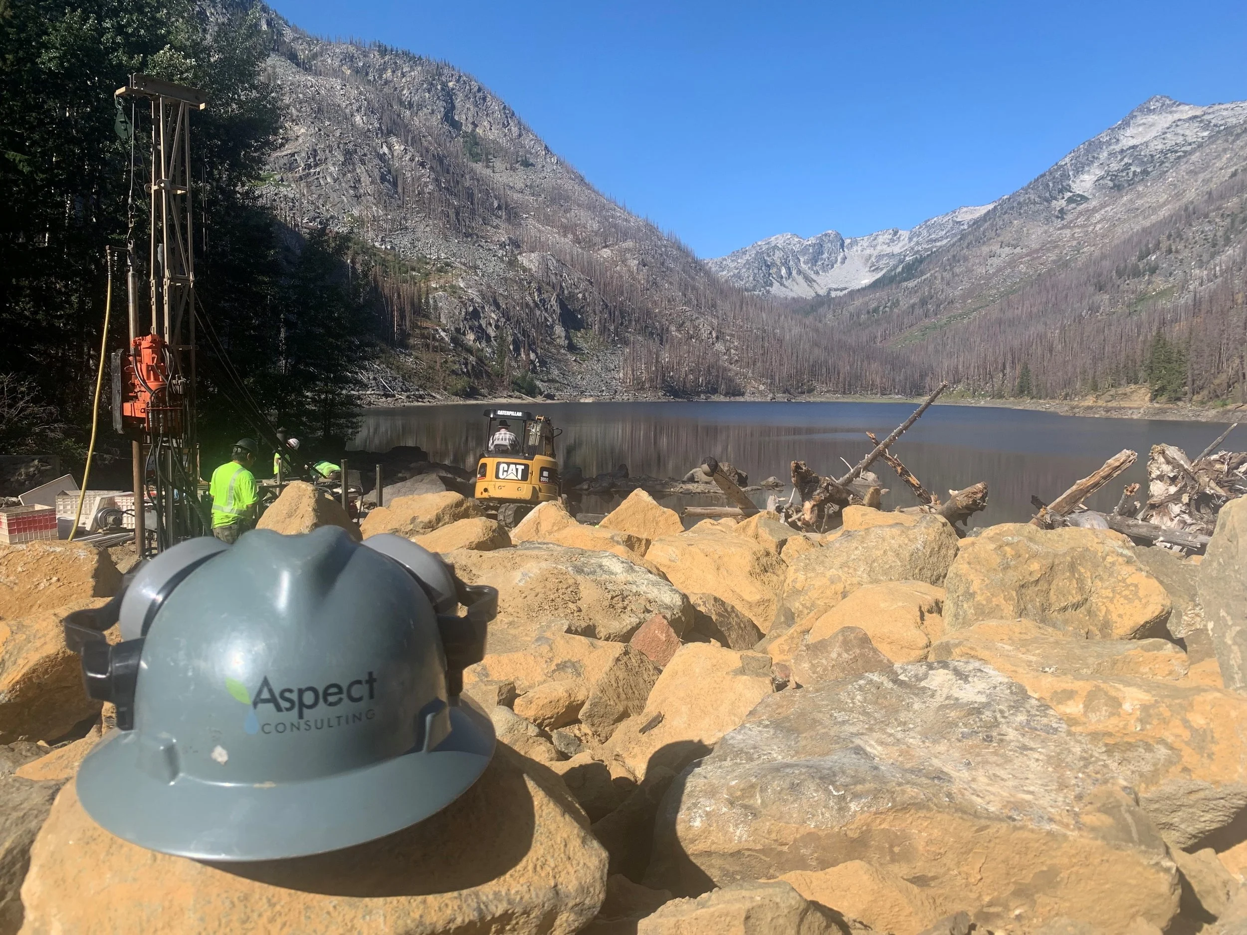
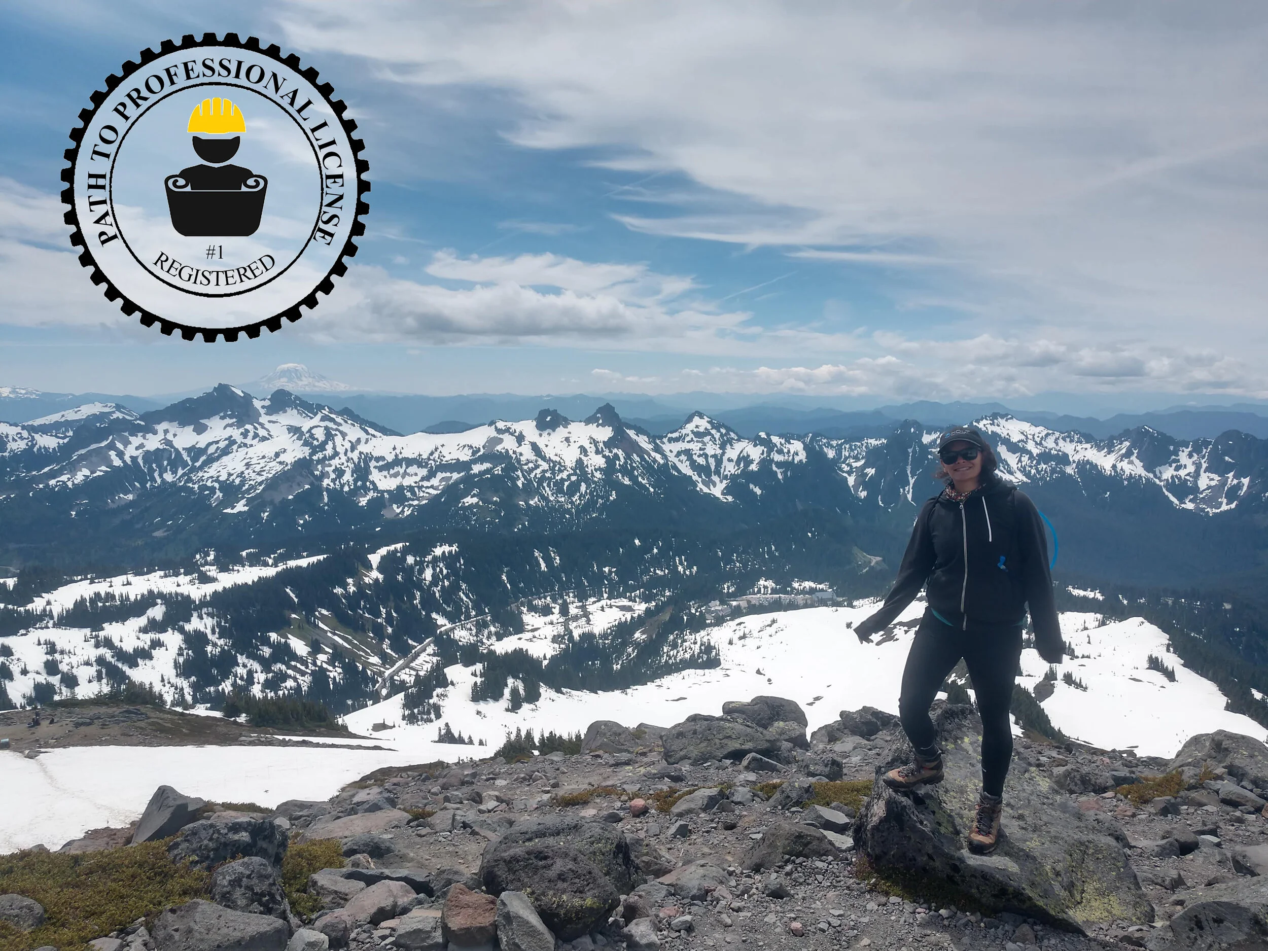
Henry at a residential reconnaissance site.

When did you start with your test prep?

I think around July, but I didn’t hit it too hard until August.

What were your study tactics? How did you get started?

Lots and lots of practice exams was my study tactic. I started by talking with Aspect folks and other friends that had just taken the exam to see what worked for them in terms of studying techniques and planning. A big first step I did in July was to outline on a calendar what days I would study and the number of hours I would spend each day to get myself up to 100 hours of study time. I don’t think I hit my exact goals, but this gave me a good outline and schedule to hold myself to.

What should a person gearing up to do this know about the mental, physical, and social challenges of test prep?

Just try to not get stressed out about the test prep and studying. At first it is intimidating because a lot of the material you review is on topics you haven’t seen since college, but in reality most of the material in the general civil category involves very simple calculations.

Walk us through the Big Test Day…

I don’t have any unique tips for the big test day, just the classics of get a good night sleep, try to stay relaxed and not stressed, and trust your studying and intuition. Test day for me was pretty funny as I showed up in a dark parking lot to see people with wheelbarrow-sized carts full of books walking across the street like zombies while I just had a little bag of books. Once I got signed into the test center and placed at my desk, I went to the bathroom while we were waiting for them to pass out tests and got scorned for doing that without permission. So overall not the best start, but it still worked out.

How did you feel when you got the results?

New PE Henry in Mexico.

It was a huge relief for sure, because you take the test and afterwards it is hard to gauge how you did or what the passing grade will be, then a couple months go by before you know anything. It’s worth mentioning though that there is no shame in not passing it on your first go; it’s just a reminder to study a little more next time around and come in more prepared and relaxed. My great friend from college who is an excellent engineer ended up failing the same test I took but passed it the next time around and is better for it. 

What lessons did you learn that you’d want others to know?

For many of us, academic life was a huge series of tests that determined your grades and continuation in school. This is just one more test in a long series, and possible the last major one you ever take. So enjoy that feeling of walking out of a big exam that you were well-prepared for. That amount of closure can be hard to find in the professional world.

Aspect's Mark Swank and Bodie McCosby Presenting at AEG's Annual Meeting

Aspect’s Infrastructure team will be at the Association of Environmental and Engineering Geologists (AEG) 65th Annual Meeting this month in Las Vegas. Associate Engineering Geologist Mark Swank, CEG, LEG, and Staff Geologist J. Bodie McCosby, GIT, will present as part of the Dams and Levees Technical Symposium on Thursday, September 15.

Bodie’s talk, “Eightmile Lake Restoration Project - Characterization of a Landslide Dam,” chronicles his and Aspect’s ongoing geologic and seismic studies to modernize the dam infrastructure at the remote Eightmile Lake dam, which was built on an ancient landslide in the Alpine Lakes Wilderness Area of the Cascades.

Drill rig at the remote Eightmile Lake site

Mark’s presentation, “River’s Edge – The Story of a Levee Setback and Restoration Project,” is on Aspect’s recent project for the Jamestown S’Klallam Tribe to build a new levee setback and restore natural river processes along the Lower Dungeness River near Sequim. Earlier this year, the River’s Edge Levee Setback Project won in the Geotechnical category of the Seattle Section of the American Society of Civil Engineers (ASCE) Local Outstanding Civil Engineering Achievement Awards.

Aerial view of the new levee setback – photo courtesy of the Jamestown S’Klallam Tribe

Mark will also moderate the “Wild Problems, Unique Solutions, and Lessons Learned” panel on Friday, September 16.

Tips for Waterfront Homeowners: Promoting Shorelines and Protecting Property

Puget Sound has 2,500 miles of some of the most breathtaking shoreline and nearshore habitat in the world. From a geologic perspective, these shorelines are a dynamic environment – with the waves naturally eroding the base of the slopes above while carrying important, nutrient-rich sediment to build back up the beaches. For waterfront residents, the dynamic shoreline is often the reason they choose to live there.

Recent regulatory focus by the Washington State Department of Fish and Wildlife (WDFW) increasingly emphasizes nearshore habitat goals, which means waterfront homeowners frequently grapple with what can feel like competing interests:

  • Preserving and protecting the land between shorelines and homes

  • Allowing natural shoreline erosion and processes to occur to feed marine habitat

Example of a soft shoreline system along the Cornet Bay shoreline in Island County. Source: Washington State Department of Ecology

Photo Credit: Hugh Shipman

What’s New in Waterfront and Nearshore Habitat Permitting?

In July 2021, WDFW approved a revised code requiring an Alternatives Analysis for replacing waterfront structures. This analysis follows a prescribed flow chart that considers options ranging from complete bulkhead removal to installation of a soft shoreline to in-kind hard structure replacement

Graphic source: Aspect Consulting

Bulkhead removal and soft shoreline systems are increasingly favored by state and local jurisdictions, to emphasize nearshore habitat development. The soft shoreline systems emphasize strategically adding large woody debris (i.e., anchored beach logs); placement of beach sand; and planting native vegetation to keep slopes stable and help the shoreline environment. As WDFW and other agencies (both local and county) begin enforcing and implementing this new code, waterfront homeowners need to be aware of how to both protect their waterfront while also promoting shoreline health.

What Should Shoreline Homeowners Be Aware Of?

As waterfront residents consider how to maintain their property, it’s important to consider shoreline erosion as a benefit for ecological function so that the beauty and dynamic nature of the shoreline remains for future generations. If you own property along the shoreline, there are a few things that you can do to preserve this important habitat:

  • If you have a bulkhead, get to know it by inspecting it at low tide, take photos and measurements on a regular basis. Look for things like damage to the structure, undermining of the foundation, and signs of over-topping during high tides and/or wind storms. Don’t delay maintenance and document changes over time.

  • Know and understand your stormwater system, including the final outfall. This includes catch basins, yard drains, roof-gutter downspouts, foundation drains, curtain drains, etc. If these systems are not maintained or are poorly designed to begin with, they can increase the rates of erosion behind or on the shoreline.

  • Plant and maintain native vegetation to help control surface water and rain water, and resulting erosion.

  • Measure distances from the closest point of all structures (sheds, residences, utilities) to where the vegetation along the shoreline ends to:

    • Document changes over time

    • Comply with bulkhead maintenance requirements for your jurisdiction

To learn more, contact Engineering Geologist Ali Dennison.

Jamestown S’Klallam Tribe’s Rivers Edge Levee Setback Project Wins ASCE LOCEA Award

The Seattle Section of the American Society of Civil Engineers (ASCE) honored the Jamestown S’Klallam Tribe’s (JST) Rivers Edge Levee Setback project with its 2022 Local Outstanding Civil Engineering Achievement Award (LOCEA) in the Geotechnical category.

The project replaced an aging, constricting levee on the Lower Dungeness River near Sequim with a new levee setback designed to meet modern flood protection standards and aligned to restore the area’s natural floodplain and salmon habitat. Work completed on a compressed, whirlwind schedule. JST acquired the land and started preliminary design in mid-2020, and by September 2021, they’d completed final design, successful navigation of a complex series of permit applications and design reviews, and substantial construction—a monumental feat in just 14 months.

The new levee was constructed in part with gravel from a nearby quarry pit, limiting the cost, time, and environmental impact of importing materials to the site. The project was done in tandem with an adjacent similar levee project by Clallam County, and together they will open up 143 acres of reclaimed floodplain and habitat. You can learn more about the Rivers Edge project in our previous blog post.

Aspect led geotechnical engineering design and construction of the levee as a subconsultant to Pat McCullough and his firm Engineering Services Association (ESA), alongside WEST Consultants for hydrology and hydraulics.

Aspect’s Project Manager and Lead Geotechnical Engineer Andrew Holmson and Project Geotechnical Engineer Mari Otto gave a short presentation on the project during the LOCEA virtual awards ceremony on Wednesday, March 9.  

Other LOCEA Winning Projects

Aspect was also on the winning teams for two projects as geotechnical subconsultants to our frequent teaming partner Osborn Consulting:

  • The City of Kenmore’s new boathouse on the Sammamish River won in the Small Projects and Non-Construction Studies category. We provided foundation redesign support and services during construction of the two-story prefab metal building that is the new home for the Kenmore Community Rowing Club and Northshore School District rowing programs.

  • The City of Sammamish’s Ebright Creek Fish Passage Culvert Replacement was honored in the Water Resources category. Aspect led the geotechnical evaluation for design and construction of two new 30-inch-diameter culverts along busy arterial East Lake Sammamish Parkway. Replacing the outdated culvert was a priority for the City of Sammamish to enhance fish passage and habitat for kokanee salmon. Construction was completed in fall 2021, and the City has already seen an increase in returning kokanee and other fish species passing through this stretch of the creek.

This year’s other LOCEA winners honored during the ceremony were:

  • Climate Pledge Arena Renovation (Thornton Tomasetti) – Structures

  • Northgate Link Extension (MJA) – Transportation and Development

  • 2021 Airfield Pavement Replacement + Infrastructure Upgrade Project (HNTB) – Transportation and Development

  • Seattle-Tacoma International Airport North Satellite Modernization (AECOM) – Transportation and Development

20+ Years in the Making: Levee Sparks Dungeness River Restoration

On the Olympic Peninsula in Northwest Washington, the Lower Dungeness River Floodplain Restoration project restores habitat and natural river processes that are confined by various levees and dikes constructed in the 1940s through 1960s. The lower reaches of the Dungeness River have been constricted on the right bank by an existing 2.4-mile-long levee built in the 1960s by the United States Army Corps of Engineers (USACE). However, the USACE levee is ‘under-designed’ for anticipated flood events to come.

Aerial view of the 2,600-foot setback levee

Photo credit: Jamestown S’Klallam Tribe (JST)

Twenty years ago, the Lower Dungeness River Floodplain Restoration project was conceived with the goal of building a new setback levee and reconnecting the Dungeness River with its historical floodplain; improving habitat conditions; and restoring riverine processes and functions. The project was split into two parts: the Clallam County (County) levee setback project from River Mile (RM) 0.8 to 1.75, and the River’s Edge Project between RM 1.75 to 2.7. The County project started in 2015, but then the floodplain restoration work hit a standstill – until the Jamestown S’Klallam Tribe (JST) brought the River’s Edge Levee Setback project to life.

Jamestown S’Klallam Tribe Rebuilds a Floodplain to Restore the Region

For thousands of years pre-colonialism, the JST nurtured the land and many saltwater bays and freshwater rivers. Today, the JST takes an active role in community environmental projects, including participating in the Dungeness River Management Team and implementing habitat restoration projects such as this levee project, which is a part of the Lower Dungeness River restoration efforts.

JST purchased farmland along this stretch of the Dungeness River (with a strong show of support from local community members) with the understanding that the purchased land would be used for conservation efforts. JST secured funding support from Washington state’s  Floodplains by Design grant and brought on Engineering Services Association (ESA) to lead the project design. ESA in turn brought Aspect in to be the geotechnical lead, as well as several other key team members like WEST Consultants (hydrology and hydraulics) and Johnston Land Surveying.

The River’s Edge project will renew historical riparian habitat and boost the overall health of the ecosystem, including salmon recovery for key species like Chinook salmon, summer chum, bull trout, and steelhead. The new setback levee will also double as a walking path to be used by all members of the community.

Early Detective Work in a Floodplain Leads to Success

Rivers deposit soils in highly varied and complex ways. To set up the 2600-foot-long setback levee for success and understand the subsurface conditions, Aspect led a two-phase subsurface exploration program that included six soil borings (2 with vibrating wire piezometer installations), 11 test pit excavations, 13 hand-dug explorations, and 4 cone penetrometer explorations. Using this information we created a profile of subsurface conditions to power smart levee design.

Levees Need to Be Made of the ‘Right Stuff’

Nearby gravel pit that ‘fed’ the levee

Photo credit: Krazan & Associates

A key driver in any levee project is the availability of material. This levee was made up of over 37,000 cubic yards of gravel and sand. ESA identified a material source only two minutes away and Aspect and ESA tailored the levee design to make sure the material available from the gravel pit could be successfully used to build the levee to meet design standards. Having a material source so close to the Site helped save budget, time, and greenhouse gas emissions.

Finishing a 2,600-Foot Levee in Under Two Years: A Win !

Floodplain restoration without River's Edge Levee Setback project (on the left) and WITH River's Edge Levee Setback Project (on the right).

Photo credit: North Olympic Land Trust

Aspect collaborated with ESA, JST, and USACE to design the setback levee in just under one year, with construction of the project hot on the heels of the final design submittals. Construction then started and the new setback levee was built in just over 2 months!

In summer 2022, the existing levee will be removed to allow the Dungeness River to reclaim 56 acres of floodplain. The Clallam County project will eventually tie into the River’s Edge Setback Levee to open up an additional 87 acres for a combined 143 acres of reclaimed historical floodplain and habitat for salmon, birds, and wildlife.

The hard work and dedication of the River’s Edge project team helped realize the JST’s desire to create a quality setback levee that meets the latest and greatest safety standards, within their desired schedule – and underbudget!

Groundbreaking Ground Improvements for Seattle Affordable Housing

Construction at Mt. Baker Housing Association’s Maddux Development is underway—the beginning of the end of a project that is bringing 203 units of affordable housing to Seattle’s Mt. Baker neighborhood. It features an innovative partnership between MBHA and Ecology as the first project under Ecology’s Healthy Housing program to help fund the environmental cleanup of future affordable housing sites. It also features a first-in-Seattle use of a ground improvement technique called displacement rigid inclusions to address the site’s challenging geology and the project’s limited budget.

Drilling the displacement rigid inclusions columns.

Drilling the displacement rigid inclusions columns.

Soil Liquefaction Muddies Building Design

The land under the new Maddux buildings consists of very loose fill soils that lie on top of glacial recessional deposits – a hodgepodge of loose soils left behind as the last glaciers retreated from the Puget Sound area thousands of years ago. Under that are stiffer soils that were consolidated by the weight of the glacier. The loose soils are saturated by groundwater that lies on top of it unable to infiltrate into the harder soil underneath.

During an earthquake, the saturated, loosely packed grains of soils at the Maddux site could be shaken to a point where the elevated water pressure within the pore spaces increases the space between grains and causes the soil to lose strength and flow like a liquid in a process called liquefaction.

Think of wiggling your toes in the sand while standing on a beach near where the waves come in—the Maddux site soils would respond in similar fashion. When the shaking starts, the loose soils would become even weaker and any foundation bearing weight on them would settle, crack, and potentially collapse. Structures on sites like Maddux require particular design for seismic conditions in order to be built safely.

Weak Soils Get an Automatic F

The building code divides the soils at sites into six classes – ranging from A (strong rock)  to F (weak, loose, liquefiable soils) – based on the characteristics of the upper 100 feet of soil from the base of any future building. These site classes set the parameters for how a building must be designed to respond to strong shaking from earthquakes.

The building code rates sites with any amount of soils at risk of liquefaction as Site Class F. Building on Site Class F sites usually requires either deep foundations or ground improvement—both of which are more expensive than conventional shallow foundations. The building itself can also be more expensive, since building on weaker soils often requires more steel and other materials. And for an affordable housing project like this one, cost is a critical factor to the viability of the project.

Conscious of these cost concerns, Aspect’s geotechnical team started to investigate the most effective foundation design for building on a Site Class F site such as Maddux. In a nutshell: It’s complicated.

Design vs. Complex Site Geology vs. Costs

This figure shows the varying elevations of bearing layer –soils that can safely bear the weight of a building foundation – at the Maddux site.

The land the Maddux site is on has been through a lot. The last glacier left not just weak soils but left them at wildly varying depths. You can drill at one spot and reach stiffer soils within a few feet of the surface, then move over 10 feet, drill again, and have the strong glacial soils be 15 or more feet further down.

Add to this the legacy contamination from former dry cleaners and a gas station that has since spread throughout the soil and groundwater. Excavation to remove contaminated soil was already part of the site’s environmental plan, but to extend that excavation to remove all the soft and liquefiable soils in addition to all the contaminated soils would have required more digging, deeper shoring, and more off-site soil disposal – and a lot more money. We also needed to make sure whatever ground improvement we used didn’t interfere with our environmental team’s remediation plan.

Whatever the method, we wanted it to be as cost-effective as possible. Ecology’s funding for the Maddux development only covers the environmental remediation. Any expense for building foundations is the responsibility of MBHA, which as a nonprofit has limited funding. Our geotechnical team carefully weighed the costs versus benefits of several options. For example, conventional deep auger cast piles, which are often used at sites like Maddux, are relatively inexpensive to install, but they require a lot of concrete and steel to construct, adding more to the cost of materials. They also don’t improve the ground around the piles; the class rating would still be an F, which increases the cost of the building itself.

Displacement Rigid Inclusions to Raise the Grade

As we weighed the factors, it became apparent that displacement rigid inclusions were the most appropriate and cost-effective technique for the site. Rigid inclusions are a ground improvement method that use columns of concrete to transfer the weight of a structure through loose soils down to more competent bearing soils below, thereby reducing potential damage from liquefaction.

What made the ground improvement for the Maddux project unique in the Seattle area was the use of displacement rigid inclusions. Displacement rigid inclusions are a type of rigid inclusion that involve specialty tooling that densifies the soil around each column. The act of drilling the columns “displaces” the ground around it. The soil between the columns is pushed together and becomes denser, thereby reducing the chance it will liquefy during an earthquake. Displacement rigid inclusions provide structural support for the building with the same element that is used to mitigate liquification.

Tests to Pass the SDCI Test

There aren’t many chances to test seismic design—the Seattle area hasn’t experienced a “design-level” earthquake, one with the magnitude we are designing our buildings for, in hundreds of years, so it can be hard to predict exactly how a building will respond. Instead, engineers study what has happened during other earthquakes under similar circumstances. We can then apply that understanding to safely develop innovative techniques to protect against earthquakes at more problematic sites like Maddux. To use displacement rigid inclusions for the Maddux project, the design required approval from the City of Seattle. Displacement rigid inclusions had never been used before to change the site class of a project in Seattle.

During design, we conducted cone penetrometer tests (CPTs) to determine the soils’ geotechnical engineering properties plus extensive laboratory tests on the soils. We worked with specialty ground improvement contractor Condon Johnson to assess whether the soils would respond to the displacement the way we thought they could. From those tests, the detailed ground improvement design was established including the spacing of each column needed to effectively strengthen the soil between columns.

Our team met regularly with Seattle Department of Construction and Inspections (SDCI) to present our design approach. Conservative estimates were developed for how much densification would be possible in the site soils. We found that the ground improvement could be designed to achieve adequate densification to eliminate liquefaction risk –and thus raise the site class.

SDCI approved the approach during design, but all was contingent on the results of verification testing after the rigid inclusions were installed. If we installed the columns and performed more CPTs that showed enough improvement in the soil strength, they would give final approval.

Installing the Columns

We started installing the displacement rigid inclusion columns at the Maddux site at the beginning of 2021. The drilling required specialty displacement auger tooling, and because this technique isn’t used much in this area, the driller had to bring the displacement auger up from California.

Displacement rigid inclusion installation in early 2021 at the Maddux site

Displacement rigid inclusion installation in early 2021 at the Maddux site

A cage of rebar is set in place after the column is filled with concrete.

A cage of rebar is set in place after the column is filled with concrete.

The displacement auger drilled 18-inch-diameter columns down through the weaker soils and into the underlying dense glacially overridden soil layer. As the auger pulled out, it pumped concrete into the void created by the auger pushing soil to the side. The concrete itself is under pressure, which pushed out the soil even more, which aides in densification. Once the auger was fully removed, a “cage” of rebar could then be lowered in to reinforce the concrete once it cures.

In all, there were 249 columns drilled at Maddux North and 219 at Maddux South, each placed about 5 feet apart center to center, installed over two months.

The Results

Once the displacement rigid inclusions were installed, we completed another round of CPTs to physically verify that we achieved the level of densification we predicted in design. Results from the post-treatment CPTs showed the displacement rigid inclusions had worked even better than we thought. Our team delivered the data to the City that showed the soils at Maddux were no longer liquifiable.

Aspect, as the geotechnical engineer of record, then gave the recommendation that the site class could change. This opinion was backed by the robust quality controls we used during construction, documentation of the verification CPTs, and post-treatment liquefaction analyses showing the liquefaction risk had been removed.

The Site Class at Maddux was raised from an ‘F’ to a ‘D’. A ‘D’ rating allowed for the structures to be designed using less materials, therefore saving money on construction costs.

The Maddux project represents a successful use of an innovative ground improvement technique on a complicated site in conjunction with an extensive environmental cleanup. See the Maddux ‘Story Map’ for more context on the project.

The Path to Professional License: Mari Otto, PE

In the science and engineering industry, seeing a “PE”, “LG”, “PMP”, or other initials behind someone’s name shows that person went through years of work experience that culminated in a substantial test to confirm the right to practice their area of technical expertise. A professional license is a proof statement that communicates that the people charged with designing roads and buildings; solving water supply challenges; cleaning up contaminated soil and water; and successfully managing project quality are qualified and ethically accountable professionals. Many go through this licensing journey but few outside that group know what the process is really like.

We’re telling those stories here. Aspect’s professionals are writing a series of articles that capture the trials and successes of studying for and receiving these career-defining milestones.

Mari Otto, Professional Engineering License

Test: October 2020

Awarded: December 2020

Mari on the Skyline trail at Mt. Ranier

Mari on the Skyline trail at Mt. Ranier

Where did you start with your test prep?

I started thinking about my PE test early in 2020 when I was making my New Year’s resolutions (Item 1: pass the PE). I did a bunch of Googling to see what people were saying about the exam – there’s a lot out there (Editor’s note: including Aspect’s own License Prep Series!) Some people say you need 300-400 hours of study, some people say you barely need to study at all – it was a little overwhelming, but I figured I could find a happy middle somewhere.

I spent some time outlining everything I’d need for my test application and researching study materials. The Washington State Board of Registration requires you to submit an application with an engineering law review exam, proof of experience (including transcripts from school and an experience verification form signed by a supervisor PE), and pay an application fee before you are approved for the exam. I decided to get my application in and buy my study materials early (like, in July) so later on I could focus just on studying. I’m grateful that Aspect is very supportive of the PE process and I was able to expense all my study materials and application fee. Thanks Aspect!

I started studying in earnest in late August 2020 for my exam on October 23, 2020.

What was the best piece(s) of advice you got from others who’d done this before?

  • Do as many practice exams as you can.

  • Do the actual test in passes:

Pass 1 = Go through the entire exam and answer the questions you know how to answer quickly.

Pass 2 = Go through the exam again and answer the questions you know how to answer but will take more time.

Pass 3 = Review any remaining questions.

This strategy helped me because I wasn’t panicking during the exam. I could look at my answer key and have a good idea of what my percentage score would be for that portion of the exam. Building up my score early on helped reduce anxiety as the clock ran down.

What should a person gearing up to do this know about the mental, physical, and social challenges of test prep?

I initially tried studying after work so I could keep my weekends free. That plan unraveled pretty quickly. It just wasn’t sustainable for me to work a full day and then hit the books. If you can make that work for you, then great! But go into it knowing that unless you’re a superstar time manager, you’ll probably have to give up at least some of your weekends to studying. That being said, I found it was really important for me to rest between long study sessions.

My schedule generally followed this timeline:

  • Saturday: Practice exam (full 8-hour practice test)

  • Sunday: Rest day – go on a nature walk or do a water activity

  • Throughout the week: light practice problems if schedule allows

  • Saturday and Sunday: ~4 hours study sessions to review practice exam and study weak material. Prep for another practice exam the next week.

  • Repeat

I’m lucky that the people in my life had just the right mix of being understanding of my study schedule and being pushy enough to drag me outside every once in a while.

Walk us through the Big Test Day…

The test was in Puyallup, so I got a hotel nearby and got a good night’s rest before the exam. I woke up early and did some light stretches and ate some yogurt and fruits. I made sure that I had my lunch packed and that I had plenty of water and granola bar snacks.

I felt pretty well-prepared for the exam from all my practice exams, so I just took my time and did my best. It actually wasn’t too bad. During lunch, I had a great big salad and took a walk around the neighborhood and listened to a podcast. I made friends with a neighborhood cat on my lunch walk, so that felt auspicious.

After the exam, I drove home and had vegetarian burgers and beer and just chilled. It was great. I then took that Friday off for a long weekend trip down to the Oregon coast for some surfing.

How did you feel when you got the results?

I did my best to put the test out of my mind after taking it, knowing that it would be a couple months before I got my results. When I finally got my results in December and saw that green “Pass” icon, I felt a huge sense of relief and gratefulness – I could relax! It was the middle of a winter week during COVID-times, so I really went wild with my celebrations – I spent the evening drinking peanut butter whisky and watching Schitt’s Creek.

Mari study graphic.jpg

Any parting advice for those getting ready to take the PE?

  1. Lots of people love to talk about the PE and share their experience / give advice. I loved hearing people’s stories, but I found it important to not compare myself to others too much, ESPECIALLY when people talk about how many hours they are studying/have studied. You can listen to what worked for others, but in the end, you’ll have to find what works for yourself.

  2. I spent a lot of time at the beginning of my studies trying to do a deep dive into the subjects that would be on the breadth morning exam – it was NOT necessary. When I started doing practice exams, I noticed that the Geotech questions on the breadth exam were really basic. It’s reasonable to assume that the breadth questions for the other subjects would be considered really basic by someone who specializes in that particular subject. Realizing that helped me relax about the breadth exam – I identified common questions using the NCEES Examinee guide (use it - they tell you exactly what kind of questions will be on the exam) and used that to guide my breadth studying. It helped me to not get too into the weeds subjects that were not Geotech.

  3. Do lots of practice exams. The NCEES practice exam is the closest you’ll get to the actual exam. I did that exam at the beginning of my studies in late August and again at the end of my studies the weekend before the exam. I found other practice exams online. I took practice exams every other weekend and tried to simulate exam conditions – quiet environment, 4-hour morning exam, 1-hour lunch break, 4-hour afternoon exam. I even wore my facemask during my later practice exams to make sure I was used to having it on.

  4. In addition to the huge CERM book, I would recommend getting the little CERM Quick Reference. It has 99% of the equations you might need for the morning exam and probably like 60% of the equations you might need for the afternoon exam (at least for Geotech).

Lake Crescent Roadway Stabilization Project Honored with ASCE Award

The American Society of Civil Engineers’ (ASCE) Seattle Section honored Aspect’s Lake Crescent Roadway Improvement Project at their recent Local Outstanding Civil Engineering Achievement (LOCEA) Awards ceremony. The project won this year’s award for Geotechnical Engineering, recognizing Aspect’s innovative moment slab design that widened and stabilized a key stretch of Highway 101 along Lake Crescent in Olympic National Park.

The two-lane stretch of Highway 101 and its varying geologic conditions prior to moment slab construction.

The two-lane stretch of Highway 101 and its varying geologic conditions prior to moment slab construction.

Principal Geotechnical Engineer Erik Andersen walked the group of 60 people watching online through the project and how Aspect got involved. A 400-foot-long section of two-lane road on the shore of Lake Crescent was in need of a permanent solution to address ongoing instability and widen the road. The Federal Highway Administration’s Western Federal Lands Highway Division (FHWA), who have jurisdiction over this part of Highway 101, recommended the unstable shoulder fill be removed, and a mechanically stabilized earth (MSE) wall be constructed at or above the lake level.

Complex Geology + Unstable Shoreline = Great Engineering Challenge

This recommendation presented a host of challenges to an already complex site with varying geology and an unstable shoreline. Constructing the MSE wall would require blasting bedrock in some areas and constructing concrete beams in other areas where bedrock was below the lake elevation, which would be difficult to execute within the 4-hour windows they were permitted to have both lanes of the highway closed. Blasting the rock and construction near the lake would greatly disturb wildlife, fish, and the lake itself. Strider Construction, tasked with building the MSE wall, determined this concept was too difficult and risky. They turned to Aspect to develop a safer and more constructible alternative. Erik and Staff Engineer Henry N. Haselton brainstormed with Strider and FHWA to develop a moment slab design.

Rebar reinforces the moment slab that extends over the shoreline but doesn’t impact the water.

Rebar reinforces the moment slab that extends over the shoreline but doesn’t impact the water.

Henry and Ken Wilson from Integrity Structural Engineering joined the presentation to discuss the analysis and design for the slab. The heavily reinforced concrete slab was designed to be supported on the shore at one end and suspend (or cantilever) over the embankment. It required significantly less excavation and blasting from the site, eliminated the need for temporary shoring, and could be completed without disturbing the pristine waters of Lake Crescent. With the easier design in place, construction moved at a more predictable pace. Ultimately, work was completed three weeks earlier and saved the project over $100,000, as compared with the original MSE wall concept.

Bellingham Waterfront Project Also Honored

Aspect contributed to the success of another of the night’s honorees. Project Geologist Matthew von der Ahe provided hazardous material mitigation during construction of KPFF’s Granary Avenue and Laurel Street Project. This roadway/bike lane/sidewalk project for the City of Bellingham improved access into Waypoint Park (itself a winning project) on the former industrial site that housed the Georgia-Pacific Tissue Mill.

Photo from City of Bellingham website.

Photo from City of Bellingham website.

This year’s other LOCEA winners are:

  • Small Projects and Non-Construction Study: CSO 171 Outfall Project (HDR and team)

  • Transportation and Development Engineering:  NE 45th Street East Approach Seismic Retrofit Project (HDR and team)

  • Water Resources and Environmental Engineering: Meydenbauer Bay Park Project (Anchor QEA and team)

  • Ports and Waterways Engineering: WWPS043 Emergency Force Main Replacement Project (Staheli Trenchless Consultants and teams)

The Rainy Season Part 1: When Geohazard and Stormwater Specialists Shine

The end of 2019 and the first months of 2020 brought unprecedented rainfall across the Pacific Northwest—as just two examples, January was the third wettest Seattle month ever; areas in Northeast Oregon received 10 inches of rain in 3 days. This even-rainier-than-usual season has inundated the region with flooding and landslides. These events are a threat to the safety of homes, businesses, and infrastructure. In this two-part series, we’re highlighting how Aspect professionals have been helping assess earth and water challenges caused by the rain and help communities and clients problem-solve.

Our first part of the series looks at some of the scientific tools we use to track hazardous conditions during wet weather and how we respond to help local communities assess and repair damage from earth movement.

Landslides: When Water and Steep Slopes Don’t Mix

Landslides lie dormant and unseen to the untrained eye for years, and even decades. However, intense short-term or persistent long-term rainfall can waterlog steep slopes and awaken landslides triggering widespread damage. In February 2020, following a period of heavy precipitation, a landslide six miles south of Bellingham shut down half of Washington State’s main business artery – Interstate 5 – for half a day. 

Location of landslide across Interstate 5 south of Bellingham in February 2020

Photo Credit: Whatcom County Weather

One Tool to Understand Landslide Risk: Cumulative Precipitation Threshold 

Among other monitoring approaches, Aspect’s geohazard team uses a public tool created by the United States Geological Survey (USGS) to help continuously assess the level of landslide risk in the Puget Sound region.

This tool was developed after reviewing data on historical conditions from 1933 through 1997, including several notable intense rain events that triggered multiple landslides in the Puget Sound area—notably those in 1986 and 1997, which are two of the biggest landslide “years” in Seattle history because of the amount of rainfall (and for 1997, the rain fell on top of snow during the winter, creating significant soil saturation conditions).

The tool uses monitoring points near Puget Sound coastal bluffs to give a snapshot of rainfall intensity and duration in the area. From these data, the USGS developed “rainfall thresholds” to forecast landslide potential and risk along rail corridors between SeaTac and Everett.

From this data, the USGS developed an intensity (I) and duration (D) relationship (shown above).

For example, on the left side, the graph shows that 1/10th (0.1) of an inch of rain per hour, falling steadily for about 22 hours, is enough to enter the high-risk threshold (yellow area over the blue line). Similarly, about 1/20th (0.05) of an inch per hour falling over 45 hours will enter the threshold. This means short-intense rain AND less intense, but long-duration rainfall can both oversaturate the ground and cause a landslide.

How Wet Has Winter 2020 Been in the Pacific Northwest?

Thanks to recent data from the USGS’ Mukilteo monitoring station, Winter 2020 in the Seattle area has been a season of unrelenting precipitation. We’ve had two different periods where the Seattle area has been over the cumulative landslide threshold for two straight weeks.

This is a snapshot of Jan 29, 2020, landslide threshold graph. Any symbols to the right of (or above) the red line indicates heightened landslide risk. Taking about a 2-month period, from Dec 1, 2019 – Feb 11, 2020, the Seattle area has been to the right of the line twice for significant, extended periods of time (for about two weeks straight each time—Dec 20, 2019, through about January 7, 2020, and from January 28, 2020, through Feb 11, 2020.) Special thanks to Rex Baum of the USGS for the recent Seattle-area 2020 data.

That is a substantial amount of time for soils to stay wet because, well, water is heavy. And when water saturates soil over longer-than-normal periods it adds enough weight that can cause the soil to move on steep slopes. Think about the difference between a box of feathers on a sloped bed of marbles versus a box of wet feathers on that same sloped bed of marbles. The heavier that box becomes it starts to move. Here are some additional technical factors involved in this kind of landslide:

  • A buildup of groundwater can pressurize the soil’s pore spaces, which reduces the strength of the soils causing the soils to fracture or slide.

  • Trees and their root structures can greatly reinforce shallow soils, but they have less ability to hold onto soils that have lost strength due to saturation, leading to loss of strength in the soil reinforced layer and toppling of shallow, rooted trees.

Responding to Geohazards

When active landslide hazard potential rises, Aspect’s geologists and geotechnical engineers prepare to support local agencies with whom we have on-call contracts. These contacts often include specific language that Aspect be ready to support public works staff as they respond to sudden or emergency geohazard events. During this last round of heavy precipitation, we were spurred to action with a call from the City of Kenmore—we provide geotechnical services as part of their team for an on-call contract—about a landslide impacting a roadway. We were on site to assess conditions within about one hour.

Result of a shallow surface landslide in Kenmore, which closed part of a road in the City.

Another view of the slide that resulted from heavy rains, which Aspect responded to within an hour.

The City wanted Aspect to assess potential risks. Are the residences atop the slope safe from further movement? How will removing the weight of the slide debris affect the slide? Our assessment concluded the slide posed a low risk to the residences and we were able to assure the City that removing the debris would not create further concerns for the slope.

Stay tuned for Part 2 of our Rainy Season series – where we learn how stormwater and water quality experts “storm chase” to track storms and perform water monitoring in wet conditions.

Robyn Pepin and Spencer Ambauen Talk Fish Habitat Solutions at River Restoration Northwest

The 19th annual River Restoration Northwest symposium is this week in Stevenson, Washington. Representatives from Aspect’s Seattle, Wenatchee, and Portland offices are attending to cheer on presentations by two of our colleagues focused on removing fish passage barriers in the Pacific Northwest.

Senior GIS Analyst Robyn Pepin’s presentation “Data-Driven Decision Making: An Innovative Prioritization Tool for Restoration (and more!)” showcases the methodology behind the GIS-based tool she created in partnership with the Upper Columbia Salmon Recovery Board that synthesizes and streamlines numerous data sets to prioritize what barriers are most need of removal in the Wenatchee Basin.

Spencer Ambauen is presenting his poster on the Geosynthetic Reinforced Soil-Integrated Bridge System (GRS-IBS). This bridge construction system is made from alternates layers of compacted structural fill soils and a mesh-like geosynthetic reinforcement that can be used in many subsurface and seismic conditions. For public agencies looking to replace hundreds of aging, undersized culverts and other structures hindering riparian habitat, GRS-IBS bridges are a less expensive option that are easier to construct and maintain. These bridges becoming more common across the east coast, but so far there have been only two constructed in Washington state. Spencer is well familiar with the GRS-IBS system; masters thesis involved numerical modeling to evaluate how these bridges behave under surcharge loading, and he completed design for an GRS-IBS bridge for the Washington State Department of Fish and Wildlife to enhance fish passage at Tolmie State Park near Olympia.

From Historic Sawmill Dump Site to Seattle Workforce Housing

The historic Pioneer Square district—the front porch to Seattle’s downtown waterfront—is the City’s first neighborhood. The area is shaped by its proximity to the waterfront, active seismology, and over 150 years of urban development, infill, and industry– including housing one of Seattle’s first true startups, the Yesler Lumber Mill.

Built in the early 1850s, the Yesler sawmill was a steam-powered sawmill on the shores of the growing downtown Seattle.
Photo Credit: www.historylink.org

These confluence of factors also trigger specific criteria for building in the neighborhood today – taking historical preservation compliance, seismic codes, and a tricky subsurface into account.

In the heart of the neighborhood, at 165 South Washington Street, Aspect is helping Johnson & Carr, LLC guide the development of an eight-story workforce housing project. The site – currently a vacant pit – formerly housed an apartment building bearing directly on weak urban fill and sawdust. That building was damaged in two separate earthquakes – the 1949 (Olympia) earthquake and 2001 (Nisqually) earthquake, leading to it being condemned and demolished.

The project site, currently a vacant pit that’s sat unused for years, awaits design and construction of a new 8-story workforce housing building.

The Complexity of Seattle’s Original Sawmill Dumpsite

This project site is directly influenced by the past in several ways. It was originally a tidal marsh, used over a century ago, among other things, as a dumping ground for sawdust from the Yesler Mill. This means current project design must grapple with up to 25 feet of sawdust fill in the subsurface. As white settlers filled the surrounding waterfront during the Klondike Gold Rush era, the former tidelands were swallowed up by all manner of new buildings and roads in the haste to infill the neighborhood (as seen on the figure below).In addition, several seismic sources contribute to the seismic risk at the site, including the Seattle Fault Zone which is less than 2 miles away, and the Cascadia Subduction Zone, which can trigger a magnitude 9 earthquake. The seismology, historical uses of the project area, and decades and decades of man-made development have only added to the complexity of building here.

The project site was the dumping ground for sawdust from the nearby Yesler mill. The map on the right shows how much the downtown Seattle shoreline has changed in the last 150 years.

Next Steps: Geotechnical, Seismic, and Engineering Problem Solving

To set the stage for building design and construction in this complicated subsurface, Aspect is conducting several geotechnical and environmental evaluations to develop design recommendations to solve the challenges posed by the historical fill and sawdust at the site. Our detailed evaluations include:

  • Conducting a site-specific seismic response analysis which includes determining dynamic properties of the sawdust to model its behavior under seismic loads

  • Conducting deep foundation design to transfer building loads to underlying competent soils

  • Evaluating and mitigating risk associated with environmental issues which are ubiquitous with the historic fill throughout the Pioneer Square area.

The Vision: Realizing More Affordable Workforce Housing for the Community

These evaluations will be critical to shepherd the development through the City of Seattle’s permitting process and help create more workforce housing in the area. Workforce housing aims to provide a more affordable rental option within high real estate cost areas for workers essential to the local economy, such as service workers, police officers, fire fighters, teachers, nurses, and medical personnel.

When completed, Pioneer Square will gain a new eight-story building with street-level commercial space below seven stories of residential workforce housing.

Cashmere’s Sherman Reservoir Gets a New Roof

Last March, the metal and wood roof over the City of Cashmere’s Sherman Reservoir cracked under the weight of snow, threatening the integrity of the city’s drinking water. The Wenatchee World recently reported on the City’s efforts to replace the damaged roof with one made from heavier, sturdier concrete. Aspect’s geotechnical team contributed to this critical project to get the reservoir back under safe cover.

Senior Geotechnical Engineer Nick Szot in Aspect’s Wenatchee office began by inspecting the reservoir walls for cracks, and excavating test pit explorations near the reservoir tank to analyze the soil’s strength and capacity to bear the weight of a heavier roof. Informed by collaborative geotechnical and structural analyses from Aspect and structural engineering firm Leslie Engineering, the City chose to enlarge and retrofit an interior column’s footing to support the heavier concrete panel roof and limit differential settlement to tolerable levels.

The concrete panels are now being put in place, supported by the foundations Aspect helped to design. Read more about this project in the Wenatchee World.


Aspect Geologist and Parent Welcomes New Blakely Elementary School

Ali Dennison, Senior Engineering Geologist - Photo by Luciano Marano | Bainbridge Island Review

With a new school year upon us, the Bainbridge Island Review has an overview of the last days of construction on Bainbridge Island’s new Blakely Elementary School. Aspect’s Geotechnical Engineering group has been involved with the project since 2016, from initial design phases through construction of the new 51,000 square foot school.

Aspect was founded in 2001 on Bainbridge Island, and we take particular pride in the projects we work on in our hometown. It’s especially meaningful for our Senior Engineering Geologist Alison Dennison—her son and daughter will start third and first grade, respectively, in the new Blakely building. Read more about Ali’s geologic investigations to support the project in the Bainbridge Island Review article.

Attracting Talent – Simple Steps, Great Results

Lindsay Pearsall - Director of Human Resources

Earth science and engineering firms are in a buyer’s market in 2019. Anyone in a leadership position in the Architectural/ Engineering/ Construction industry knows the mantra of “Always Be Recruiting.” At Aspect, we are no different. Our success (and our clients’) hinges on our ability to find and retain the most talented consultants in our industry. It’s essential, then, that our Human Resources department takes a very thoughtful approach to finding and hiring this top-tier talent.

Recently, at RecruitMAX 2019 – one of the A/E/C industry’s top professional industry conferences—Aspect’s HR Director Lindsay Pearsall shared a segment of her approach with a presentation “How to Build a REAL Candidate Pipeline with Phone Interviews and Informational Interviews.”

Some takeaways of Lindsay’s presentation are:

  • Why treating your candidate like a client should be your #1 priority

  • Conducting informational interviews to go beyond your current hiring needs

  • Simple solutions, like how and when to follow up with individuals, to maintain relationships

Lindsay’s presentation stressed that hiring managers need to remember how difficult it is to be a candidate. By flipping the script and treating candidates like a client, we are able to humanize the experience. Whether someone is hired or not, they should have an expectation of a positive experience and feel valued as a professional and as a human.

See current job openings for Aspect here: https://www.aspectconsulting.com/careers

Meet Carly Schaeffer!

Carly Schaeffer recently joined Aspect as a Project Geotechnical Engineer. Here are five questions we asked to get to know her better.

  1. Where are you from? If you’re not from the Pacific Northwest, what brought you here?

    I grew up mostly in a small beach town in central California and then moved to the Bay Area for college. I came to the PNW to experience something new, and love it up here!

  2. What inspired you to pursue geotechnical engineering? What made you curious about it?

    Geotech was an easy choice for me. I’ve always been fascinated with earthquakes, and I like practical applications (rather than theory). Being a geotech meant I could study the things I was interested in, but also get to build things and see tangible results.

  3. What do you like best about your area of expertise? What excites you and keeps you motivated?

    My favorite part about Geotech is how much it is dependent on judgement. I enjoy the challenge of having to solve problems with limited information and having to consider a wide variety of factors. Geotech always keeps me engaged because every project is truly unique. Thanks to unpredictable site conditions, I’m constantly learning and being challenged as an engineer.

  4. What do you like to do when you aren’t working?

    I try to spend as much time outdoors as I can, although that’s tough in the winter for this Californian. I’m happiest in the water—I love to swim, kayak, and raft. I also really enjoy taking in all of the scenic hikes throughout Washington. I’m a big baker as well, and always looking for new recipes!

  5. Where in the world would you like to travel next?

    My sister is moving to Belgium soon, so I’m hoping to use that as an opportunity to explore the parts of Europe I haven’t seen—and of course, eat waffles! I’d love to go to Greece, Budapest, and Switzerland, and venture up to see the Northern Lights.

Carly out hiking at Mt. St. Helens

Bellingham's Waypoint Park Wins Local and National Awards

Waypoint Park touts a playground, a pier, access to the beach along the Whatcom Waterway, and now, several awards. The project recently won the American Shore and Beach Preservation Association (ASBPA)’s award for Best Restored Beach in the U.S.; and the American Society of Civil Engineers (ASCE) Seattle Section’s 2019 Local Outstanding Civil Engineering Achievement Award.

The park sits upon the site of a former Georgia-Pacific pulp mill. Aspect was a part of the team that spent seven years cleaning up the contaminated industrial area and providing geotechnical and environmental consultation throughout the design, permitting, and construction. It opened to the public last summer, and there are more redevelopment projects planned in the vicinity to continue the transformation along Bellingham’s waterfront.

Congratulations to the City and Port of Bellingham, prime firm KPFF, and the whole project team for your award-winning vision and work for this project!

Aspect’s Principal Geotechnical Engineer Erik Andersen strolls amongst the bubbles during the Waypoint Park opening celebration last summer. He developed foundations recommendations for the repurposed 400,000-pound industrial acid ball tank turned public art piece titled “Waypoint.”

Removing Barriers to Fish Passage at Icicle Creek

Like many of Washington’s waterways, Icicle Creek in Chelan County is the site of several projects with the goal of helping salmon and other fish make their way upstream to spawn. Many of the projects involve constructing structures, like a habitat-friendly culvert or a fish ladder, to balance fish passage with the many other needs and uses for the river. But a project sponsored by Trout Unlimited is focused on removing barriers—in this case, large boulders in the creek that stand in the fish’s way. Once the boulders are removed, fish will have access to another 26 miles of habitat.

This project is one of a suite of projects the recently released Icicle Programmatic Environmental Impact Statement (PEIS) recommends in the Preferred Alternative to implement the Icicle Strategy, an $82 million dollar effort to ensure a sustainable water supply and water resources for people, farms, and fish in the Wenatchee Basin through 2050. Aspect has been the technical and facilitation lead on this project since 2012. Our work includes serving the Icicle Work Group—a group of approximately 30 stakeholders from local, state, and federal governments, Tribes, irrigation districts, farmers, and non-profit groups that created the Icicle Strategy; developing the PEIS; and leading technical evaluation of proposed projects across the basin that may improve water resource management and increase instream flow during critical flow periods.

Senior Geotechnical Engineer Nick Szot, PE, and Senior Engineering Geologist Mark Swank, LEG, are supporting Trout Unlimited’s goals for the Icicle Creek project by developing alternatives for fish passage and relocation of a 16-inch-diameter watermain that brings water to the City of Leavenworth. They have also provided considerations for protecting creek bank slope stability during construction, which is expected to start in summer 2020.  Learn more about the project in this recent article in the Wenatchee World.

Helping Power Seattle's Tech Sector

Seattle City Light is about to unveil its new state-of-the-art substation that will transition this South Lake Union site from a Greyhound bus maintenance facility and parking lot into an “architectural marvel.” From property acquisition and contaminant remediation through design and construction, Aspect completed a full range of environmental and geotechnical services to support the redevelopment of a sleek electrical substation wedged in the heart of Seattle’s tech sector.

Check out this great Seattle Times article on the new substation and peruse some photos of the truly impressive facility.

Tales from Bertha: Till, Fill, and Dewatering

As Seattle weathers the close of one historic stretch of Highway 99 and awaits the opening of a brand new one (at the time, the largest soft-ground tunnel bore in the world), we’re recapping a tale that played out in connection to one of the more dramatic milestones of the tunneling project: Bertha gets stuck.

In December 2013, the mega tunnel boring machine known as Bertha overheated and broke down 1,000 feet into its journey. Eager to keep the project moving, crews working for Washington State Department of Transportation (WSDOT) quickly designed and excavated a deep rescue shaft to get in front of the stuck machine and repair it. It was a complicated effort to drill down to Bertha considering the unique geology and human history that has defined Seattle’s waterfront.

Peering into the 130-foot-deep rescue shaft. Photo credit: Seattle Times

How an Inch of Displacement Can Cause Trouble

Stabilizing the ground to create the 130-foot-deep shaft required a significant amount of dewatering [1] that had to be done quickly. This dewatering caused the surrounding soils to settle much more than was anticipated from the planned tunnel construction—the settlement reached over a wide half-mile radius, and about an inch in some places, and even more than that close to the shaft.

An inch may not seem like a lot, but for the underground maze of City of Seattle (City) utility infrastructure, including aging, brittle water and sewer lines (some over 100 years old), any additional settlement was problematic. This unforeseen settlement was enough to trigger an expedited program to assess and replace the utilities where risks were unacceptably high. The City, in need of expertise on local geology, hydrogeology, tunneling, and soil behavior, brought on Aspect to investigate problems resulting from the rescue shaft construction and help design repairs.

The aerial image of the Seattle waterfront shows locations of satellite radar altimetry points TRE Altamira used to measure precise changes in ground surface elevation from May 2014 through February 2015, which included the period of Bertha rescue shaft dewatering. The colors of the dots represent the cumulative change in elevation, with hot colors showing subsidence and cool showing uplift. The orange and red areas show the broad pattern of ground subsidence associated with the shaft dewatering. For more information on this technology, visit TRE Altamira.

Aspect’s role was four-fold: determine what parts of the City’s infrastructure were being most affected by the settlement; assess vulnerability of other areas further along the tunnel route; assist with geotechnical engineering recommendations for replacing infrastructure damaged by the settlement; and help the City understand the cause of the settlement.

Till + Fill + Development = Complex Subsurface Challenges

Our investigation started with an extensive review of the waterfront’s underlying geology. Deep beneath the City lies a complex history of multiple glacial advances and retreats, separated by long interglacial periods. Sediments from glaciations include tills, layers of glacial lake and marine silts and clays, and sheets of glacial outwash sand and gravel. These glacial soils are interbedded with floodplain silts and sands and gravelly channel deposits transported by rivers flowing from the surrounding mountains, including lahar deposits (large volcanic mudflows) from as far away as Mount Rainier.

These strata were deposited in more-or-less horizontal and generally orderly ways, then subsequently compressed and compacted by repeated advance of glacial ice sheets. In the Pioneer Square area, a present-day look at the resulting stratigraphy is, however, far from orderly, due to its setting within the Seattle fault zone. This zone of tectonic compression repeatedly ruptured during prehistoric earthquakes, and much of the strata are now sheared, tilted, overthrust, and truncated. All of this was then overlain by weak estuary, beach, and tide flat deposits—and then extensively modified by humans.

This map shows the rescue shaft – and the southern portion of the tunnel route – in or below what was formerly the beach and tide flats of Elliott Bay. Pioneer Square was a tidal marsh area. These areas were infilled over the century with sawmill wood waste and soil fill, making the ground throughout the (now) Pioneer Square area both geologically and historically complex. Map credit: Aspect

A major part of Aspect’s analysis focused on the location, thickness, and nature of the weak and shallow soils draped above the strong glacial soils, intertwined with the historical changes that occurred as Seattle developed its waterfront. The Pioneer Square area was a small upland Native Americans had lived on for millennia. Occidental Square was a shallow coastal lagoon, and most of the area south of King Street was tide flats. As timber and shipping industries flourished in the 1800s, much of the waterfront was developed with piers and trestle bridges, then filled with sawdust and wood waste from waterfront mills and soft muck sluiced from nearby hills.

On top of all that, roads, sewer lines, water lines, and buildings were constructed on the new ground. Not surprisingly, these weak fills have settled over time, resulting in bumpy roads, tilted sidewalks, and tall curbs in the Pioneer Square neighborhood. But these same soils were also highly susceptible to further consolidation when the water table was rapidly lowered by the Bertha rescue shaft dewatering.

Historical Record Sleuthing

To assess the areas of vulnerable underground utilities, we dug into the historical records—maps dating from the original land surveys of Seattle to locate the original shorelines, and previous drilling investigations going back decades to reveal the subsurface data. Aspect compiled soil records of hundreds of borings and wells to develop a database that could be mapped in three dimensions and used to identify the areas where weak soils were present. When combined with the City’s utility maps, Aspect’s weak-soils map allowed the City to easily spot areas where weak soils and vulnerable infrastructure overlapped.

Aspect also assisted the City in pursuing remote surface elevation surveying techniques including use of synthetic aperture radar (InSAR), a satellite-based radar distance measuring technique that permits detection of precise changes in ground surface elevation over time. These studies looked at time-series analysis of data beginning well before tunneling started through shaft dewatering and continuing to the time of the study. They showed an unmistakable correlation between rescue shaft dewatering and broad areas of ground settlement.

Dewatering: The Science of Making a Wet Excavation Dry

Dewatering the excavation required pumping, but at a rate and depth to keep water pressure low (too high could risk “blowing out” the bottom of the 130-foot-deep shaft). There are two aquifers beneath the rescue shaft site and Pioneer Square area – one shallow and one deep. Because the shaft bottom sat in the “deep” aquifer, pumping targeted that aquifer, which was thought to be confined from the shallow aquifer and the vulnerable utilities sitting above it.

However, because settlement happened in the shallow aquifer area, Aspect’s forensic analysis looked at answering several questions: how susceptible are the utilities to pumping a deep aquifer? Does pumping the deep aquifer cause dewatering of the much shallower aquifer? And if so, does pumping the deep aquifer or dewatering the shallow aquifer cause most of the settlement that the City was observing? Understanding the hydrogeologic connections between pumping the two aquifers and the net effects of dewatering on soil behavior required multidisciplinary consideration of many factors.

This graph from TRE Altamira shows the elevation of a single point on the map near the area of greatest ground subsidence. The dots show the date of the satellite pass, and the elevation difference from the baseline series. The sharp drop in elevation between October and December 2014 corresponds to the period when shaft dewatering began. These satellite altimetry data correlated well with elevation control data collected by others using traditional on-the-ground surveying methods.

To understand the amount of shallow dewatering that had occurred, Aspect developed a comprehensive groundwater monitoring program that instrumented existing wells to collect data while the dewatering pumps were running. Then, once the pumps were shut off, before and after comparisons of water levels could be made to see the changes brought on by dewatering. Data collection continued until dewatering had ceased and groundwater levels had returned to normal.

Fixing the Faults Caused by the Fault

Ultimately, the project team concluded that there had been localized impacts to the shallow aquifer that were related to pumping of the deep aquifer. Some of those impacts were the result of leakage from the shallow aquifer downward along the outside of the Bertha rescue shaft, and some from leakage between the shallow and deep aquifers that occurred along zones of disrupted strata that the Seattle fault created to form the complex geology below Pioneer Square. The data collected by our team provided strong support that the Bertha shaft dewatering caused enough settlement to require replacement of vulnerable utilities. This led to a program in 2015 to replace the large water main buried below Western Avenue, with Aspect providing the geologic analysis used for the design. The drive along Western Avenue is now much smoother, and the section of new water main is now less vulnerable to the next big construction project or major earthquake.

Ironically, while past activity along the Seattle fault was largely responsible for the complex hydrogeology that made dewatering the Bertha rescue shaft a challenge, it was concerns about future rupture of the Seattle fault (or one of the other regional faults) that triggered replacing the Viaduct with the tunnel to begin with. This in turn led to the rebuilding of the waterfront seawall and reconstruction of Pier 62.

As some Aspect geologists are fond of saying – “geology explains everything.” With a site as complex as the Seattle waterfront, it takes an expert “read” of the geology and a skilled team of geologists, hydrogeologists, and engineers to inform design for projects that make Seattle safer and better for the future.

The Waterfront’s Next Chapter – Highway 99 Tunnel

While the water main beneath Western Avenue was being replaced and groundwater monitoring continued, WSDOT crews had Bertha repaired and chugging along beneath the city, breaking into daylight near South Lake Union in April 2017. Seattle now awaits the opening of the tunnel Bertha cleared that will move traffic through the complex web of geology, hydrogeology, infrastructure, and development that makes up the Seattle waterfront.

WSDOT’s map shows the new Highway 99 tunnel through downtown Seattle to South Lake Union. Map credit: WSDOT

[1] Dewatering is the process of pumping water to keep an excavation dry.

Meet Nick Iapalucci and Henry N. Haselton!

Technical Support Specialist Nick Iapalucci and Staff Engineer Henry N. Haselton (definitely a relation to his uncle, Aspect’s Principal Geotechnical Engineer Henry Haselton) recently joined Aspect’s Seattle office.Here are five questions we asked to get to know them better.

Nick Iapalucci - Technical Support Specialist

Nick Iapalucci, Technical Support Specialist

  1. Where are you from?

    I grew up in Carrollton, Texas and went to college in Santa Fe, New Mexico. My wife and I were ready to expand our careers and our son was starting middle school, so after finding work in Seattle we decided to make the move!

  2. What inspired you to pursue Technical Support. What made you curious about it?

    I have been in a support role in wide variety of fields: outdoor recreation, film, theater, radio, social work, childcare, and information technology. I enjoy helping people and solving problems.

  3. What do you like best about your area of expertise? What excites you and keeps you motivated?

    I think this is a very exciting time to be working with information technology! With our advances in virtualization and connectivity, I think possibilities have expanded farther than we can imagine at this point.

  4. What do you like to do when you aren’t working?

    I have family in California, Colorado, Texas, Pennsylvania, and Massachusetts so traveling is a popular activity. On the weekends we camp, hike, bike, paddle, or whatever else we can come up with outside.

  5. Where would your dream house be located?

    Nowhere permanent! Our dream house will probably be an RV someday.

Henry N. Haselton - Staff Engineer

Henry N. Haselton rating the Grand Canyon.

  1. Where are you from? If you’re not from the Pacific Northwest, what brought you here?

    I grew up on the coast of Maine in a small town called Rockport. I spent the last 7 years in Bozeman, Montana, before coming to Washington. I came to the Northwest because I love the combination of the big mountains and the ocean.

  2. What inspired you to pursue geotechnical engineering? What made you curious about it?

    I was initially drawn to civil engineering because of my interest in math and science and a desire to apply these fields to real-world problems. I have always enjoyed problem solving, so civil engineering made sense as a field to pursue. Within civil engineering, I was attracted to geotechnical engineering because of the highly variable nature of soil and rock between different locations. I have always been drawn to the outdoors, so working in an engineering field that involves site-specific field investigations and learning about varying ground conditions is a great fit for me.

  3. What do you like best about your area of expertise? What excites you and keeps you motivated?

    I like that geotechnical engineering requires lots of field work and site investigations to determine the specific conditions in a given area. I enjoy learning about the natural world surrounding us and how to allow humans to inhabit places safely and sustainably. The spatially variable soil conditions and hands-on investigation keep me motivated and interested. I am excited to learn more about the geology of the Pacific Northwest and be able to apply it to geotechnical engineering.

  4. What do you like to do when you aren’t working?

    I enjoy a wide variety of outdoor recreation, including skiing, mountain biking, hiking, backpacking, and fishing. I am trying to spend more time learning some water sports such as white water rafting and surfing. I am excited to live in the Pacific Northwest so I can explore new areas for skiing and other activities.

  5. Where in the world would you like to travel next?

    There are lots of new places I would like to visit and many I want to revisit as well. Near the top of my list for new places to travel would be doing a ski trip to Chile and Argentina in our summer (winter in the southern hemisphere).