Aspect’s Principal Geologist Dave Cook and Senior Hydrogeologist Andrew Yonkofski joined representatives from Mount Baker Housing Association (MBHA), staff from Perkins Coie, Beacon Development, WGClark, Mithun, Seattle Mayor Bruce Harrell’s office, and the Washington State Department of Ecology (Ecology) along with community members at the public grand opening celebration of the Maddux on Friday, March 17.

Then: Former Mt. Baker Cleaners sign, circa 1968

Now: Andrew Yonkofski, Dave Cook, and Barry Baker from Mt. Baker Housing Association with the refurbished sign at the Maddux grand opening.
The Maddux is a set of buildings—Maddux North and Maddux South—at 2807 and 2810 South McClellan Street, about two blocks from the Mt. Baker Light Rail station in south Seattle. The buildings are composed of 203 affordable housing units ranging from studios to three-bedroom apartments. Applicants’ income cannot exceed the maximum allowable income based on their household size, and their eligibility is determined based on screening criteria.
This new affordable housing complex paved the way for a first-of-its-kind funding agreement with Ecology. “The new funding agreement allowed us to formally study and cleanup the soil and groundwater on the property where a dry cleaner and gas station once stood,” said David Tan, executive director of MBHA, in a press release for the opening celebration. “Because of The Maddux project, the Department of Ecology created a grant funding program for affordable housing developers to restore and utilize other urban brownfield sites in Washington State that would otherwise sit dormant.”
Aspect started working with MBHA on the Maddux in 2016 as they set out to acquire these properties, which were blighted by contamination from previous use as gas stations, auto shops, and a dry cleaner. Our work over the years has ranged from extensive environmental and geotechnical investigations with over 150 soil borings and 40 monitoring wells, excavation and removal of 18,000 tons of solvent- and petroleum-contaminated soil, chemical treatment of contaminated soil and groundwater that couldn’t be excavated, and design of an innovative ground improvement technique using displacement rigid inclusions to strengthen site soils in the event of an earthquake. Dozens of Aspect’s staff—from field technicians, engineers, and geologists to technical editors, the marketing team, and our contracting staff—have supported Maddux from the first monitoring investigations to the final construction inspections.
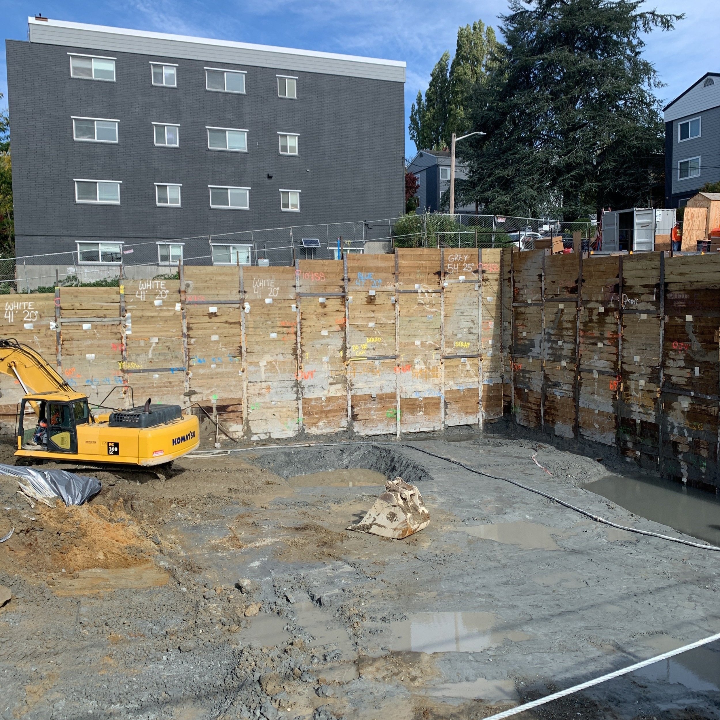
Shoring for Maddux North starts, October 2020

Contaminated soil is excavated from the northeast corner of Maddux North, late 2020

First rigid displacement inclusion ground improvement, January 2021
The Maddux is the first of several brownfields-to-affordable housing projects Aspect is supporting under Ecology’s new funding agreement. Construction is underway just 2 miles north of The Maddux at MBHA and Lake Union Partners Grand Street Commons project, which includes 360 affordable units at the future Judkins Park light rail station near I-90. We are also partnering with GardnerGlobal for the future Town Center development in Skyway, one of King County’s most diverse neighborhoods.

A drill rig is lowered into the Grand Street Commons site, October 2022.
Other projects in the Seattle area include environmental and geotechnical due diligence for a new residential community in SeaTac led by African Community Housing & Development, a new community center and future affordable housing for Estelita’s Library on Beacon Hill, and a potential large mixed-use development for Seattle Chinatown International District Preservation and Development Authority, Lake Union Partners, Goodwill, and Community Roots Housing at the Dearborn Goodwill site.
Aspect congratulates MBHA on this historic milestone and looks forward to more opportunities to work with Ecology and public and private partners to improve diverse neighborhoods by turning contaminated properties into thriving communities.