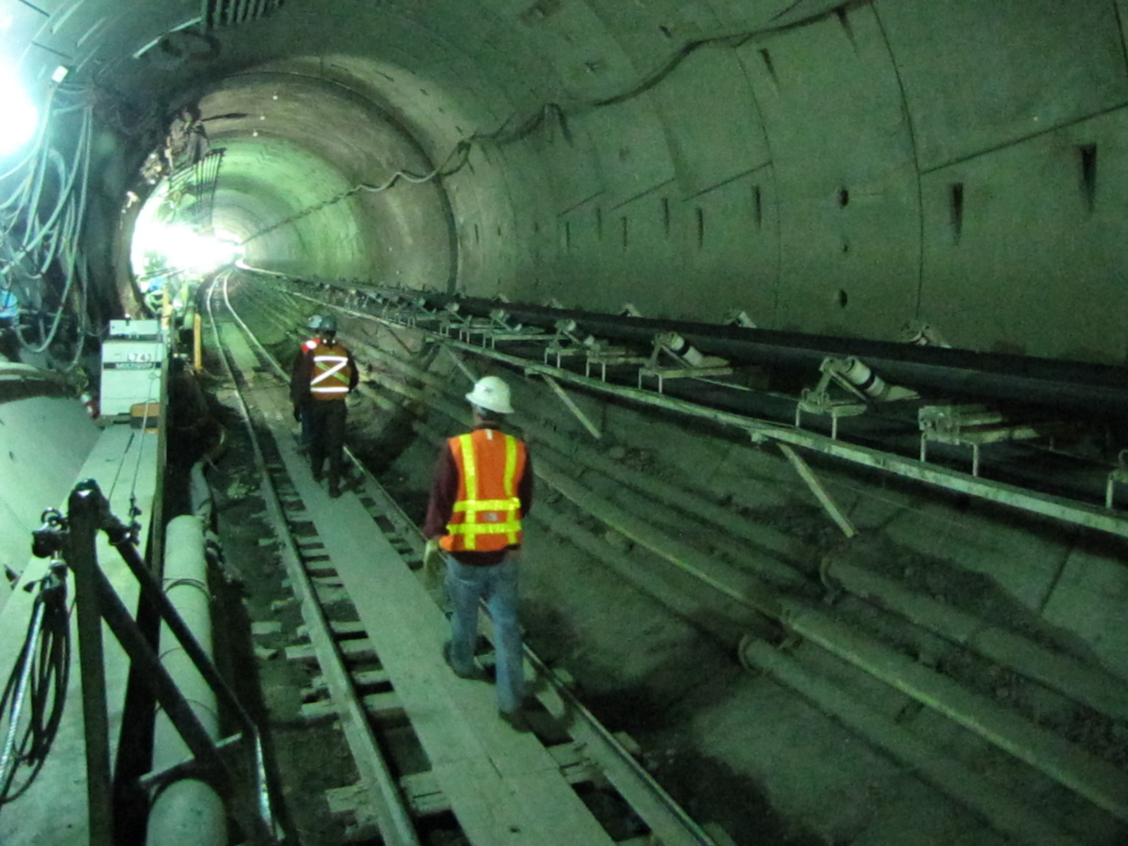
As Seattle weathers the close of one historic stretch of Highway 99 and awaits the opening of a brand new one (at the time, the largest soft-ground tunnel bore in the world), we’re recapping a tale that played out in connection to one of the more dramatic milestones of the tunneling project: Bertha gets stuck.
In December 2013, the mega tunnel boring machine known as Bertha overheated and broke down 1,000 feet into its journey. Eager to keep the project moving, crews working for Washington State Department of Transportation (WSDOT) quickly designed and excavated a deep rescue shaft to get in front of the stuck machine and repair it. It was a complicated effort to drill down to Bertha considering the unique geology and human history that has defined Seattle’s waterfront.
Peering into the 130-foot-deep rescue shaft. Photo credit: Seattle Times
How an Inch of Displacement Can Cause Trouble
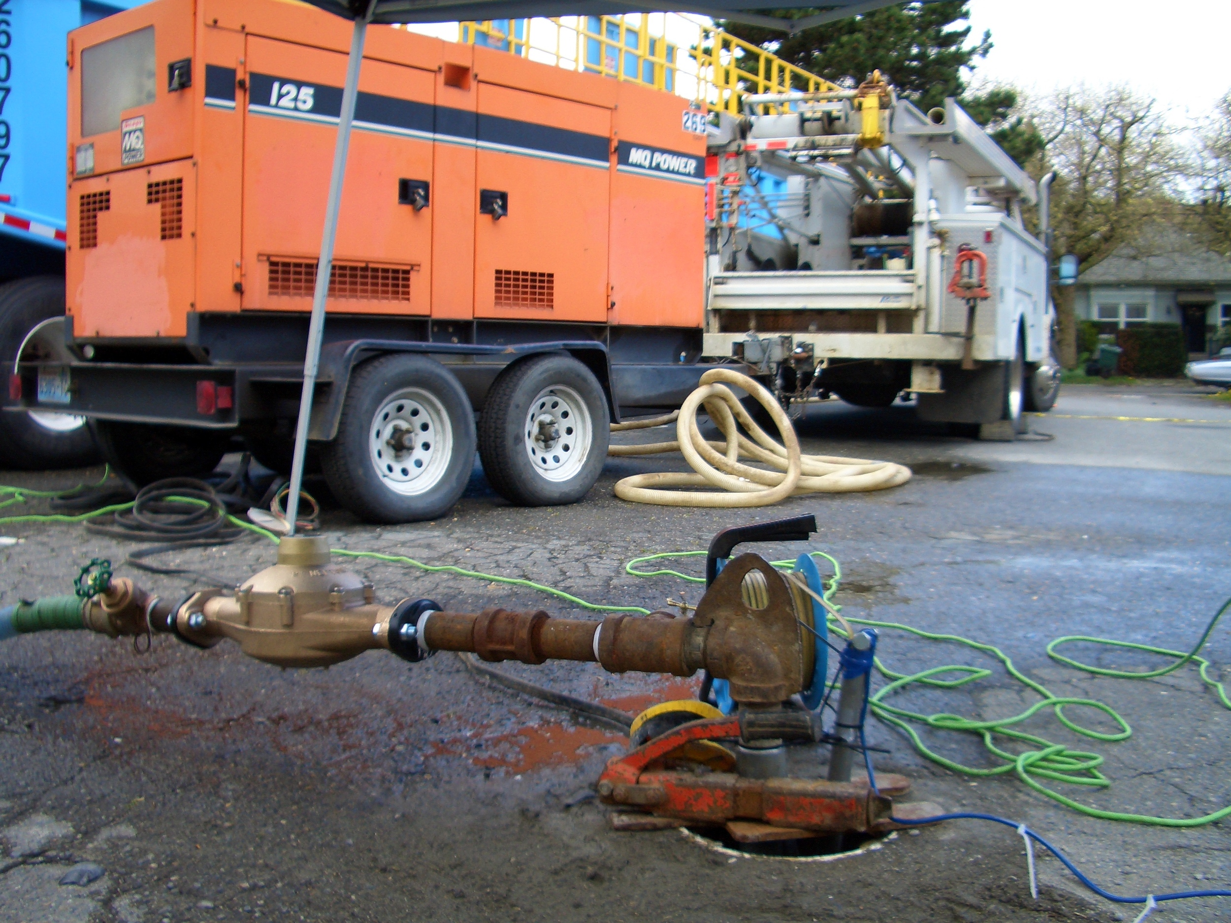
Stabilizing the ground to create the 130-foot-deep shaft required a significant amount of dewatering [1] that had to be done quickly. This dewatering caused the surrounding soils to settle much more than was anticipated from the planned tunnel construction—the settlement reached over a wide half-mile radius, and about an inch in some places, and even more than that close to the shaft.
An inch may not seem like a lot, but for the underground maze of City of Seattle (City) utility infrastructure, including aging, brittle water and sewer lines (some over 100 years old), any additional settlement was problematic. This unforeseen settlement was enough to trigger an expedited program to assess and replace the utilities where risks were unacceptably high. The City, in need of expertise on local geology, hydrogeology, tunneling, and soil behavior, brought on Aspect to investigate problems resulting from the rescue shaft construction and help design repairs.
The aerial image of the Seattle waterfront shows locations of satellite radar altimetry points TRE Altamira used to measure precise changes in ground surface elevation from May 2014 through February 2015, which included the period of Bertha rescue shaft dewatering. The colors of the dots represent the cumulative change in elevation, with hot colors showing subsidence and cool showing uplift. The orange and red areas show the broad pattern of ground subsidence associated with the shaft dewatering. For more information on this technology, visit TRE Altamira.
Aspect’s role was four-fold: determine what parts of the City’s infrastructure were being most affected by the settlement; assess vulnerability of other areas further along the tunnel route; assist with geotechnical engineering recommendations for replacing infrastructure damaged by the settlement; and help the City understand the cause of the settlement.
Till + Fill + Development = Complex Subsurface Challenges
Our investigation started with an extensive review of the waterfront’s underlying geology. Deep beneath the City lies a complex history of multiple glacial advances and retreats, separated by long interglacial periods. Sediments from glaciations include tills, layers of glacial lake and marine silts and clays, and sheets of glacial outwash sand and gravel. These glacial soils are interbedded with floodplain silts and sands and gravelly channel deposits transported by rivers flowing from the surrounding mountains, including lahar deposits (large volcanic mudflows) from as far away as Mount Rainier.
These strata were deposited in more-or-less horizontal and generally orderly ways, then subsequently compressed and compacted by repeated advance of glacial ice sheets. In the Pioneer Square area, a present-day look at the resulting stratigraphy is, however, far from orderly, due to its setting within the Seattle fault zone. This zone of tectonic compression repeatedly ruptured during prehistoric earthquakes, and much of the strata are now sheared, tilted, overthrust, and truncated. All of this was then overlain by weak estuary, beach, and tide flat deposits—and then extensively modified by humans.

This map shows the rescue shaft – and the southern portion of the tunnel route – in or below what was formerly the beach and tide flats of Elliott Bay. Pioneer Square was a tidal marsh area. These areas were infilled over the century with sawmill wood waste and soil fill, making the ground throughout the (now) Pioneer Square area both geologically and historically complex. Map credit: Aspect
A major part of Aspect’s analysis focused on the location, thickness, and nature of the weak and shallow soils draped above the strong glacial soils, intertwined with the historical changes that occurred as Seattle developed its waterfront. The Pioneer Square area was a small upland Native Americans had lived on for millennia. Occidental Square was a shallow coastal lagoon, and most of the area south of King Street was tide flats. As timber and shipping industries flourished in the 1800s, much of the waterfront was developed with piers and trestle bridges, then filled with sawdust and wood waste from waterfront mills and soft muck sluiced from nearby hills.
On top of all that, roads, sewer lines, water lines, and buildings were constructed on the new ground. Not surprisingly, these weak fills have settled over time, resulting in bumpy roads, tilted sidewalks, and tall curbs in the Pioneer Square neighborhood. But these same soils were also highly susceptible to further consolidation when the water table was rapidly lowered by the Bertha rescue shaft dewatering.
Historical Record Sleuthing
To assess the areas of vulnerable underground utilities, we dug into the historical records—maps dating from the original land surveys of Seattle to locate the original shorelines, and previous drilling investigations going back decades to reveal the subsurface data. Aspect compiled soil records of hundreds of borings and wells to develop a database that could be mapped in three dimensions and used to identify the areas where weak soils were present. When combined with the City’s utility maps, Aspect’s weak-soils map allowed the City to easily spot areas where weak soils and vulnerable infrastructure overlapped.
Aspect also assisted the City in pursuing remote surface elevation surveying techniques including use of synthetic aperture radar (InSAR), a satellite-based radar distance measuring technique that permits detection of precise changes in ground surface elevation over time. These studies looked at time-series analysis of data beginning well before tunneling started through shaft dewatering and continuing to the time of the study. They showed an unmistakable correlation between rescue shaft dewatering and broad areas of ground settlement.
Dewatering: The Science of Making a Wet Excavation Dry
Dewatering the excavation required pumping, but at a rate and depth to keep water pressure low (too high could risk “blowing out” the bottom of the 130-foot-deep shaft). There are two aquifers beneath the rescue shaft site and Pioneer Square area – one shallow and one deep. Because the shaft bottom sat in the “deep” aquifer, pumping targeted that aquifer, which was thought to be confined from the shallow aquifer and the vulnerable utilities sitting above it.
However, because settlement happened in the shallow aquifer area, Aspect’s forensic analysis looked at answering several questions: how susceptible are the utilities to pumping a deep aquifer? Does pumping the deep aquifer cause dewatering of the much shallower aquifer? And if so, does pumping the deep aquifer or dewatering the shallow aquifer cause most of the settlement that the City was observing? Understanding the hydrogeologic connections between pumping the two aquifers and the net effects of dewatering on soil behavior required multidisciplinary consideration of many factors.
This graph from TRE Altamira shows the elevation of a single point on the map near the area of greatest ground subsidence. The dots show the date of the satellite pass, and the elevation difference from the baseline series. The sharp drop in elevation between October and December 2014 corresponds to the period when shaft dewatering began. These satellite altimetry data correlated well with elevation control data collected by others using traditional on-the-ground surveying methods.
To understand the amount of shallow dewatering that had occurred, Aspect developed a comprehensive groundwater monitoring program that instrumented existing wells to collect data while the dewatering pumps were running. Then, once the pumps were shut off, before and after comparisons of water levels could be made to see the changes brought on by dewatering. Data collection continued until dewatering had ceased and groundwater levels had returned to normal.
Fixing the Faults Caused by the Fault
Ultimately, the project team concluded that there had been localized impacts to the shallow aquifer that were related to pumping of the deep aquifer. Some of those impacts were the result of leakage from the shallow aquifer downward along the outside of the Bertha rescue shaft, and some from leakage between the shallow and deep aquifers that occurred along zones of disrupted strata that the Seattle fault created to form the complex geology below Pioneer Square. The data collected by our team provided strong support that the Bertha shaft dewatering caused enough settlement to require replacement of vulnerable utilities. This led to a program in 2015 to replace the large water main buried below Western Avenue, with Aspect providing the geologic analysis used for the design. The drive along Western Avenue is now much smoother, and the section of new water main is now less vulnerable to the next big construction project or major earthquake.
Ironically, while past activity along the Seattle fault was largely responsible for the complex hydrogeology that made dewatering the Bertha rescue shaft a challenge, it was concerns about future rupture of the Seattle fault (or one of the other regional faults) that triggered replacing the Viaduct with the tunnel to begin with. This in turn led to the rebuilding of the waterfront seawall and reconstruction of Pier 62.
As some Aspect geologists are fond of saying – “geology explains everything.” With a site as complex as the Seattle waterfront, it takes an expert “read” of the geology and a skilled team of geologists, hydrogeologists, and engineers to inform design for projects that make Seattle safer and better for the future.
The Waterfront’s Next Chapter – Highway 99 Tunnel
While the water main beneath Western Avenue was being replaced and groundwater monitoring continued, WSDOT crews had Bertha repaired and chugging along beneath the city, breaking into daylight near South Lake Union in April 2017. Seattle now awaits the opening of the tunnel Bertha cleared that will move traffic through the complex web of geology, hydrogeology, infrastructure, and development that makes up the Seattle waterfront.
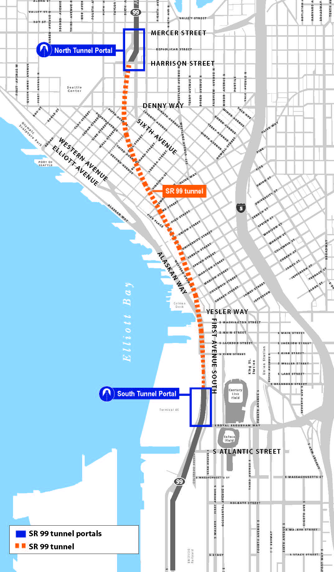
WSDOT’s map shows the new Highway 99 tunnel through downtown Seattle to South Lake Union. Map credit: WSDOT