Setting the Stage for Alaska Airlines’ 128,000-Square-Foot Groundbreaking

Alaska Airlines recently deepened its local roots with a groundbreaking for a new 128,000-square-foot corporate facility in SeaTac.

Aspect is helping set the stage for this by providing environmental and geotechnical services to prep the property for development.  Our team evaluated property-wide environmental conditions and is serving as the geotechnical engineer of record, which includes designing foundations and shoring walls.  Aspect pilot tested and designed a deep stormwater infiltration system to sustainably manage stormwater and get it back into the ground in a more native/natural way. This helped achieve the sustainability goals of the project. We will be on hand to perform construction observation as that kicks off. 

The “Hub” will be a 6-story office building scheduled for construction and then move-in for first quarter 2020.

The May 3rd groundbreaking ceremony was attended by various city, county and state dignitaries, including governor Jay Inslee, Congressman Adam Smith, King County Executive Dow Constantine and Alaska Airlines CEO Brad Tilden, as well as Alaska employees and members from the surrounding community.

Meet Chris Bellusci and Blair Deaver

Chris Bellusci and Blair Deaver recently joined Aspect's Bend, Oregon office.  Here are five questions we asked to get to know them better.

Chris Bellusci, Associate Business Systems Architect

Chris hiking near the Maroon Bells -- two peaks in the Elk Mountains in Colorado.

1.    Where are you from? If you’re not from the Pacific Northwest, what brought you here? 

I was born and raised in Missoula, Montana on a small ranch, where I developed my love for the outdoors and our natural resources. From Missoula, I moved to Seattle where I spent 10 years going to school, working, and exploring all the great outdoor activity it had to offer. But I felt I needed to get back to something a bit smaller in city size (and more sunshine) so I moved to Bend, Oregon, a place I really call home and have loved it ever since. 

2.    What inspired you to pursue data infrastructure? What made you curious about it?

My degree is in Electrical Engineering, but my first job right out of school was for Boeing Aerospace where I supported the hardware and software that developed the first design-by-wire aircraft, the 777. I saw the power of how technology can revolutionize an industry or a way of doing business. This set my path into the world of software. 

3.    What do you like best about your area of expertise? What excites you and keeps you motivated?

My focus is helping industries solve their complex business problems by applying technology solutions. My real belief is business process should drive the technology approach, which is why I enjoy learning so much about our client’s business and helping them to find the best solution to meet their business needs. I believe that applying technology to better manage our natural resources is the next great frontier.

4.    What do you like to do when you aren’t working? 

Being outside!!! I love Bend because of the four seasons it has to offer and I love being outside in each one of them, whether if it’s 90 degrees in July or 10 degrees in January. Hiking, biking, camping, skiing--I enjoy all of it!  

5.    Where in the world would you like to travel next? 

It has been over 15 years since I have visited Europe and I would like to get back there again this time with our two children. I would like them to see and experience other cultures, plus I have an older brother that lives in London, UK, so a good excuse to go.

Blair Deaver, Senior Geospatial Data Scientist

Blair riding the Jem biking trail in Utah.

1.    Where are you from? If you’re not from the Pacific Northwest, what brought you here? 

I grew up in Washington, D.C. I fled west for college in search of real mountain ranges I could explore on my mountain bike.

2.    What inspired you to pursue GIS and IT? What made you curious about it?

When I was going to school at the University of Oregon I worked part-time for the US Forest Service as a Hydro-technician in Oakridge, OR. I was a seasonal employee with aspirations for a full-time field job.  I quickly determined that a full-time job would be difficult. A peer at the time mentioned to me that if he were me, he would learn everything there is to know about this thing called “GIS”.  I quickly transitioned much of my school focus to Geography and GIS.  I was fascinated by GIS and quickly learned all I could.  When I graduated college, I was fortunate to get a job at Esri in Redlands, CA. I went from working in the woods for 10 hours a day to helping Esri customers solve technical problems behind a desk. The transition was a bit rough at first, but I have loved every minute of it. 

3.    What do you like best about your area of expertise? What excites you and keeps you motivated? 

I love the pairing of earth science + technology to solve real problems. I enjoy working with others to focus on the mastery of understanding a problem rather than quickly jumping to an engineering solution. I have worked over 20 years in the geospatial and IT industry. I have seen lots of change in the industry. What motivates me daily is to always keep learning. Being able to design and deliver technology solutions for earth science customers requires technical agility, creativity, and a solid understanding of the problem you are trying to solve.

4.    What do you like to do when you aren’t working? 

I love being a father and husband. You may also find me riding and racing my bicycle on trails throughout the PNW. I also love trail running and winter sport activities.

5.    Where in the world would you like to travel next? 

I would love to travel to Africa. All parts of Africa. I better save up my vacation.
 

Dave Cook Presents on Affordable Housing to Upper Kittitas County

On April 25, Aspect’s Dave Cook will be giving a lunch presentation on affordable housing development from the environmental consulting perspective to the Rotary Club of Upper Kittitas County at Suncadia Lodge.

Dave’s presentation will discuss how blighted, contaminated property doesn’t have to be a deal-breaker for redevelopment.  In fact, some brownfields property is actually being sought as a way to turn blighted property into affordable/work force housing.  Aspect’s first-of-its-kind work on the Mt Baker Housing Association’s Gateway project in the Mt Baker/Rainier Valley neighborhood in Seattle has become an example of what is possible.  Mt Baker Housing non-profit took on a significantly contaminated site to redevelop as affordable housing where the cost of the cleanup is more than the value of the five properties combined. 

How are we doing this?  Through environmental risk management via a Prospective Purchaser Consent Decree, cleanup evaluation through site characterization and Rough Order of Magnitude cost estimating, and unique funding via a Redevelopment Opportunity Zone (allowing funding from the State Dept of Ecology and Commerce), while also seeking other funds through a traditional path of accessing potentially liable parties (like big oil companies and old insurance policies).  This project is becoming recognized throughout Washington state and is a model for possible allocation of State cleanup funds to pilot this concept in other areas. 

Aspect’s Growing Data Science and Mapping Services

Science and engineering insights fueled, managed, and clearly communicated through technology. 

This sums up Aspect's successful client-focused approach since our inception in 2001. This year, we’ve enhanced the technology piece of this formula by adding three new staff, with over 10 years working together, focused on software development, technology integration, and geospatial data science. Chris Bellusci, Associate Business Systems Architect, and Blair Deaver, Senior Geospatial Data Scientist join Aspect’s recently opened Bend, Oregon office; and Mike Mills, Senior Project Software Developer, joins Aspect’s growing Portland, Oregon office.

These three will enhance Aspect’s already robust Data + Mapping services—helping our clients and project teams with solutions like map-integrated stormwater monitoring dashboards; environmental data management system design and integration; technology needs assessment and road-mapping; web map and GIS application development; integrated systems for mobile field data collection; and the development of machine learning-based approaches to basin-scale hydrology issues.

Data + Mapping Practice Lead and Aspect’s Director of Professional Services Parker Wittman explains the benefits to clients, “Chris, Blair, and Mike boost our core skills and add industry-leading, sought-after services like web development and cloud-based data management expertise,” Wittman said. “Reflecting the world at large, our clients will continue to seek out solutions that are interactive and mobile-platform friendly, that translate large amounts of data into scientific and business insights. These clients require teams that are analytical high-performers, who speak in the languages of business, regulation, earth science, and technology.”

Chris Bellusci

Chris Bellusci recognizes Aspect as an emerging leader in the data science and mapping world. “Joining Aspect was a clear choice for us. They’ve always partnered their earth engineering and science experts with creative technologists focused on client satisfaction. The three of us (Bellusci, Deaver, and Mills) see a lot of potential to help Aspect’s growing client base,” Bellusci said. “The cloud and web tools we leverage can shrink project times and costs—for example turning a typically three-week monitoring report process into three days. Mountains of data that were tracked by hand previously can now be managed in the cloud and presented to decision makers in minutes instead of weeks.”

Chris has been working in the world of IT/software development, support, and product management for more than 20 years, with an educational background in Electrical Engineering. For the past 12 of those years, Chris has been helping clients plan for and build technology-driven solutions related to earth science problems. He is a seasoned project and client manager with a penchant for new business development. 

Blair Deaver

Blair Deaver’s educational background is in Environmental Studies and GIS. His geospatial expertise is both broad (everything from open source GIS, scripting, mobile development, dev ops, data management, enterprise IT) and deep—he is a recognized Esri GIS expert and is Amazon Web Services certified. Blair is known for an incredibly nimble style of problem-solving, a trait that meshes well with Aspect’s overall approach to client services. 

Mike Mills

Mike Mills’s core expertise/background is in web and database development—he’s done everything from statistical analysis (writing custom kriging algorithms for in-browser spatial analyses) to mobile application development.  He’s a full-stack developer with a decade of experience delivering solutions for earth science and engineering projects. Mike’s educational background is in Mathematics and Computer Science.

Chris, Blair, and Mike all joined Aspect from GeoEngineers, where they had previously worked as a team for the better part of 10 years. Together—with Associate Water Resources Engineer, John Warinner—Chris and Blair make up Aspect’s new Bend, Oregon office. With Mike joining Aspect’s growing Portland office as well, Aspect is continuing its earnest expansion into the Oregon earth + water market. The experts who are part of Aspect emerging Oregon presence service all the firm’s core practice areas—and are collectively a reflection of Aspect’s multidisciplinary approach.


Inspiring Burgeoning Environmental Consultants

For an interdisciplinary WWU course led by Dr. Ruth Sofield and focused on the Science and Management of Contaminated Sites (SMoCS), Aspect’s Steve Germiat and Kirsi Longley gave budding environmental consultants a look at what life and work is really like for professional environmental consultants.

To complement the students’ landfill RI/FS case study, Kirsi presented Aspect’s recent RI/FS work at a landfill in western Washington. The presentation focused on the scope of the investigation, the findings, including how volatile contaminants can transfer between landfill gas and groundwater, and how the findings were developed into recommendations for remedial alternatives.  In addition to the scientific and technological challenges of environmental remediation, Steve and Kirsi addressed the nuts and bolts of a consultant’s role in the MTCA cleanup process, and the skills and attributes that enable a consultant to excel. Looking back on the presentation, Dr. Sofield said “Students benefit so much from interactions with Steve and Kirsi.  To actually learn from a practitioner and see that classroom material has real application changes how students think about and participate in their education.  It changes a lot for the students, including their intended career path.”

About SMoCS

In collaboration with Washington State Department of Ecology Toxics Cleanup Program, WWU’s Huxley College of the Environment (Huxley) offers undergraduate students a course series in the Science and Management of Contaminated sites (SMoCS). The SMoCS series includes three courses that build knowledge of the contaminated site cleanup process in Washington State with an emphasis on how scientific investigations are conducted, use of the technical documents associated with cleanups, the roles of different parties in cleanup decisions, and enhanced professional skills.  For more information on the program visit http://faculty.wwu.edu/harperr3/SMoCS.shtml.

The Story in the Sediment: Tracing Stormwater Pollution Sources at Superfund Sites

Since 2001, the lowest five miles of Seattle’s Duwamish River (known as the Lower Duwamish Waterway or LDW) has been designated as a 412-acre Environmental Protection Agency (EPA) Superfund site. The LDW’s Superfund status results from decades of historical industrial activity. On top of the historical contamination, the LDW has ongoing issues with contaminated stormwater runoff. Rain hits the abundance of impervious surfaces – e.g., asphalt roads and lots, building roofs – in the industrial areas next to the river, collects contaminants from those surfaces, and carries it to the nearest storm drain and into the river.

Sediment sampling in Seattle's Lower Duwamish Superfund area helps identify contaminates and cleanup strategies to improve water quality. 

Among the many tasks in cleaning up Superfund sites is the ongoing detective work to sleuth what contaminants are there and where they came from. In the LDW cleanup, one of the key clues isn’t even in the river water itself, but in the sediment carried by stormwater. 

Aspect staff have sampled stormwater sediments across the LDW Superfund site – previously for the City of Seattle and King County and currently for the Port of Seattle at Harbor Island. Our efforts studying these solids in stormwater runoff provide key information about the recent history at a site and the extent of contamination.
 

The Benefits of Sediment Sleuthing: Unlike Water, It Accumulates

Unlike stormwater, which runs through and beyond an outfall to receiving waters, heavier sediments and other settleable solids (relatively heavy substances that sink in water) carried by runoff drop out and accumulate. This accumulation, which occurs in key locations such as stormwater catch basins, vaults, and low-gradient pipes, provides a rich environment for valuable leads on water quality contaminants that may eventually end up in streams, rivers, lakes, wetlands, and Puget Sound. Sediment monitoring often provides a more comprehensive historical picture of pollutants compared to instantaneous or short-term sampling of water alone.

At Superfund areas, and many other sites challenged by stormwater runoff, sediment monitoring benefits clients by: 

  • Providing a historical picture of pollution—through accumulated sediment analysis--associated with stormwater runoff and industrial discharge.
  • Identifying chronic types of pollution that may deteriorate water quality and habitat.
  • Tracing the sources of pollution to their origin for purposes of management, treatment, or elimination.
  • Determining sediment accumulation rates in sewers and catch basins to improve maintenance and operation needs and to anticipate and prevent flooding.
  • Complying with permits, records of decision, and other legal requirements for preventing environmental degradation or requiring cleanup of polluted sites.
  • Measuring the effect of land use activities and stormwater treatment best management practices (BMPs).
     

Tracking Hot Spots Across 600 Acres of Pavement and Buildings

Boeing Field (aka King County International Airport or KCIA) is one of the nation’s busiest primary non-hub airports and covers over 630 acres of mostly impervious surface. Managing stormwater runoff over this much area and with many industrial tenants is a challenge, especially because KCIA faces the challenge of being responsible for all discharge to the LDW from its property, even runoff or discharge in tenant-operated areas. 

Sediment traps in a storm sewer manhole

Aspect staff previously performed inexpensive but high-resolution sediment monitoring throughout KCIA’s storm drainage infrastructure that ranged from shallow old brick manholes to deep new stormwater treatment vaults. The results from the sediment monitoring provided a finer-grained picture of accumulated sediment quality than had ever been collected at KCIA. This allowed King County to identify hot spots of likely pollution sources coming from both individual tenants and from legacy airport infrastructure and helped prioritize an action plan to address these areas.

Using Sediment Data to Track Down Drainage Ditch Polluters

In a different area of the LDW, sediment data helped the City of Seattle identify the source of intermittent toxic metal pollutants from a far upland drainage area to the LDW, despite having outdated drainage maps. 

Sediment collection in a storm sewer manhole

Because the area was previously in unincorporated Seattle, sewer records were incomplete. With the assistance of an Ecology inspector who knew the area and businesses well, Aspect staff collected sediment samples from both the public and private drainage systems. The sediment samples helped both Ecology and the City efficiently trace the source of the metals pollution to a business that had a previously unknown illicit connection from its industrial waste drainage system to the ditches outside, which served as the public storm drainage.

Long-term Sediment Monitoring at Harbor Island to Support Environmental Compliance

Aspect is currently assisting the Port of Seattle with sediment monitoring at a 15-acre marine terminal on Harbor Island, a discrete Superfund site located downstream of the LDW Superfund area. The sediment monitoring supports the Port in demonstrating compliance with a Record of Decision (ROD) to rehabilitate the site. As a site that drains directly to Puget Sound, the objective of the cleanup (which included dredging and removing contaminated soil) is to reduce concentrations of hazardous substances in runoff to levels that will have no adverse effect on marine organisms. 

Sediment traps mounted on the side of a storm sewer manhole

Sample bottles with accumulated sediment at the bottom

To evaluate this over the required 10-year monitoring period, Aspect is monitoring accumulated sediments in the new stormwater drainage system at the terminal for metals, tributyltin, polycyclic aromatic hydrocarbons (PAHs), and polychlorinated biphenyls (PCBs). The results from the sediment monitoring are compared to target concentrations in the Washington State Sediment Management Standards and show the Port’s commitment to compliance with the ROD and to ensuring that the site rehabilitation was successful. 

Sediment Sampling Provides Key Historical Context to Water Quality Evaluation

Measuring sediment quality is an excellent – and affordable – complement to measuring water quality. Aspect’s sediment sleuthing has helped clients in the LDW create a more holistic picture of both historical and ongoing stormwater pollution, as well as flooding potential. From this picture, they are better able to identify sources of contamination and create specific plans to address them—leading to a healthier LDW for all. 

Aspect’s Dan Haller Sharing His Water Rights Strategies and Discussing the New Exempt Well Legislation at the Central Washington Agriculture Seminar

On April 6th, Aspect’s Dan Haller will be speaking on three water right topics: how to stretch your existing rights to cover new irrigated lands (spreading), the new legislation on rural exempt wells (ESSB 6091), and relinquishment protection strategies

Join Dan and other distinguished speakers for the FREE Central Washington Agriculture Seminar.

The Story of a 106-Year-Old Northwest Map Making Institution

The color of the water is off; it’s too dark. So he prints the map three more times, each time adjusting a small detail.”  

Yup, that’s map making. Aspect's mapping team was nodding along to this touching Seattle Times story about a 106-year-old map-making business. We’ve had a Kroll map hanging in the office ever since Aspect’s early days for motivation and inspiration. It serves as an important reminder that you never know the longevity and influence the maps you create just might have, even the little details have to be just right.

The Kroll map hanging in Aspect's Seattle office

Join International Development Discussion on February 20 During Engineers Week

On February 20 at Pyramid Alehouse in Seattle, join Aspect's Principal Geologist Dave Cook and other panelists for an Engineers Without Borders-hosted panel discussion on the role of engineering in international development. 

If you are interested in international development and want to use your engineering skills to make a positive impact, please consider joining us. Our panel will consist of speakers from the following non-profit organizations that are devoted to using the tools of engineering, planning, and design in order to build a better world.

  • Engineers Without Borders USA (Represented by Dave Cook): In the world's toughest places, EWB-USA is partnering with communities at home and around the world to meet their basic human needs through sustainable engineering projects. A dynamic organization with over 16,000 members nationwide, Dave Cook has served as the President and on the Board of Directors for EWB-USA in year's past.  
  • Construction for Change (Represented by Kevin Hunter): Construction for Change (CFC) builds spaces where people struggling with oppression can become healthier, learn, and increase their economic mobility. They partner with organizations that provide life-changing resources but have outgrown their facilities or seek to expand the service they offer. Mr. Hunter has been Executive Director of CFC since November 2016, leading the organization to develop a sustainable and scalable model to expand the reach of the organization around the globe, and his previous experience includes leadership roles with Young Life, World Vision, and Habitat for Humanity. 
  • Kilowatts for Humanity (Represented by Kirk MacLearnsberry): Kilowatts for Humanity (KWH) was founded in 2014 as an organization centered around an electrical engineering project for a hybrid wind/solar/storage system in Muhuru Bay, Kenya. The organization has since expanded to several major international solar project initiatives, with the goal of providing access to sustainable electricity in energy impoverished areas. Kirk MacLearnsberry has been a member of the design team since 2015 and was involved as the engineering lead on last summer's implementation trip to construct a local solar/storage kiosk in Munyama, Zambia. 

Meet new members, newtwork with fellow engineers and planners, and learn about EWB! More information about the February 20 event at Pyramid Ale at 6:30 pm.

What the Hirst “Fix” Signals for WA's Rural Water Users and Managers

Last month, after months of delay that even stopped Washington state’s capital budget from passing, the Washington State House and Senate passed ESSB 6091 to address legal water availability issues for exempt well users stemming from the landmark Whatcom County v. Hirst case. Because of the complexity of implementing the new law, it is too soon to know all of the consequences of this proposed fix. However, here are several early takeaways:

What it means

  • In many, but not all, areas of the state, the new law allows building permits relying on exempt wells in areas with instream flows to be approved by local jurisdictions without reviewing each case for impairment considerations.
  • Overall impairment to instream flows caused collectively by new exempt wells is to be addressed through restarting the watershed planning process in Water Resource Inventory Areas (WRIAs) with no adopted Watershed Plan, or through an update of existing adopted Watershed Plans.  
  • Plan recommendations to improve streamflows may include, among other options, acquiring senior water rights, water conservation, water reuse, off-channel storage, and aquifer recharge. 
  • Several watersheds were specifically excluded from the law based on other regulatory considerations, including:
    • Watersheds with instream flow rules that explicitly regulate exempt wells and provide for reserves, such as the Stillaguamish, Methow, and Wenatchee basins. These watersheds must rely on the finite reserves of water already allocated.
    • Federally regulated watersheds (Yakima basin).

How we got here

Under existing state law (RCW 90.44.050), the groundwater permit exemption allows, for a limited number of purposes, water users to construct and develop groundwater wells for small quantities of groundwater without obtaining a permit. In October of 2016, in a landmark decision on the use of exempt wells and county responsibility for evaluating impacts from the wells on instream flows, the Washington Supreme Court (Court) ruled in the Whatcom County v. Hirst case that the Growth Management Act (GMA) placed an independent responsibility to ensure water availability on counties, not on Ecology. Counties across the state had varying responses to the decision, with some placing a moratorium on granting building permits relying on unmitigated exempt wells, others including disclaimers on proof of legal water availability, and others taking a wait and see approach.

New $500 fee and new Exempt Well Use Limitations

The new Bill 6091 requires a new $500 fee to be paid as part of obtaining a building permit relying on an exempt well, to support watershed planning efforts.  In basins with adopted Watershed Plans, the law allows an exempt well to use a maximum average of 3,000 gallons per day, while in basins with no watershed plan, a limitation of 950 gallons per day is imposed.

Understanding of Bill 6091 Still Evolving

The Washington Department of Ecology is responsible for implementing ESSB 6091, and is still formulating relevant policy. As general understanding and consensus evolves, Aspect will continue to comment on this for clients.

The following link provides the Washington Department of Ecology’s Initial Policy Interpretations on ESSB 6091:https://fortress.wa.gov/ecy/wrx/wrx/fsvr/ecylcyfsvrxfile/WaterRights/wrwebpdf/6091-EcologyPolicyInterpretations.pdf

The following link provides the Hirst Supreme Court Decision:https://fortress.wa.gov/ecy/wrx/wrx/fsvr/ecylcyfsvrxfile/WaterRights/wrwebpdf/91475-3opinion.pdf

Progress at the City of Bellingham's Waypoint Park

That’s some nice looking beach gravel! Aspect has been helping with geotechnical engineering and construction monitoring for the City of Bellingham’s Waypoint Park project. When finished later this year, it will mark a new era for Bellingham’s waterfront. See the Bellingham Herald’s video below for a glimpse of the construction underway.

Who are the scientists in your neighborhood?

Aspect outreach connects younger residents with cleanup and redevelopment work at Mt. Baker Housing Association

On a recent cloudy afternoon, about 15 kids gathered on a corner in Seattle’s Mount Baker neighborhood to peer down a hole. The hole isn’t just any hole, it’s a groundwater monitoring well—one of 35 that Aspect is using to measure groundwater contamination levels in the area. The kids, ranging from second grade through high school, are residents of six nearby apartment buildings managed by the Mt. Baker Housing Association (MBHA). This field trip was led by Aspect’s Principal Geologist Dave Cook and Senior Geologist Jessica Smith, who have been sharing their environmental work on an innovative MBHA redevelopment project with some of the neighborhood’s younger residents through an ongoing series of visits that helps kids understand the science that will help shape the future of their neighborhood.

Located two blocks from the Mount Baker light rail station, the cleanup site has sat unused for years due to solvent-contamination from a dry cleaner and gasoline-contamination from a former gas station. Aspect is supporting a first-of-its-kind partnership between the MBHA, the City of Seattle, and the Washington State Department of Ecology that will use state funds to help cover some of the costs for environmental evaluation and cleanup. With significant help from an Ecology Public Partnership Grant, MBHA plans to redevelop the five parcels of land with two new residential buildings to meet the City’s critical need for more affordable housing.

Stepping out of the Typical Cleanup Process to Invite Community into the Project

Outreach and collaboration with the area’s residents, businesses, and other stakeholders is a key part of the project. Dave and Jessica’s work puts community, education, and science into action by speaking directly to a segment of the population not usually directly engaged in these types of projects. The kids get to meet the scientists and engineers working in their neighborhood and gets to find out what’s happening, and what’s going to happen, in their own backyard.

Dave and Jessica collaborated with MBHA’s Resident Services Coordinator Sameth Mell and intern Cristina Pinho to engage with the younger members of the Mount Baker community. “After 26 years of quietly cleaning up and recycling land for better uses, I thought it was time to break out of the standard consulting role and focus on the community in a more direct way,” Dave said. “I’ve always enjoyed educating people about what we do. The science is really cool, it’s practical, very visual, and I figured kids would be totally into geology and engineering. What kid doesn’t like playing with dirt, sampling water and learning about mysteries below ground?”

An Outdoor Classroom to See the Underground Up Close

On this recent visit, Dave and Jessica met the kids inside over pizza for introductions before heading out to the corner in front of the building, where Staff Geologist Na Hyung Choi was already busy gathering samples at one of the groundwater monitoring wells. She filled sample containers with groundwater located about 15 feet below the ground surface and answered questions while Jessica and Dave explained more about her work.

Jessica said, “For me, the best part of being involved in the community outreach is being able to introduce kids to the practical aspects of science and engineering to get them excited about STEM [science, technology, engineering, and math]. As we were watching Na Hyung obtain the groundwater samples, one of the fourth-grade girls asked me if she could be a Geologist or an Engineer when she grows up, to which I enthusiastically replied, ‘Of course!’ Facilitating that curiosity and excitement in these kids is what this is all about.”

Back inside, Dave and Jessica presented a video of how the well they’d just been looking at was created, showing how the hole was drilled and the soil that was unearthed from the drill. Jessica also gave a tangible explanation of just what groundwater is. Marbles in a glass represented the dirt, with a little water poured in to help them visualize how groundwater lives between the soil grains.  A bright green straw inserted into the glass stood in for the groundwater monitoring well that was installed into the soil to suck out the water.

Ongoing Outreach as Work Heads Toward 150 Units of New Housing

This visit was the second one Dave and Jessica have made since beginning their field work in mid-November. They plan to return often as the project continues, to share results from the samples Na Hyung was taking and what that data tells them about how the contaminants are behaving underground. From these data, Dave, Jessica and Ecology will develop the best plan to clean up the contaminated soil and groundwater so that construction can begin.

Cleanup and redevelopment on the MBHA project is slated to begin in 2019. Once complete, there will be an estimated 150 units of new affordable housing on the parcels. The kids Dave and Jessica have been checking in with will be able to tell their new neighbors, “Hey, I know what used to be underneath your building!” 

Wet weather season: When the levees go to work

November is historically the wettest month of the year in western Washington. The seemingly constant mist of precipitation punctuated by storms that dump inches of rain in short amounts of time sends water levels in area rivers rising. The risk of flooding presents a critical need to protect nearby homes, businesses, and habitat. Levees a play a key role in that protection.

In the old days of flood control, a levee was typically little more than a pile of dirt. These days, they’re still dirt, but have evolved into a highly engineered, specifically designed mass, often made from less permeable soil (like clay) and designed wider at the base and narrower at the top. Levees are especially critical in floodplain areas to maintain healthy fish and riparian habitats, and of course near neighborhoods and businesses that would be vulnerable should a river top its banks.

While western Washington’s levees are working to protect their surrounding areas, Aspect is hard at work supporting several levee improvement projects in King County and beyond. Our services for recent and ongoing projects include:

Lower Russel Road Levee Setback, Kent, WA

Lower Russel Road Levee Setback, Kent, WA
Map from King County's Project Website

Lead geotechnical engineer and hydrogeologic support for Lower Russell Road Levee Setback, which is improving 1.4 miles of the flood control system along the Green River in Kent. Once completed, the project will provide greater flood protection and water conveyance capacity while improving both riparian habitat and recreational opportunities. This project is nearing the 60 percent design stage of completion, and is anticipated to be constructed by 2020. More project information and pictures can be found on King County’s project page

South Unit Shillapoo and Buckmire Slough Restoration Design, Vancouver, WA

South Unit Shillapoo and Buckmire Slough Restoration Design, Vancouver, WA
Map from the Washington State Department of Fish and Wildlife’s project website

Geotechnical engineering and hydrogeologic efforts for the South Unit Shillapoo and Buckmire Slough Restoration Design, along the Columbia River in Vancouver, Washington. The project will improve hydrologic access to approximately 540 acres of intertidal, freshwater slough and wetland habitat. Our work first includes subsurface explorations and geotechnical design for breaching the existing levee (to clear room for the new levee); constructing three WSDOT bridges along State Route 501; flood control levee construction; roadway raises to meet 100-year flood elevations; and construction of up to 14 interior water control structures in the wetland system. You can read more about the project on the Washington Department of Fish & Wildlife’s website

Countyline Levee Setback, Pacific, WA

Environmental and geotechnical support for the Countyline Levee Setback project along the White River near Pacific, just north of the border with Pierce County. When contaminated materials were encountered during construction of the Levee Setback project, our environmental team advised the County on whether the material posed a risk to the project if left in-place, while also determining proper disposal methods. Our geotechnical engineers conducted a targeted, cost-effective investigation to study flooding during high flows and collected data to inform the levee setback design. The project was finished this fall, just in time for late October rains, and now protects 121 acres of floodplain. See an aerial video of the project below

Pacific Right Bank Project, Pacific, WA

Pacific Right Bank Project, Pacific, WA
Map from King County’s project website

In late November, Aspect will provide both geotechnical and environmental services on the Pacific Right levee setback, along the opposite site of the White River from the Countyline Levee. The project will create a setback levee between the BNSF Railway and Government Canal to significantly reduce the potential for river flooding of adjacent neighborhoods. Learn more about the project on King County’s project website. 

Countdown to the new Pier 62

Seattle’s Daily Journal of Commerce reported yesterday that construction on the city’s new Pier 62 will begin in two weeks. Once completed, this $34.8 million dollar rebuild will create a new park on the pier and reintroduce the public to this part of Elliott Bay.

Aspect helped set the foundations for this new phase of the Pier 62’s history. Read more about the construction on the Daily Journal of Commerce’s website and Aspect’s previous work on our blog

An Alternative Approach for Petroleum-Site Cleanups

With around 3,000 historical leaking underground petroleum storage tanks (USTs) and systems across Washington state, petroleum cleanup is a big issue for business owners, homeowners, and regulators. The traditional leaking UST cleanup process is typically counted in years and often stymied by the lack of available regulatory staff to handle the large volume of sites efficiently. 

To help remedy this, the state’s Pollution Liability Agency (PLIA) created a new cleanup route--the Petroleum Technical Assistance Program (PTAP)--beginning in January 2018. The PTAP program offers applicants the potential of lower cost associated with regulatory oversight and a commitment to faster turnaround times for opinions on their UST sites. Thanks to a 2017 change in state law, PLIA now has the statutory authority to provide technical oversight and write opinions--something only Ecology previously had--on UST sites, thus giving site owners and operators a new alternative to the state’s traditional Voluntary Cleanup Program (VCP) process.

With over a decade of petroleum site cleanup experience, Aspect’s Senior Engineer Eric Marhofer gives a primer on the potential PTAP has for UST owners.

What does the new PTAP Program Mean for Site Owners? 

The nuance of PLIA’s approach is to work more collaboratively with site owners--for example, they plan to hold an intake meeting at the outset upon enrollment to review the site status with the applicant and set achievable milestones. PLIA is looking to provide more certainty upfront, and quicker, more pragmatic opinions and responses throughout the process. The goal is to efficiently move sites toward a “No Further Action” determination and, ultimately, allow the owner to return their site to a business asset instead of a liability. 

Additionally, the PTAP may work more seamlessly for site owners already working in cooperation with PLIA through their Commercial Reinsurance and/or Loan and Grant programs.

There’s a number of PLIA financing and insurance options available to help UST owners and operators move their sites towards closure.

What’s the Process?

PLIA is looking to offer a streamlined application and approval process, a one-time flat fee of $7,500 for service (vs. hourly billing for review and opinions in the VCP), an intake meeting with senior technical staff to review your Site (which does not typically happen in the VCP), and faster turn-around times for written opinions (a goal of 45 days versus 90+ days with Ecology).  

PTAP’s Program begins accepting applications January 2, 2018.

Are there any risks?

Depending on how much regulatory oversight is anticipated, a flat-fee of $7,500 may not make sense for some sites. However, for more complex sites that may need multiple opinions over the life of the investigation and cleanup, that fee will likely represent a good value. 
There are also certain factors site owners will want to consider when determining whether their site qualifies for PTAP. For example, there can be no impacts to sediment or surface water and there can be no co-mingled, non-petroleum contamination. Additionally, sites facing litigation may not qualify. If the site is disqualified for one or more reasons after enrollment in PTAP, it is unclear whether the enrollment fee is refundable.

PTAP eligibility criteria.

PLIA also expects actionable steps to be taken on the part of the applicant/owners to move forward with investigations and cleanups once accepted to the program.  In other words, PLIA will not be a safe harbor for Sites to enroll to avoid Ecology enforcement but not take any actions to investigate or clean up their site.  Sites may be disqualified from the program for inactivity and the enrollment fee may not be refundable.  

Learn more here: http://plia.wa.gov/ptap/ or contact Eric at emarhofer@aspectconsulting.com.
 

Meet Caroline Van Slyke

Caroline Van Slyke recently joined Aspect's Seattle office. Here are five questions we asked to get to know her better.

    Caroline Van Slyke, Senior CAD Specialist

    1. Where are you from?

    I hail from a small town in northeast Ohio that had one stop light. We lived on a dirt road and couldn’t see the neighbor’s house because it was too far away.  After years of high humidity, winter blizzards, and lake-effect snow, I packed everything up and headed west to the Emerald City of Seattle.  I’ve been here for almost 30 years and never tire of this beautiful state.

    2.    What inspired you to pursue CAD? What made you curious about it?

    To me, CAD wouldn’t exist if drafting never existed. One of the classes I took during my senior year in high school was a drafting class where we used pencils and T-squares because CAD did not exist.  The subject matter came very easily and as a result, I was put into a small subset of students affectionately named “All You Others” that did advanced studies while the rest of the class followed the standard curriculum.  it was so enjoyable that I decided to pursue an AA in Mechanical Engineering.

    3.    What do you like best about your area of expertise? What excites you and keeps you motivated? 

    Every day, there is something new and exciting to work on!  Over my career, I have helped engineering professionals with many different projects spanning all engineering disciplines, which affords exciting learning opportunities daily.  It’s fun to have a pulse on the Puget Sound region by way of being involved with projects in our line of work.

    4.    What do you like to do when you aren’t working? 

    I secretly rock out and play the blues on my guitar and when it’s not raining, drive my car around the track at Pacific Northwest Raceways at high velocities.  I also indulge in video games when time permits.

    5.    What is the most unusual thing in your wallet, pocket, or purse right at this moment?

    Just for conversation starters, I have a 45-rpm record adapter that I will occasionally show to a post-vinyl record era person and see if they can guess what it is.
     

    Meet Mari Otto and Meilani Lanier-Kamaha'o

    Mari Otto and Meilani Lanier-Kamaha'o recently joined Aspect's Seattle office. Here are five questions we asked to get to know them better.

      Mari Otto, Staff Geotechnical Engineer

      1.    Where are you from? If you’re not from the Pacific Northwest, what brought you here? 
      I am from a little tiny archipelago in the Pacific called Palau. Not a lot of people have heard of it, so if you want to learn about it come find me – I love talking about home. It’s a great place to grow up – lots of great diving spots and pretty scenery. I spent almost my entire childhood running around (or more often than not, swimming around) having a blast. 

      I came to the US to study civil engineering at UH Manoa in Hawaii and I worked in New Zealand before deciding to come to Seattle for grad school at UW. Then I decided I like the Pacific Northwest so much, I might as well stay here for a few more years! 

      2.    What inspired you to pursue geotechnical engineering? What made you curious about it?
      My geotech professor in undergrad was a great teacher and he had a lot of cool stories about working as a consultant on the Boston Big Dig. Taking my geotech courses from him made me want to learn more about working in this field. 

      3.    What do you like best about your area of expertise? What excites you and keeps you motivated? 
      My favorite part about geotech is that it involves a lot of hands-on work and going out in the field. Don’t get me wrong, I like being nice and comfy in the office - but if I was inside all the time, I would probably go a little stir-crazy.

      4.    What do you like to do when you aren’t working? 
      I’m still a total Seattle/WA noob, so I’m trying to spend more time exploring the area, hiking, and looking for my future favorite food spots. On lazy days, I like to hang out and read, play guitar (badly), and watch sci-fi/horror movies.

      5.    Where would your dream house be located?
      I’ve actually put a lot of thought into my dream house. It’ll be in Palau, at a nice spot not too far from the beach. It’ll be timber-framed, with an awesome deck for BBQs and viewing the ocean. Ideally, it’ll have a good surf/paddling spot nearby so I could go out on the water every morning.
       

      Meilani Lanier-Kamaha'o, Project Geologist

      Utah's Arches National Park

      1.    Where are you from? If you’re not from the Pacific Northwest, what brought you here? 
      I grew up between Santa Cruz and Valley Center, California – i.e., a proud-to-be-tree-huggers bubble on the Monterey Bay where the Redwoods meet the Pacific Ocean versus the granite hills covered in avocado and citrus groves in the northeast corner of San Diego. In the past dozen years, I’ve lived in Los Angeles, Ellensburg, north county San Diego, and Orange County. The Cascades stole my heart when I flew over them on my way to Missoula in 2010 and after marrying a local – and living throughout the southern California megalopolis – it only made sense to come back to the mountains!

      2.    What inspired you to pursue geology? What made you curious about it?
      Like knowing an older sibling, I do not remember I time when I was not interested in the earth and sky. As a child, I was transfixed by characters that made mountains, chased stars, sent storms around the earth with a breath, or pierced into the core of the earth or sea to find whole new worlds. I also had the benefit of living in spectacular parts of California and was surrounded by an environmentally conscious community. By the time geology entered my life academically it just made sense to me. Genie Elliott introduced me to plate tectonics and Dr. Ann Blythe introduced me to research and career opportunities. So, I pursued a career that was intuitive, generally involved being outdoors, and helped preserved the natural resources I love.

      3.    What do you like best about your area of expertise? What excites you and keeps you motivated? 
      Geology is pretty unique in its physicality compared to other sciences. Our laboratory is everywhere around us, even if covered by concrete and maybe especially in those instances where we manipulate and apply our knowledge of geology. I love that geology exists on so many scales from mountain building and planetary evolution to fractional crystallization and microns. For me environmental consulting is like conducting many little research projects; predicting what’s in the subsurface then finding out. I love when everything I’ve learned is true but also when something different is going on.  Our work directly relates to society and I love working in teams of multidisciplinary professionals. 

      4.    What do you like to do when you aren’t working? 
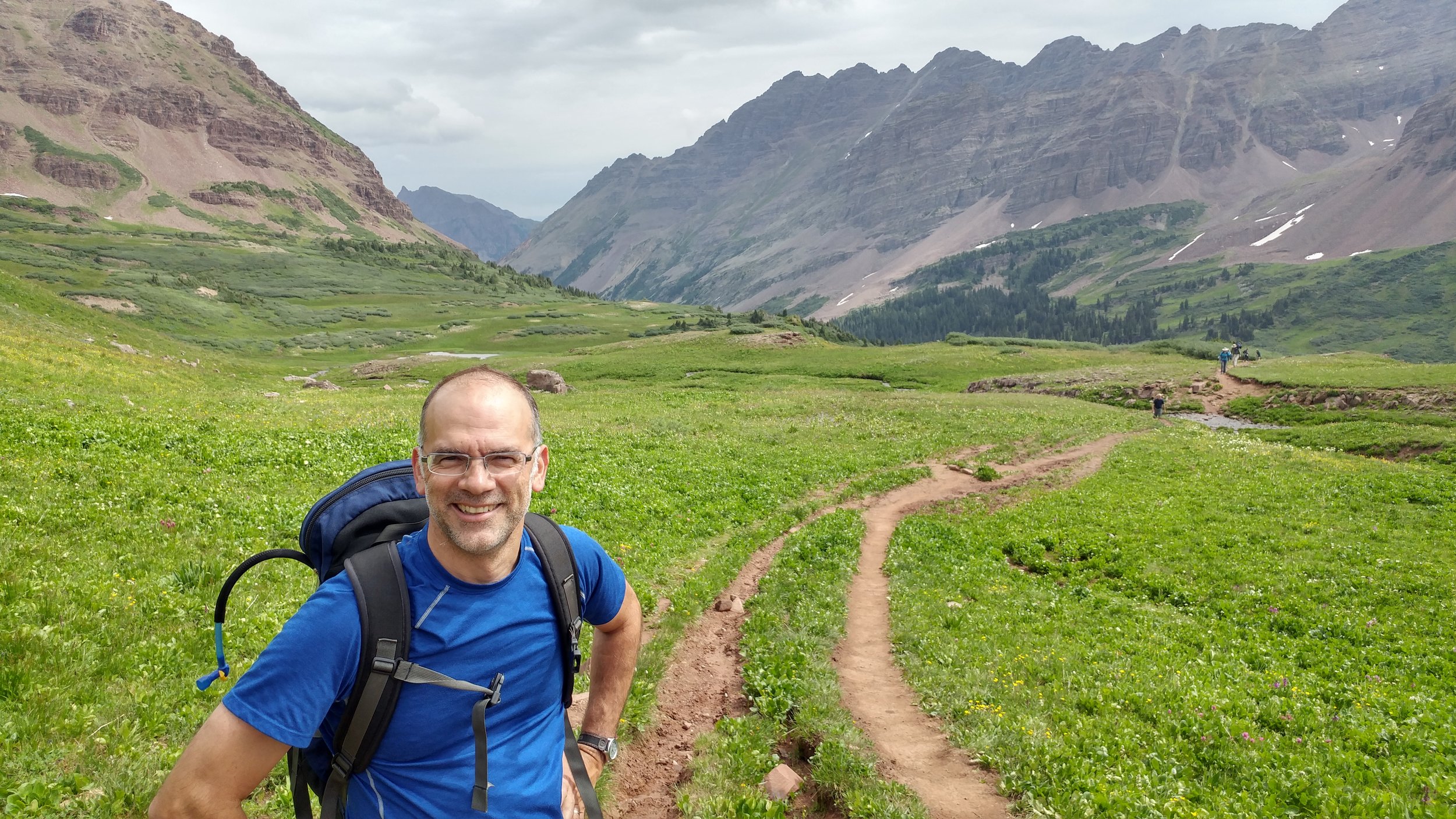
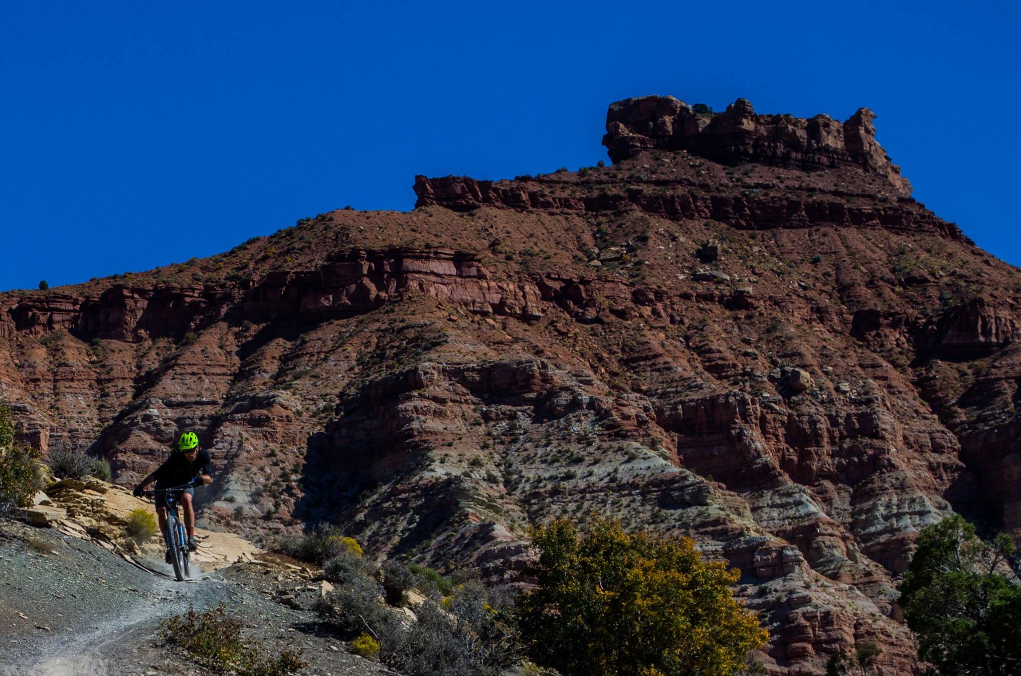
      Generally being outdoors is what I love, be that hiking, cycling, running, swimming, or sitting with a tasty beer. When there isn’t time for an outing I end up doing miscellaneous projects including building shelves, bedframes, crocheting, sewing, or dabbling in painting and drawing. When I’m not talking with my husband about social justice, the state of education, implicit bias, or all the possibilities of our future, I try to sit down with an instrument and fumble through the process of learning or re-learning how to play it. All that aside, most days my happy place is cooking up delicious food in the kitchen. Vegetables are my thing and trying different spices, sauces, and new ways to prepare could-get-boring-ingredients is fun, calming, and I get to enjoy (EAT) my hard work! 

      5.    Where would your dream house be located? 
      I am a soul divided: 

      1. My dream house would certainly be located in the sky. I’m not yet sure of the logistics, either a semi-permanent cloud city (semi-permanent because I’d still want other clouds, the ones not supporting my house, to be floating by from time to time) or suspended mountains with little root cities on their undersides.
      2. My dream house would certainly be located in the Shire. Beautiful round doorway leading into a cozy home INSIDE A HILL or MOUNTAIN. Gardens, mead, and mountains!
         

      30 Years and Beyond: Caring for Landfills Post Closure

      For landfill owners and operators, an ounce of prevention can be worth hundreds of thousands of dollars of cure. Read Chris Augistine’s DJC article about navigating the regulatory requirements and applying strategies to reduce monitoring requirements, save money, and successfully plan for post-closure care at closed landfills.

      READ IT HERE

      Aspect's Dan Haller Presenting on Water Law, Water Banking, and Water Rights - 9/28 & 9/29

      Washington Public Utility District Association Conference - 9/28

      On day two of this year’s WPUDA conference in Leavenworth, Aspect’s Dan Haller will be participating on a morning session panel titled “What’s a Water Bank and How Does it Work?” During the afternoon sessions, Dan will be giving a Water Rights 101 presentation.  Public Utility District's manage numerous water rights over domestic systems, dams, hatcheries, and Parks, which put them in a unique position to participating water Banks to accomplish their overall District. Protecting District water rights is a key priority to ensure they are available for multiple District business needs.

      Yakima County Bar Association - 9/29

      Dan will be giving a presentation on the Hirst decision and how it affects Eastern Washington water rights to the Yakima County Bar Association September 29th. The Hirst decision changed the regulatory framework of County rural building permit and land use policies and is prompting numerous changes from new regulations, moratoriums on building, creation of water Banks, and water write transactions.

      From Water Wars to Water Policy – 100 Years of Washington Water Code

      This year marks 100 Years of water rights in Washington state. In parallel with this centennial, water rights have received a flood of recent attention in the public eye, primarily because of the role the Hirst decision has played in halting the state’s $4 Billion capital budget.

      Image credit: Washington State Department of Ecology

      To take the pulse of the water managers, policy makers, and others who steer water law in the state, Aspect conducted a reporter’s roundtable to hear thoughts on Washington water policy today and for the future. Read their account in this month’s “The Water Report”, as well as a fascinating look back to the pre-code, wild west era where dynamite was occasionally preferred as a dispute resolution tool for water management.

      Also, be sure to check out the excellent story map and video series developed by the Washington State Department of Ecology on this topic. Lastly, the water code centennial will be the center of attention of next month’s American Water Resources Association – Washington Section (AWRA-WA) State Conference,  October 3, 2017 in Seattle, Washington.