Visualizing Stormwater Infiltration + Visualizing the Story

Aspect recently led a first-of-its-kind approach to help the City of SeaTac (City) understand water quality requirements at the land use planning stage. Aspect, along with Robin Kirschbaum, developed publicly-available webmaps that visualize stormwater infiltration potential at a parcel level across the City’s 10 square miles. These maps will help both City planners as well as developers screen development options with infiltration requirements and make this step of the land use planning process much more efficient.

Take a look at the interactive Story Map for this exciting new tool here: https://maps.aspectconsulting.com/lidmapjournal/index.html.

Read Emelie’s article in the Daily Journal of Commerce about this pioneering project.

Aspect’s Henry Haselton and Dave McCormack Join October Landslide Seminar

Aspect’s Principal Geotechnical Engineer Henry Haselton and Principal Engineering Geologist Dave McCormack will participate as faculty at The Seminar Group's Landslides program on October 25, 2018 at the Washington Athletic Club in Seattle. This seminar covers the science behind slope movement and landslides in Washington and discusses the liability concerns for a wide audience of attorneys, claims professionals, and real estate experts.

Register to attend today.

Central-Washington Geology: Field Trip!

Rocks have histories and their histories tell us stories. 

This was the underlying theme of Aspect’s recent seminar on central Washington geology, led by esteemed experts Dr. Kathy Troost, LG, of Troost Geosciences and the University of Washington and Dr. Eric Cheney, Geology Professor Emeritus at UW. While topography alone makes clear the relevance of geology to the eastern Washington landscape, less sure is how the regional setting impacts the realm of projects—those distinct points on and below the ground where Aspect’s earth science and engineering work enters in. 

Over two days in June, staff from across Aspect’s offices came together to learn about big-picture geology and earth processes related to 66 million years of local history, and then travel to the outcrops to see the deposits firsthand. Woven throughout were the contributions of each person’s unique experiences with geology and relevant insights from nearby project sites. Together, the balance provided each of us the tools to make sense of an otherwise complex landscape; a way to break it down into manageable pieces, put it back together, and learn what it has to tell.

Learn about Washington Water Law

Aspect’s water law expert, Dan Haller, will be presenting on Water Banking for Agricultural Water Supplies at the 27th Annual Water Law in Washington conference (June 14-15). This year’s conference focuses on major legislative changes, new case law, and important practical information for water rights and resource management in the State of Washington.

Washington State’s First Affordable Housing Fund for Contaminated Sites: Applications Due June 30th

The Washington State Departments of Ecology and Commerce have created an innovative new program that will provide grants to affordable housing developers seeking to redevelop contaminated properties and increase the state’s housing stock.

The Healthy Housing Remediation Program will provide grant funds to nonprofit and private housing organizations to evaluate, investigate, and clean up contaminated properties to support the development of affordable housing. It was created by the Washington State Legislature during the 2018 session and will be funded in the 2019 session.

The program builds upon the successful partnership between Ecology and the Mt. Baker Housing Association on the Gateway Project in Seattle. Mt. Baker Housing’s Gateway Project will redevelop several contaminated properties for affordable housing near transit hubs in Seattle’s Rainier Valley. Aspect and law firm Perkins Coie — with lead counsel Mike Dunning — serve as Mt. Baker Housing’s environmental team on the Gateway Project. Perkins Coie and Aspect have worked directly with Ecology and Mt. Baker Housing to build this unique concept.

Ecology and Commerce started soliciting applications for the program on June 1 and the application period closes June 30. Perkins Coie and Aspect can help interested organizations complete and send in their applications. This needs to happen as soon as possible to meet the June 30 deadline.

If you have any questions about the Healthy Housing Remediation Program or about redeveloping contaminated properties for housing, please contact Dave Cook at 206.838.5837 and at dcook@aspectconsulting.com or Mike Dunning at 206.359.3464 and at mdunning@perkinscoie.com.

Before and after conceptual image of Mt. Baker Gateway Project  in South Seattle – one of the affordable housing cleanup sites that the Healthy Housing program is inspired from.

Next Step in Icicle Creek Basin Solution – June 27 Public Hearing in Leavenworth

Taking the next step in a process that began in 2012, Chelan County and the Washington State Department of Ecology (Ecology)  have released the Draft Programmatic Environmental Impact Statement (PEIS) for the Icicle Creek Water Resource Management Strategy (Icicle Strategy). The Draft PEIS will be summarized and discussed at a public hearing on Wednesday, June 27 from 4pm to 8pm at Leavenworth Festhalle, 1001 Front Street, Leavenworth, WA. The PEIS evaluates five alternatives to help the Icicle Work Group (IWG) map out a solution for instream flow, tribal, agricultural, domestic, and recreational water needs for the Icicle Creek Subbasin in central Washington.

See Chelan County’s Icicle Strategy website for more information. Aspect has helped coordinate the development of the PEIS, along with multiple teaming partners and co-leads Chelan County and Ecology.

Water Banking in the West

Water banking is increasingly being looked at as an innovative approach to storing and releasing water in water-challenged areas of the West. In May’s issue of The Water Report, Aspect’s Dan Haller wrote an in-depth look at water banking in Washington state, how it compares to the rest of the West, and what recent legislative changes mean for the successful adoption of this water supply tool. Click below to read the article. 

Strengthening our Water Resources Services with Jon Turk and James Bush

Aspect strengthens its water resources practice with the addition of Associate Hydrogeologist Jon Turk, LHG and Project Hydrogeologist James Bush, LHG. Jon is a hydrogeologist with over 16 years of experience focused on quantitative hydrogeology for water, wastewater, and industrial markets for public agencies and private industry. He will work out of Olympia, supporting Aspect’s Seattle office as well as expanding Aspect’s capabilities for clients in the south Puget Sound area. James brings over seven years of hydrogeologic and numerical modeling experience for groundwater projects.

Jon Turk

James Bush

“Jon’s background and expertise are a seamless match with Aspect’s water resources client base,” says Tim Flynn, Aspect’s President. “We’re also excited to continue to introduce Aspect to all the south Puget Sound and western Washington clients that Jon has built strong relationships with.”

While at his previous firm, Brown and Caldwell, Jon led an integrated water resources management team providing regional leadership and national consulting for complex and integrated surface water and groundwater systems. He brings recognized skill in groundwater recharge, water supply management, wastewater reuse, and numerical modeling for clean water projects as well as site remediation support for Brownfields and Superfund projects. James also comes from Brown and Caldwell, where he was a primary technical contributor to groundwater projects, environmental site characterization, and numerical modeling projects throughout Washington, Oregon, and the western United States.

“I’m excited to join the Aspect team and proud to join such a talented group of consultants,” says Jon.  “I’ve always considered Aspect as one of the premier hydrogeologic consultancies in the region, with a strong brand that truly values both innovative and practical approaches to solving complex water resource challenges.”

Testing Innovative Methods for Landfill Gas Monitoring in King County

Scientists from the CSE Corporation (a company developing cutting-edge gas detection devices used in air-quality monitoring) and Aspect remediation engineers are working in partnership to develop new methods for continuous methane-gas monitoring at landfills. CSE’s methane-gas monitoring products use solar-powered instruments outfitted with telemetry. Solar power eliminates the need for frequent battery replacement while telemetry allows remote monitoring of the data. With cooperation from King County Solid Waste Division, CSE has provided Aspect with test units to install at several of the County’s closed landfills to gauge the effectiveness of this technology for the landfill industry.

CSE has roots in the mining industry and a history of innovations, including the first self-contained rescue-breathing apparatus for use by mine personnel. KCSWD, Aspect, and CSE are testing the devices ability to monitor methane, a primary source of greenhouse gas emissions from landfills.
 

Got methane? CSE remote methane monitoring setup with telemetry and solar panel  on a passive landfill gas collection system in King County, Washington.

Setting the Stage for Alaska Airlines’ 128,000-Square-Foot Groundbreaking

Alaska Airlines recently deepened its local roots with a groundbreaking for a new 128,000-square-foot corporate facility in SeaTac.

Aspect is helping set the stage for this by providing environmental and geotechnical services to prep the property for development.  Our team evaluated property-wide environmental conditions and is serving as the geotechnical engineer of record, which includes designing foundations and shoring walls.  Aspect pilot tested and designed a deep stormwater infiltration system to sustainably manage stormwater and get it back into the ground in a more native/natural way. This helped achieve the sustainability goals of the project. We will be on hand to perform construction observation as that kicks off. 

The “Hub” will be a 6-story office building scheduled for construction and then move-in for first quarter 2020.

The May 3rd groundbreaking ceremony was attended by various city, county and state dignitaries, including governor Jay Inslee, Congressman Adam Smith, King County Executive Dow Constantine and Alaska Airlines CEO Brad Tilden, as well as Alaska employees and members from the surrounding community.

New LiDAR Maps Reveal Skagit County's Geologic Landscape

LiDAR mapping – the process of methodically using pulsed lasers from a plane/helicopter to map aerial-view landscape features – helps communities plan for landslide hazards, understand potential floodplains, and learn about geologic features previously unknown. Because LiDAR penetrates through tree canopies, it produces much greater detail and precision than typical aerial maps. So, when new LiDAR maps are released (particularly in areas with heavy tree cover, thus meaning much longer lead times to create new maps) – it is a cause for excitement in the earth science and geographic information system (GIS) communities.

Skagit County just finished a year-long LiDAR mapping project of the county and produced a great new story map that reveals features--including a prehistoric landslide near Cultus Mountain – that were not apparent on the previous aerial maps.

The region’s first generation of LiDAR maps was a tremendous advancement over the aerial photo-based survey maps that had been used for generations. While very useful, the limitations in quality of the older LiDAR was most apparent in steep and heavily vegetated areas – frustrating because those are exactly the areas where you most want the best data. The greater detail and accuracy of this new generation of LiDAR maps presents a leap forward in resolution and ability to survey these important areas. 

Compare the quality of the 2006 LiDAR map of Guemes Island (left) to the new version (right)

The new generation also frequently includes “green light LiDAR”, a method with the ability to penetrate water and reveal the bathymetry of shorelines, streams, rivers, and other shallow water bodies.  Both of these improvements greatly improve our ability to rely on the new LiDAR maps for interpretation of geomorphic features and active processes, and detect natural and human-caused changes in the environment. 

Take a look: Skagit Lidar Map Journal

Aspect’s Growing Data Science and Mapping Services

Science and engineering insights fueled, managed, and clearly communicated through technology. 

This sums up Aspect's successful client-focused approach since our inception in 2001. This year, we’ve enhanced the technology piece of this formula by adding three new staff, with over 10 years working together, focused on software development, technology integration, and geospatial data science. Chris Bellusci, Associate Business Systems Architect, and Blair Deaver, Senior Geospatial Data Scientist join Aspect’s recently opened Bend, Oregon office; and Mike Mills, Senior Project Software Developer, joins Aspect’s growing Portland, Oregon office.

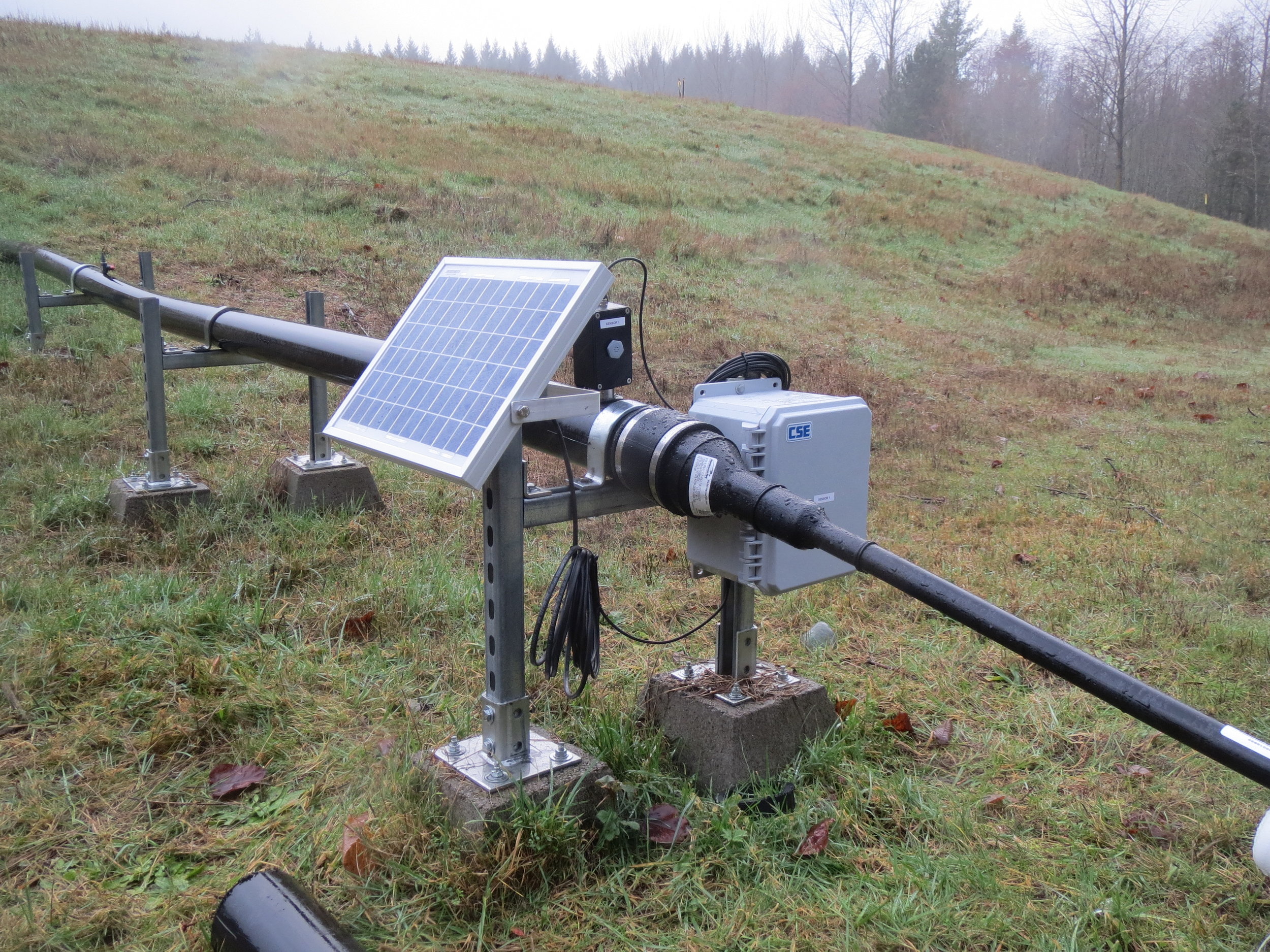
These three will enhance Aspect’s already robust Data + Mapping services—helping our clients and project teams with solutions like map-integrated stormwater monitoring dashboards; environmental data management system design and integration; technology needs assessment and road-mapping; web map and GIS application development; integrated systems for mobile field data collection; and the development of machine learning-based approaches to basin-scale hydrology issues.

Data + Mapping Practice Lead and Aspect’s Director of Professional Services Parker Wittman explains the benefits to clients, “Chris, Blair, and Mike boost our core skills and add industry-leading, sought-after services like web development and cloud-based data management expertise,” Wittman said. “Reflecting the world at large, our clients will continue to seek out solutions that are interactive and mobile-platform friendly, that translate large amounts of data into scientific and business insights. These clients require teams that are analytical high-performers, who speak in the languages of business, regulation, earth science, and technology.”

Chris Bellusci

Chris Bellusci recognizes Aspect as an emerging leader in the data science and mapping world. “Joining Aspect was a clear choice for us. They’ve always partnered their earth engineering and science experts with creative technologists focused on client satisfaction. The three of us (Bellusci, Deaver, and Mills) see a lot of potential to help Aspect’s growing client base,” Bellusci said. “The cloud and web tools we leverage can shrink project times and costs—for example turning a typically three-week monitoring report process into three days. Mountains of data that were tracked by hand previously can now be managed in the cloud and presented to decision makers in minutes instead of weeks.”

Chris has been working in the world of IT/software development, support, and product management for more than 20 years, with an educational background in Electrical Engineering. For the past 12 of those years, Chris has been helping clients plan for and build technology-driven solutions related to earth science problems. He is a seasoned project and client manager with a penchant for new business development. 

Blair Deaver

Blair Deaver’s educational background is in Environmental Studies and GIS. His geospatial expertise is both broad (everything from open source GIS, scripting, mobile development, dev ops, data management, enterprise IT) and deep—he is a recognized Esri GIS expert and is Amazon Web Services certified. Blair is known for an incredibly nimble style of problem-solving, a trait that meshes well with Aspect’s overall approach to client services. 

Mike Mills

Mike Mills’s core expertise/background is in web and database development—he’s done everything from statistical analysis (writing custom kriging algorithms for in-browser spatial analyses) to mobile application development.  He’s a full-stack developer with a decade of experience delivering solutions for earth science and engineering projects. Mike’s educational background is in Mathematics and Computer Science.

Chris, Blair, and Mike all joined Aspect from GeoEngineers, where they had previously worked as a team for the better part of 10 years. Together—with Associate Water Resources Engineer, John Warinner—Chris and Blair make up Aspect’s new Bend, Oregon office. With Mike joining Aspect’s growing Portland office as well, Aspect is continuing its earnest expansion into the Oregon earth + water market. The experts who are part of Aspect emerging Oregon presence service all the firm’s core practice areas—and are collectively a reflection of Aspect’s multidisciplinary approach.


The Story in the Sediment: Tracing Stormwater Pollution Sources at Superfund Sites

Since 2001, the lowest five miles of Seattle’s Duwamish River (known as the Lower Duwamish Waterway or LDW) has been designated as a 412-acre Environmental Protection Agency (EPA) Superfund site. The LDW’s Superfund status results from decades of historical industrial activity. On top of the historical contamination, the LDW has ongoing issues with contaminated stormwater runoff. Rain hits the abundance of impervious surfaces – e.g., asphalt roads and lots, building roofs – in the industrial areas next to the river, collects contaminants from those surfaces, and carries it to the nearest storm drain and into the river.

Sediment sampling in Seattle's Lower Duwamish Superfund area helps identify contaminates and cleanup strategies to improve water quality. 

Among the many tasks in cleaning up Superfund sites is the ongoing detective work to sleuth what contaminants are there and where they came from. In the LDW cleanup, one of the key clues isn’t even in the river water itself, but in the sediment carried by stormwater. 

Aspect staff have sampled stormwater sediments across the LDW Superfund site – previously for the City of Seattle and King County and currently for the Port of Seattle at Harbor Island. Our efforts studying these solids in stormwater runoff provide key information about the recent history at a site and the extent of contamination.
 

The Benefits of Sediment Sleuthing: Unlike Water, It Accumulates

Unlike stormwater, which runs through and beyond an outfall to receiving waters, heavier sediments and other settleable solids (relatively heavy substances that sink in water) carried by runoff drop out and accumulate. This accumulation, which occurs in key locations such as stormwater catch basins, vaults, and low-gradient pipes, provides a rich environment for valuable leads on water quality contaminants that may eventually end up in streams, rivers, lakes, wetlands, and Puget Sound. Sediment monitoring often provides a more comprehensive historical picture of pollutants compared to instantaneous or short-term sampling of water alone.

At Superfund areas, and many other sites challenged by stormwater runoff, sediment monitoring benefits clients by: 

  • Providing a historical picture of pollution—through accumulated sediment analysis--associated with stormwater runoff and industrial discharge.
  • Identifying chronic types of pollution that may deteriorate water quality and habitat.
  • Tracing the sources of pollution to their origin for purposes of management, treatment, or elimination.
  • Determining sediment accumulation rates in sewers and catch basins to improve maintenance and operation needs and to anticipate and prevent flooding.
  • Complying with permits, records of decision, and other legal requirements for preventing environmental degradation or requiring cleanup of polluted sites.
  • Measuring the effect of land use activities and stormwater treatment best management practices (BMPs).
     

Tracking Hot Spots Across 600 Acres of Pavement and Buildings

Boeing Field (aka King County International Airport or KCIA) is one of the nation’s busiest primary non-hub airports and covers over 630 acres of mostly impervious surface. Managing stormwater runoff over this much area and with many industrial tenants is a challenge, especially because KCIA faces the challenge of being responsible for all discharge to the LDW from its property, even runoff or discharge in tenant-operated areas. 

Sediment traps in a storm sewer manhole

Aspect staff previously performed inexpensive but high-resolution sediment monitoring throughout KCIA’s storm drainage infrastructure that ranged from shallow old brick manholes to deep new stormwater treatment vaults. The results from the sediment monitoring provided a finer-grained picture of accumulated sediment quality than had ever been collected at KCIA. This allowed King County to identify hot spots of likely pollution sources coming from both individual tenants and from legacy airport infrastructure and helped prioritize an action plan to address these areas.

Using Sediment Data to Track Down Drainage Ditch Polluters

In a different area of the LDW, sediment data helped the City of Seattle identify the source of intermittent toxic metal pollutants from a far upland drainage area to the LDW, despite having outdated drainage maps. 

Sediment collection in a storm sewer manhole

Because the area was previously in unincorporated Seattle, sewer records were incomplete. With the assistance of an Ecology inspector who knew the area and businesses well, Aspect staff collected sediment samples from both the public and private drainage systems. The sediment samples helped both Ecology and the City efficiently trace the source of the metals pollution to a business that had a previously unknown illicit connection from its industrial waste drainage system to the ditches outside, which served as the public storm drainage.

Long-term Sediment Monitoring at Harbor Island to Support Environmental Compliance

Aspect is currently assisting the Port of Seattle with sediment monitoring at a 15-acre marine terminal on Harbor Island, a discrete Superfund site located downstream of the LDW Superfund area. The sediment monitoring supports the Port in demonstrating compliance with a Record of Decision (ROD) to rehabilitate the site. As a site that drains directly to Puget Sound, the objective of the cleanup (which included dredging and removing contaminated soil) is to reduce concentrations of hazardous substances in runoff to levels that will have no adverse effect on marine organisms. 

Sediment traps mounted on the side of a storm sewer manhole

Sample bottles with accumulated sediment at the bottom

To evaluate this over the required 10-year monitoring period, Aspect is monitoring accumulated sediments in the new stormwater drainage system at the terminal for metals, tributyltin, polycyclic aromatic hydrocarbons (PAHs), and polychlorinated biphenyls (PCBs). The results from the sediment monitoring are compared to target concentrations in the Washington State Sediment Management Standards and show the Port’s commitment to compliance with the ROD and to ensuring that the site rehabilitation was successful. 

Sediment Sampling Provides Key Historical Context to Water Quality Evaluation

Measuring sediment quality is an excellent – and affordable – complement to measuring water quality. Aspect’s sediment sleuthing has helped clients in the LDW create a more holistic picture of both historical and ongoing stormwater pollution, as well as flooding potential. From this picture, they are better able to identify sources of contamination and create specific plans to address them—leading to a healthier LDW for all. 

How Will We Hold Up to The Cascadia Megaquake?

Two recent articles in The Seattle Times explore how the Pacific Northwest's infrastructure will be affected by the next major earthquake.

New Cascadia quake analysis shows building retrofits could save many lives

How to survive the Cascadia Earthquake? Tips from seismologist Lucy Jones, ‘the Beyoncé of earthquakes’

Back in 2015, our very own Dave McCormack chimed in with his thoughts in response to the now infamous New Yorker story, The Really Big One

A Geologist's Thoughts on the Pacific Northwest Mega-Quake Story

Source: USGS

What the Hirst “Fix” Signals for WA's Rural Water Users and Managers

Last month, after months of delay that even stopped Washington state’s capital budget from passing, the Washington State House and Senate passed ESSB 6091 to address legal water availability issues for exempt well users stemming from the landmark Whatcom County v. Hirst case. Because of the complexity of implementing the new law, it is too soon to know all of the consequences of this proposed fix. However, here are several early takeaways:

What it means

  • In many, but not all, areas of the state, the new law allows building permits relying on exempt wells in areas with instream flows to be approved by local jurisdictions without reviewing each case for impairment considerations.
  • Overall impairment to instream flows caused collectively by new exempt wells is to be addressed through restarting the watershed planning process in Water Resource Inventory Areas (WRIAs) with no adopted Watershed Plan, or through an update of existing adopted Watershed Plans.  
  • Plan recommendations to improve streamflows may include, among other options, acquiring senior water rights, water conservation, water reuse, off-channel storage, and aquifer recharge. 
  • Several watersheds were specifically excluded from the law based on other regulatory considerations, including:
    • Watersheds with instream flow rules that explicitly regulate exempt wells and provide for reserves, such as the Stillaguamish, Methow, and Wenatchee basins. These watersheds must rely on the finite reserves of water already allocated.
    • Federally regulated watersheds (Yakima basin).

How we got here

Under existing state law (RCW 90.44.050), the groundwater permit exemption allows, for a limited number of purposes, water users to construct and develop groundwater wells for small quantities of groundwater without obtaining a permit. In October of 2016, in a landmark decision on the use of exempt wells and county responsibility for evaluating impacts from the wells on instream flows, the Washington Supreme Court (Court) ruled in the Whatcom County v. Hirst case that the Growth Management Act (GMA) placed an independent responsibility to ensure water availability on counties, not on Ecology. Counties across the state had varying responses to the decision, with some placing a moratorium on granting building permits relying on unmitigated exempt wells, others including disclaimers on proof of legal water availability, and others taking a wait and see approach.

New $500 fee and new Exempt Well Use Limitations

The new Bill 6091 requires a new $500 fee to be paid as part of obtaining a building permit relying on an exempt well, to support watershed planning efforts.  In basins with adopted Watershed Plans, the law allows an exempt well to use a maximum average of 3,000 gallons per day, while in basins with no watershed plan, a limitation of 950 gallons per day is imposed.

Understanding of Bill 6091 Still Evolving

The Washington Department of Ecology is responsible for implementing ESSB 6091, and is still formulating relevant policy. As general understanding and consensus evolves, Aspect will continue to comment on this for clients.

The following link provides the Washington Department of Ecology’s Initial Policy Interpretations on ESSB 6091:https://fortress.wa.gov/ecy/wrx/wrx/fsvr/ecylcyfsvrxfile/WaterRights/wrwebpdf/6091-EcologyPolicyInterpretations.pdf

The following link provides the Hirst Supreme Court Decision:https://fortress.wa.gov/ecy/wrx/wrx/fsvr/ecylcyfsvrxfile/WaterRights/wrwebpdf/91475-3opinion.pdf

Skagit PUD and County Explore Solutions for Legal Water Availability

The Skagit River - Photo Credit: www.rivers.gov

In the face of growing development in rural areas across Washington state and limitations on legal water availability stemming from recent court decisions, public agencies like Skagit Public Utility District and Skagit County are wrestling with how to supply water to rural areas.

Potential homeowners, builders, state officials, and tribes are looking for solutions that are agreeable for the community and habitat, and that overcome legal constraints on water availability. A number of solutions are under consideration, including water banking, instream flow augmentation, and storage and release projects. Aspect is at the forefront of water banking facilitation and other rural solutions to address water availability across the state. For example, we’ve helped several private and public entities – including Kittitas and Spokane Counties -- successfully set up a water bank.

Aspect's Dan Haller and Carl Einberger are working with Skagit County PUD to evaluate what this would mean for the County and PUD. They recently joined a combined commissioner meeting with the Skagit County PUD and Skagit County to explore the concept and take questions from the Board.

See their discussion on video here.

The Beauty and Power of LiDAR in Geology

Kudos to the good people at the Washington State Department of Natural Resources (DNR)/Washington Geological Survey for their absolutely incredible Esri Story Map, The Bare Earth.

Here at Aspect, we use regional LiDAR data treasure troves nearly every single day. From landslide hazard analysis, to stormwater infiltration feasibility, to fault identification and mapping–our team of geologists and GIS analysts are well familiar with the power of this incredible, rich data.  

However, we've never seen such a thoughtful, thorough, and beautiful presentation of LiDAR's role in geology as this. In addition to the breathtaking LiDAR visualizations, it's a wonderful example of the narrative and explanatory power of a story map

Bravo, DNR. Bravo.

...oh... and happy GIS Day/Post-GIS Day! This is a wonderful way to celebrate.

An Alternative Approach for Petroleum-Site Cleanups

With around 3,000 historical leaking underground petroleum storage tanks (USTs) and systems across Washington state, petroleum cleanup is a big issue for business owners, homeowners, and regulators. The traditional leaking UST cleanup process is typically counted in years and often stymied by the lack of available regulatory staff to handle the large volume of sites efficiently. 

To help remedy this, the state’s Pollution Liability Agency (PLIA) created a new cleanup route--the Petroleum Technical Assistance Program (PTAP)--beginning in January 2018. The PTAP program offers applicants the potential of lower cost associated with regulatory oversight and a commitment to faster turnaround times for opinions on their UST sites. Thanks to a 2017 change in state law, PLIA now has the statutory authority to provide technical oversight and write opinions--something only Ecology previously had--on UST sites, thus giving site owners and operators a new alternative to the state’s traditional Voluntary Cleanup Program (VCP) process.

With over a decade of petroleum site cleanup experience, Aspect’s Senior Engineer Eric Marhofer gives a primer on the potential PTAP has for UST owners.

What does the new PTAP Program Mean for Site Owners? 

The nuance of PLIA’s approach is to work more collaboratively with site owners--for example, they plan to hold an intake meeting at the outset upon enrollment to review the site status with the applicant and set achievable milestones. PLIA is looking to provide more certainty upfront, and quicker, more pragmatic opinions and responses throughout the process. The goal is to efficiently move sites toward a “No Further Action” determination and, ultimately, allow the owner to return their site to a business asset instead of a liability. 

Additionally, the PTAP may work more seamlessly for site owners already working in cooperation with PLIA through their Commercial Reinsurance and/or Loan and Grant programs.

There’s a number of PLIA financing and insurance options available to help UST owners and operators move their sites towards closure.

What’s the Process?

PLIA is looking to offer a streamlined application and approval process, a one-time flat fee of $7,500 for service (vs. hourly billing for review and opinions in the VCP), an intake meeting with senior technical staff to review your Site (which does not typically happen in the VCP), and faster turn-around times for written opinions (a goal of 45 days versus 90+ days with Ecology).  

PTAP’s Program begins accepting applications January 2, 2018.

Are there any risks?

Depending on how much regulatory oversight is anticipated, a flat-fee of $7,500 may not make sense for some sites. However, for more complex sites that may need multiple opinions over the life of the investigation and cleanup, that fee will likely represent a good value. 
There are also certain factors site owners will want to consider when determining whether their site qualifies for PTAP. For example, there can be no impacts to sediment or surface water and there can be no co-mingled, non-petroleum contamination. Additionally, sites facing litigation may not qualify. If the site is disqualified for one or more reasons after enrollment in PTAP, it is unclear whether the enrollment fee is refundable.

PTAP eligibility criteria.

PLIA also expects actionable steps to be taken on the part of the applicant/owners to move forward with investigations and cleanups once accepted to the program.  In other words, PLIA will not be a safe harbor for Sites to enroll to avoid Ecology enforcement but not take any actions to investigate or clean up their site.  Sites may be disqualified from the program for inactivity and the enrollment fee may not be refundable.  

Learn more here: http://plia.wa.gov/ptap/ or contact Eric at emarhofer@aspectconsulting.com.
 

30 Years and Beyond: Caring for Landfills Post Closure

For landfill owners and operators, an ounce of prevention can be worth hundreds of thousands of dollars of cure. Read Chris Augistine’s DJC article about navigating the regulatory requirements and applying strategies to reduce monitoring requirements, save money, and successfully plan for post-closure care at closed landfills.

READ IT HERE