Aspect’s Owen Reese and Tom Atkins presenting at NEBC’s Stormwater Conference on March 9th

On March 9th in Tacoma, the Northwest Environmental Business Council (NEBC) will host the 9th annual Managing Stormwater Conference in Washington. This focused one-day conference is Washington's leading stormwater event, convening regulated companies, governments, solution providers, and regulators to share solutions to the challenges of stormwater management. The conference’s educational sessions will cover both basics and advanced topics in the areas of industrial stormwater management, construction stormwater management, municipal stormwater management, and cross-cutting issues. Aspect is proud to be a premier sponsor of the conference. Aspect’s stormwater engineers Tom Atkins and Owen Reese will also be contributing to two of the educational sessions. 

Tom will present a case study in the Industrial Treatment Project Showcase Session; his presentation will highlight deployment of a customized treatment system that successfully met tight time constraints, overcame challenging site conditions, and achieved NPDES permit requirements.

Owen will moderate the cross-cutting issues session on the “Impact of Third-Party Lawsuits”. This session will discuss Clean Water Act lawsuits by outside parties as a de facto enforcement tool for stormwater permit compliance, walk through the process of a typical citizen suit,  and share what can be learned from the outcome of these cases. 

Learn more about the conference HERE.

Icicle Creek Watershed Project Launches SEPA Scoping

Over the last three years, the 212-square-mile Icicle Creek watershed in Chelan County has been the focus of significant evaluation to address chronic water supply issues.

Recently, the Icicle Creek Work Group (IWG)--composed of a diverse set of local, state and federal agencies, tribes, irrigation and agricultural interests and environmental organizations--reached a key project milestone with the launching of State Environmental Policy Act (SEPA) scoping for a diverse range of projects to help fish, farms, and flows. The purpose of SEPA is twofold: it encourages public involvement in selecting project alternatives and it ensures environmental values are considered by state and local agencies before committing to action.

The proposed projects run the gamut from retrofitting existing reservoirs in the Alpine Lakes Wilderness to benefit instream flow to designing new infrastructure at the Leavenworth National Fish Hatchery to improve fish populations. In addition, proposed conservation efforts—to improve irrigation and domestic use efficiencies--look to promote both instream and out of stream benefits.

The timeline for the SEPA process will run over the next 90 days, followed by the kick-off of the Environmental Impact Statement (EIS) evaluation, which will take place over the next two years.

Learn more about the proposed projects here.

Environmental Data Management Done Right: EQuIS in Action

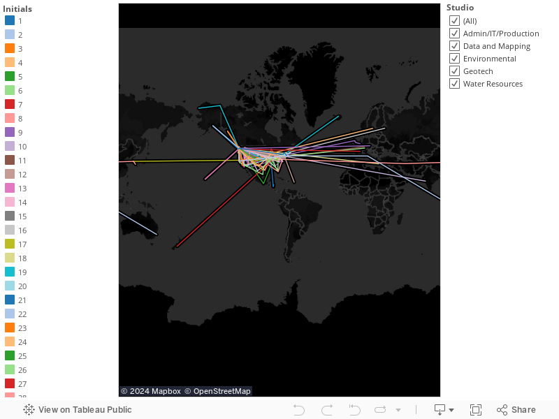
Aspect’s Data + Mapping team uses time-saving tools to streamline our data analysis and processing to inform conclusions, design, and reporting—at the center of which is the environmental data management system EQuIS. Having long been leaders in the field of environmental chemistry data management, we have recently migrated from home-built, custom database systems to this industry standard. Our expertise with this powerful software has been bolstered by Senior Staff Data Scientist Lea Beard, who joined Aspect last summer. She is an EQuIS expert who turns her deep analytical chemistry and data management skills into efficiencies and insights for Aspects project teams and clients.

Why we use EQuIS:

  • It is reliable and stable, ensuring the integrity of our clients’ valuable data.
  • It helps us to process, review, manage, and analyze data as rapidly as our projects move.
  • It enables us easily tailor reporting outputs to the nuanced needs of a project.
  • It ensures adherence to standards and helps us to maintain consistency across projects.
  • It safeguards our data’s compliance with environmental regulatory standards.

Created by EarthSoft, EQuIS is optimized to handle a broad-range of environmental data—particularly environmental chemistry data. EQuIS gives us the “brain” to formulate answers to the questions its users may ask, such as:

  • How many fish passed through this culvert last year?
  • To what extent have the concentrations of chlorinated solvents in groundwater responded to the remediation system operation?
  • Was the Reporting Detection Limit for Lead low enough to meet the Quality Assurance Project Plan?
  •  What were water level elevations in this monitoring well network from 2010 to 2015?

Having this framework already in place saves us and our clients time and money that would otherwise be spent building or customizing software to meet ever-changing needs. EQuIS also contains built-in solutions for common problems encountered in environmental reporting. It’s been put to the test by a wide cross-section of users—consultants, public agencies, corporations, laboratories—who have contributed their feedback and worked out bugs as they go. With a diverse group of users informing how it works for them, EQuIS is able to keep up with the state of environmental reporting.

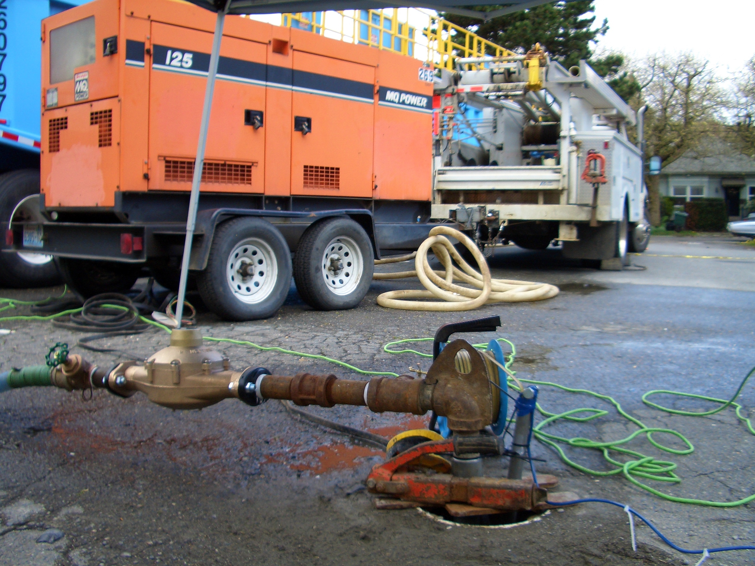
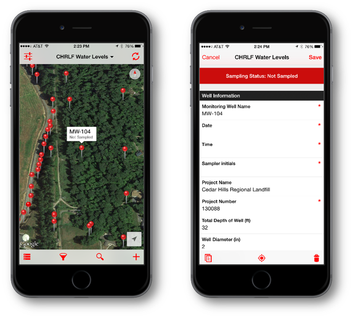
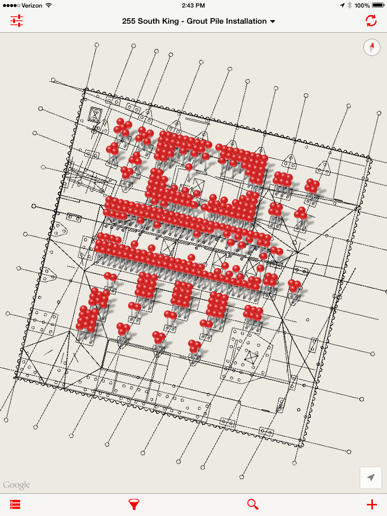
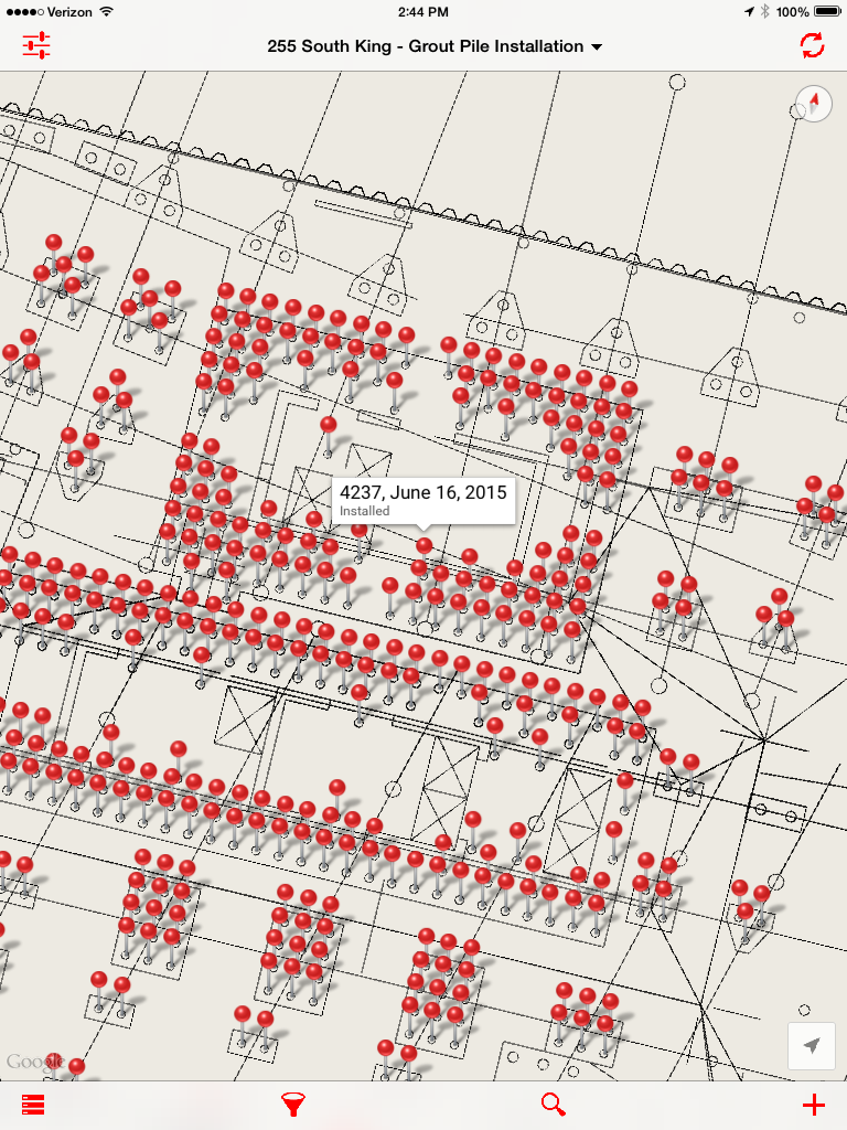
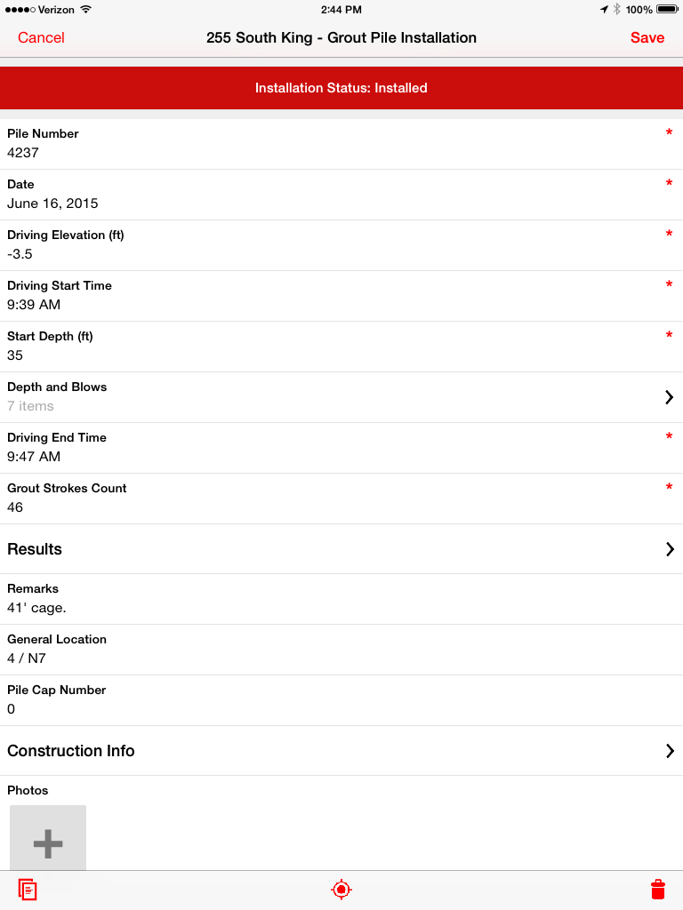
Case Study in How EQuIS Simplifies Our Data Collection

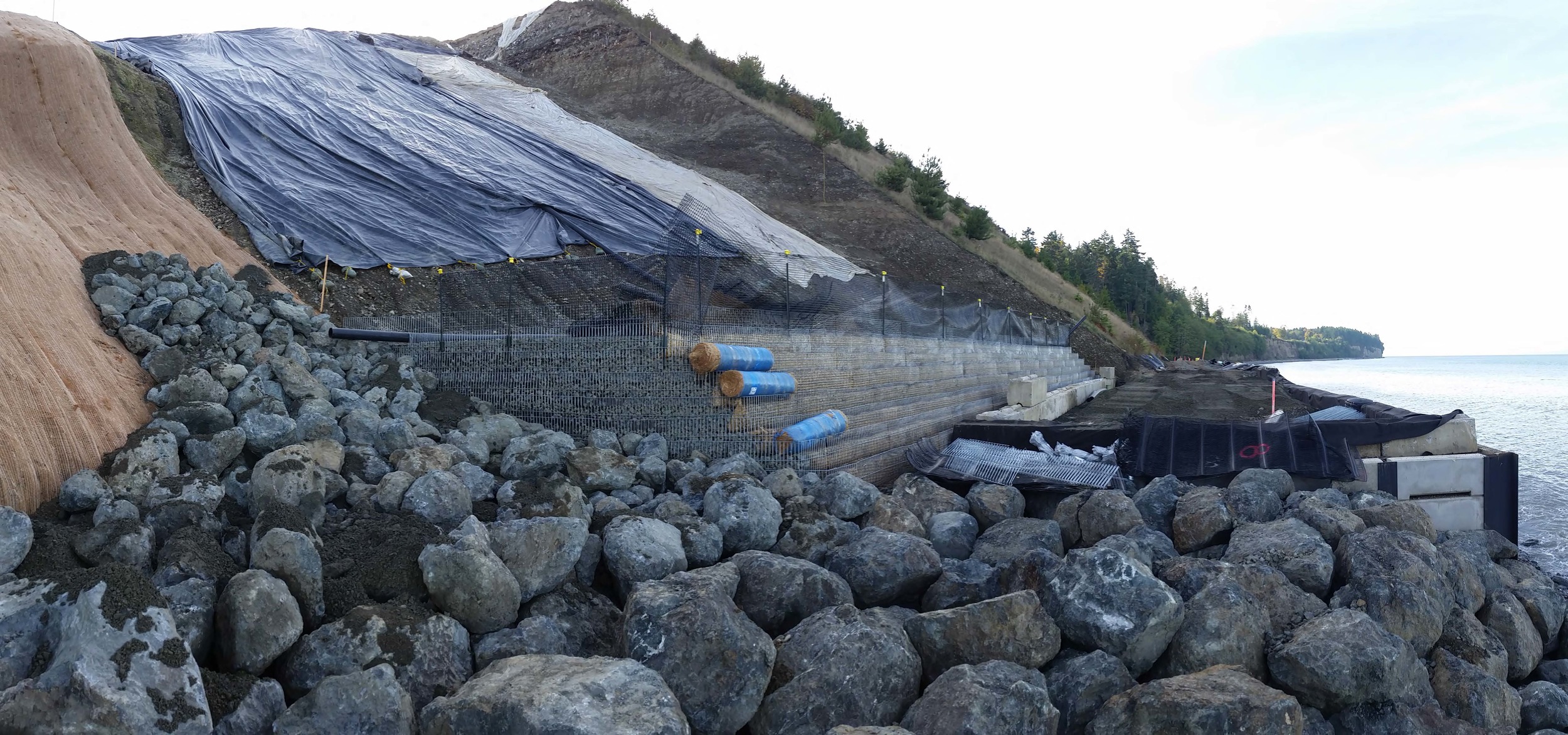
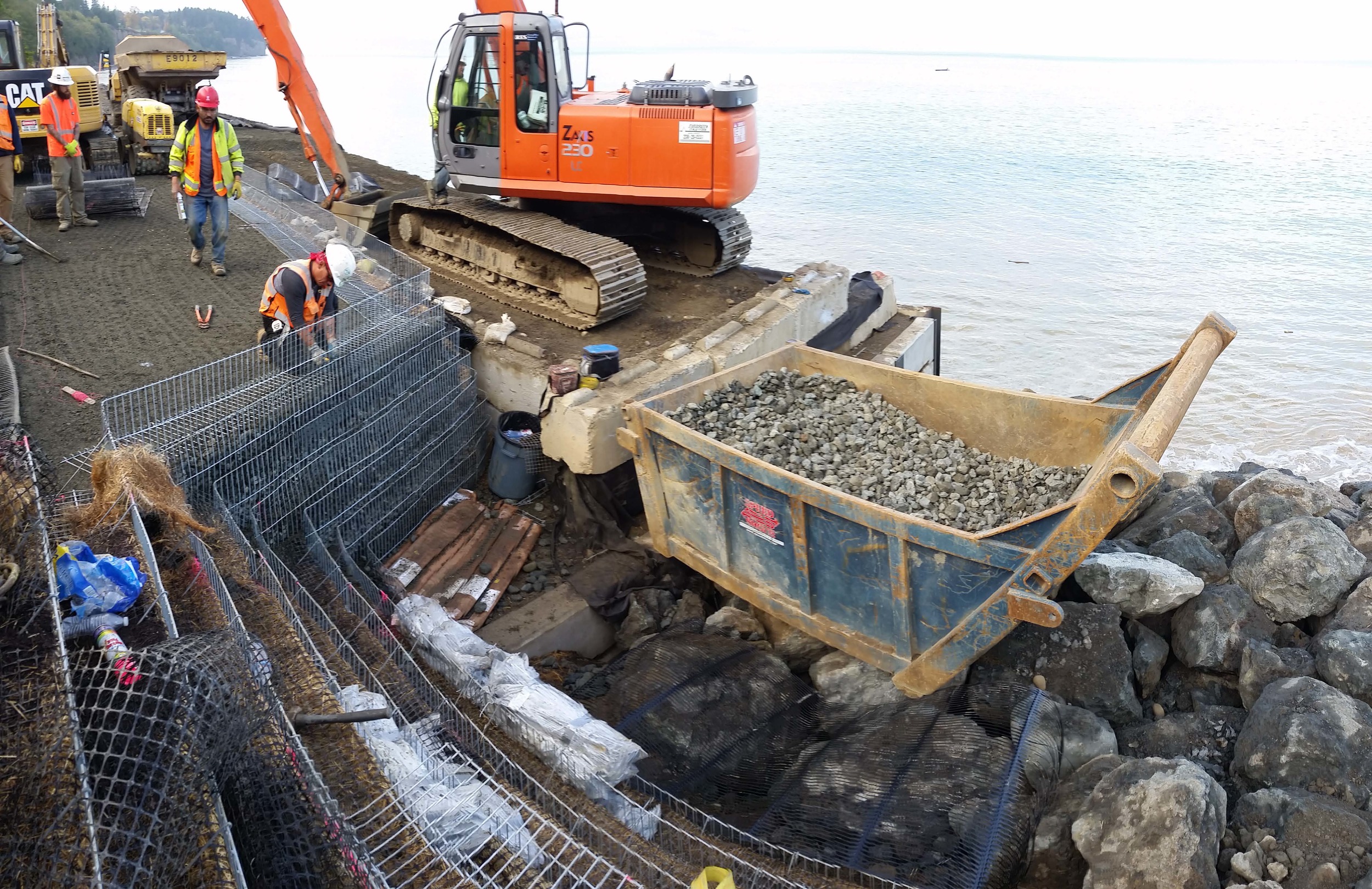
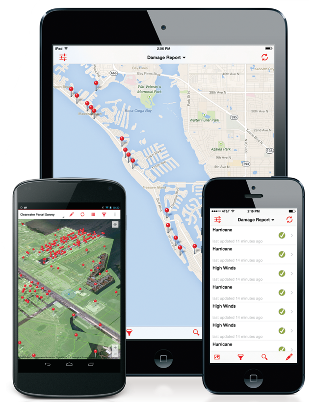
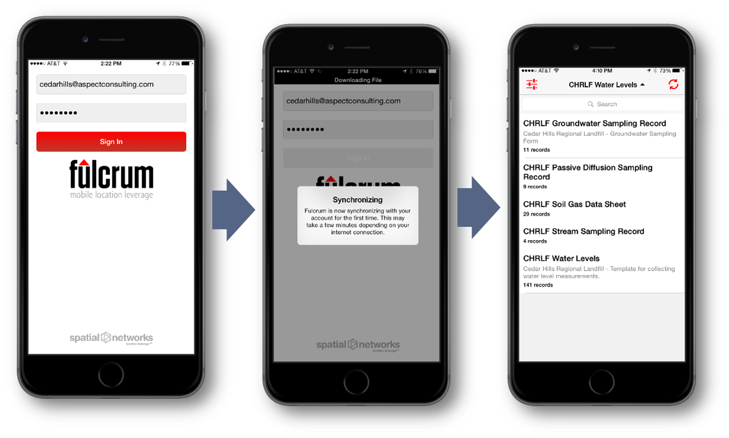
Our staff heads out to a project site, tablet loaded with Fulcrum in hand, and begins to collect data. When the day is done, they send samples to the lab for analysis. Taking the field observations and measurements from Fulcrum and the analytical results from the lab, Lea feeds these two data sets alongside one another into EQuIS. With these normally separate datasets stored together in one spot, EQuIS makes it easy to access and search. Automated alerts and reporting based on preset parameters (perhaps a particular contaminant level has been detected or exceeded) means that project teams can make timely decisions about their next round of data collection or further investigation/inquiry. Reversing the direction of the data, Lea can then feed those results back into Fulcrum, sending it out to the team in the field, ensuring they have the most up-to-date information at the site. In the past this information exchange would have taken a week, but with EQuIS and Fulcrum, it takes mere hours.

EQuIS weaves together the data streams and creates meaningful output.

A Helping Hand Sets Clients on the Right Data Management Path

While EQuIS has the power and flexibility to make managing data easy, it can be a bit daunting to learn and implement. Lea helps guide clients through the set-up process – deciding on reference values, figuring out which lab electronic data deliverable formats to use, building reporting standards – forming the framework of their ongoing data management needs. From there, Aspect can help clients create software customizations to make summing groups of analytes (such as polychlorinated biphenyls) straightforward and reproducible, and offer assistance on making data easy to export into Ecology’s Environmental Information Management (EIM) database. Our in-house experience with EQuIS allows us to help clients tell their project’s story clearly.

Having someone like Lea at the helm of a program like EQuIS allows us to efficiently collect, manage, and report on data, ensuring that the rest of our team can focus on what they’re best at: science and strategic advice for our clients.

Aquifer Storage and Recovery: An Innovative Approach to Water Storage

After years of work, Aspect recently finished a pilot test that will help the City of White Salmon (City) implement one of only a handful of Aquifer Storage and Recovery (ASR) systems in the state. ASR—essentially taking advantage of natural geology, man-made wells, and climate patterns to create an underground reservoir—is an attractive water supply concept. It’s relatively low-cost (compared to building an above ground reservoir), has a small environmental footprint, and in arid climates reduces losses from evaporation. However, permitting of an ASR system involves overcoming technical operational hurdles that hinge on two key questions:

  1. How much water are you getting back? (recoverability)
  2. Will injection or withdrawal affect water quality? (Washington State Department of Ecology’s (Ecology) antidegradation policy)

During Aspect’s monthly technical exchange series, Aspect’s Tim Flynn, Joe Morrice, and Jared Bean gave a presentation and explained Aspect’s experience with ASR in the state and what it means for future water supply.

Creating an Underground Reservoir

Essentially, this concept uses nature’s pre-built reservoirs (aquifers) to create an underground reservoir or tank to store water when it’s plentiful and withdraw it when it’s scarce. In water resources terminology, ASR typically uses seasonally available surface water to help recharge—or move water from the surface into the ground—an aquifer. It does this by capturing excess water during the winter and spring months, when surface water flows are generally high and water system demands low, and injecting that water via a well (or engineered infiltration basin) into the underground aquifer. During the dry summer season, water is withdrawn for use when surface water flows are low and water system demand is at its peak. 

Figure 1. ASR System Cycle
Source: www.groundwatergeek.com

The basic components of an ASR system include:

  • The right kind of Aquifer. Bedrock or unconsolidated aquifers may both be suitable for ASR, but ideally the target aquifer would be bounded by geologic faults or other barriers that limit the flow and loss of stored water in storage before it is recovered from the aquifer.
  • Source water of suitable quality. This is typically surface water from rivers or streams, but with the appropriate water quality treatment and permitting process can include stormwater runoff, remediated groundwater, reclaimed water, and industrial process water. These sources should be chemically compatible with ambient groundwater and do not contain constituents that would violate the State groundwater quality standards, including the antidegradation standard, or can be treated to meet these standards.
  • A way to put water in and to take it out. This means infrastructure for ASR source water diversion, treatment (as needed), conveyance, and injection to the subsurface through one or more wells, with subsequent pumping to recover stored water.

ASR in Washington State

Although ASR has been in practice for many years in other parts of the nation, it’s a fairly new concept to northwestern states that have typically relied on mountain snowpack as a form of water storage to provide supply during summer months. Because of Washington’s recent drought and the scarcity of water in many surface water basins, especially during summer low flows, ASR’s popularity is growing. In Washington state, there are approximately 9 projects in development. The existing policy framework for ASR in Washington state came about in the early 2000s with two developments:

  1. In 2000, the state’s expansion of the definition of “reservoir” to include “…underground geologic formation(s)… as part of an (ASR) project” (RCW 90.03.370); and
  2. In 2003, Ecology’s adoption of the ASR rule (WAC 173-157) which established standards for ASR projects, including standards related to water rights, water quality, water treatment, and geotechnical impacts.   

Aspect is currently working on three ASR projects in Washington, Arizona, and California. Our ASR projects locations in the PNW currently span western, central, and southern Washington and include both basalt (bedrock) and unconsolidated, glacial outwash host-aquifers.  

Figure 2. Groundwater Recharge Projects in Washington State
(ASR = Aquifer Storage and Recovery; SAR = Shallow Aquifer Recharge)
Source: http://www.ecy.wa.gov/programs/wr/asr/asr-home.html

City of White Salmon ASR

The City has historically relied on surface water from Buck Creek for the City’s water supply.  In 2002, the City switched to groundwater wells as their primary supply but with decreasing well yields and limited water rights along with the WA Department of Health issuing a moratorium on new connections the City is seeking new alternatives to boost their water supply. One of these alternatives is to explore the possibility of ASR.  Aspect has helped the City pursue this option by coordinating with Ecology throughout the process. After receiving an Ecology grant, and approval of the feasibility study, an AKART analysis was completed which secured Ecology approval for pilot testing.

The most recent pilot test involved the injection of 32 acre-feet of water over the span of 53 days (135 gallons per minute, or about 200,000 gallons per day).  With the current well and conveyance configuration the City can expect to inject, store and recover about 100 acre-feet per year, which provides approximately 25% of peak (summer) demand.  These numbers are with current operational constraints of a gravity fed non-continuous injection.  If the City upgrades to pressurized injection (continuous) then they can expect more than 300 acre-feet per year, or about 74 percent of peak summer demands.

Figure 3. Conceptual Hydrogeologic Model of White Salmon Project Area
Source: Aspect Consulting

One major concern is to make sure the quality of the water isn’t degraded while in ‘storage’.  The pilot test showed the formation of disinfection byproducts (DBPs) from treating the injected water with chlorine prior to injection.  Ecology’s antidegradation policy says injected water cannot impact native groundwater or source water quality. Groundwater quality monitoring throughout the pilot test showed that DBPs did form in the injection water, but quickly dissipated in the aquifer.

The other hurdle is the recoverable quantity of water or the amount of water recouped from what was originally injected, i.e., “recoverability”. Ecology requires that the same water that is stored be recovered, and any stored water that migrates past the capture zone of the recovery well is no longer available for use.  Aspect has estimated, based on water quality monitoring and aquifer hydraulic response to injection and recovery, that the White Salmon ASR system has 85% recoverability of injected water.

Aspect is engaged in ongoing discussions and interactions with Ecology’s water quality and water rights permitting programs regarding these issues and how to efficiently complete the required permitting while protecting groundwater quality and water rights, including instream flows for the City of White Salmon and other ASR projects.

The interpretation and understanding of water quality and water right permitting requirements for ASR projects is evolving as project proponents advance their plans through Ecology. Aspect will continue to work with clients across the state to use ASR as a viable option in providing water where and when it’s needed most. 

The New Sound Transit U-Link Rail Extension: Understanding Seattle’s Geology

The U-Link light rail extension will open on March 19th—a full six months ahead of schedule and $100 million under budget. This new car-free transportation option for the Seattle area creates a previously unheard of eight-minute UW-to-downtown ride and an under an hour trip from Husky Stadium to Sea-Tac.

This transit game-changer was made possible by routing the light rail through two parallel three-mile-long, large-diameter, soft-ground rail tunnels. The tunnels extend from downtown Seattle, beneath Capitol Hill with a deep station in the Broadway area, then cross beneath the Montlake Cut and run to another underground station near Husky Stadium on the University of Washington Campus.

In an article on MyNorthwest.com, Sound Transit spokesperson Bruce Gray said: "This project has gone fantastic for us. This is one of those projects where we had time and budget built in for a lot of risks that were out there before we started construction and things went smoothly and we didn't have to dip into that time or money to deal with any of the risks. Things went as well as they possibly could have." 

With an underground project of this size and scope, understanding subsurface conditions early and clearly conveying risk was key to project success. With that in mind, Aspect was hired to lead the geologic analysis and hydrogeology disciples, and provide planning and field support for the exploration program.  Our knowledge of regional geology and expected variability in soil properties allowed us to implement a risk-based approach in collecting additional subsurface information. Results of this approach were used to target explorations to areas where additional subsurface information would significantly reduce design and construction costs and contractor contingencies.

Aspect’s approach resulted in significant cost and schedule savings compared to previous exploration approaches that relied on more numerous and costly uniformly spaced explorations.

It is projected that this $1.9 billion project will add 71,000 riders to the light rail system by 2030.

READ MORE HERE

See Aspect at the Yakima Ag Expo January 7th and 8th

Come visit us at our booth at the Yakima Ag Expo on January 7th and 8th at the Yakima Valley Sundome. Members of our water resources team will be providing one-on-one water rights evaluations for conference attendees. We’ll be there to answer your questions about current water right trends in Washington state, and handing out some free goodies as well.

Banking Water for Future Use

The future water availability in many areas of Washington State is uncertain. To address these uncertainties, Aspect is working with Spokane, Stevens, and Pend Oreille counties to develop a regional water bank which will allow for redistribution of water rights between buyers and sellers in the Little Spokane watershed.

Aspect’s Carl Einberger co-authored an article in the American Water Resources Association Newsletter detailing this essential project.

READ IT HERE

A Look Inside Vapor Intrusion

When volatile chemicals have the potential to migrate from contaminated groundwater or soil into an overlying building—i.e., vapor intrusion (VI)—a whole new layer of complexity is added to environmental remediation projects. In Washington State over the last several years, vapor intrusion has been under increasing regulatory scrutiny. An understanding of vapor intrusion typically revolves around a few core questions:

  • How to accurately evaluate it?
  • How to keep abreast of what’s required, given that the regulatory guidance is constantly evolving?
  • How to protect human health during and after site cleanup?

During Aspect’s monthly technical exchange series, Eric Marhofer, Dave Heffner, Carla Brock, Eric Geissinger, and Kirsi Longley of our environmental team gave a roundtable presentation of their collective experience at assessing vapor intrusion at well over 100 sites.

Read More

GIS Day Roundup

Aspect commemorated GIS Day, a part of Geography Awareness Week, with a spirited celebration featuring maps, trivia, and cake. 

The festivities kicked off with a presentation by Senior Data Scientist Parker Wittman, highlighting some of the GIS team’s work over the last year. They have developed innovations using Fulcrum in concert with Google Earth, EQuIS, and other software to make field testing, sampling, and reporting much more efficient. Citing specific work Aspect has done for the Port of Seattle at SeaTac Airport, Parker demonstrated how the systems we’ve created are helping the Port assess the potential impacts proposed construction/redevelopment would have on the existing stormwater infrastructure and keep the existing mass of ever-updating data organized and easily accessible. Our team is strategically employing automated tools where it can save projects time and money.

Later in the day, we cut the cake as the GIS team set out to stump the rest of us with several rounds of GIS / geography-related trivia questions. 

Of course, a GIS Day celebration would not be complete without an informative map. The GIS team polled staffers on all the places they’ve lived throughout their lives. Using the analytical software Tableau, they created this lovely lattice crisscrossing the world. 

Tim Flynn to Talk Water Right Strategies for Irrigators at the 2015 WSWRA Spokane Conference

Over December 2-4, the Washington State Water Resource Association’s (WSWRA) annual conference in Spokane will bring together experts and public policy leaders to discuss important 2016 water issues, including climate change, drought response, and many other relevant irrigation topics. Aspect’s president and principal hydrogeologist Tim Flynn will present on day one of the conference in the Irrigation District Workshop. His presentation on “Recent Case Studies of Effective Water Right Strategies to Support District Operations” will examine irrigation district’s potential risks and opportunities and highlight case studies of the White Salmon and Methow Valley Irrigation Districts. Learn more about the conference HERE.

Stabilizing a One-of-a-Kind Slope

Since 2007, Aspect has provided landfill engineering support to the City of Port Angeles on their closed landfill located on a steep bluff high above the Strait of Juan de Fuca. In addition to our ongoing work (annual groundwater and leachate monitoring programs, gas flare operation and maintenance, and greenhouse gas emission evaluations) we’ve been working to quickly stabilize the steep slopes that wall off the refuse from the marine environment.

A Tall Order

We were recently asked to complete the final design of a 110-foot-high reinforced slope buttress – the tallest such slope in Washington. The earthwork contractor had already begun work, standby fees were accruing, and the construction weather window was narrowing. Thus, time was of the essence to finish the design ahead of the winter wet weather season to protect the surrounding environment from further slope instability. Although a design of this magnitude would normally take six to eight weeks, our geotechnical engineers worked hard to crank out the design in less than half that time.

Creating a Strong and Flexible Slope

The slope will consist of 84 layers of compacted soil sandwiched between thin layers of geosynthetic reinforcement, creating a composite mechanically reinforced soil mass with both good compressive and tensile strength. The geosynthetic reinforcement not only economically increases the strength of the soil but also creates a flexible reinforced slope system that accommodates the expected settlement of the slope buttress. The mechanically reinforced slope must also act as a low-permeability cover for the landfill. Built into the wall is a leachate drainage and collection system that is isolated from surrounding stormwater sources. Collection of leachate (the liquid that drains or “leaches” from a landfill) is a key component of good landfill design. The newly constructed wall will be vegetated with grasses and small shrubs and will keep waste buried for many decades out of the Strait of Juan de Fuca. 

We’re Gonna Need a Bigger Port

The Port of Tacoma is preparing to berth some of the biggest ships in the world. Container ships are quickly outgrowing the U.S. ports that serve them – a trend that shows no sign of slowing down. These enormous container ships enable liners, shippers, and cargo owners to ship more goods at a lower unit cost. The newest of these ultra-large container ships carry more than 18,000 TEUs (20-foot equivalent unit containers), significantly exceeding Panamax dimensions (i.e., the largest ones that can pass through the Panama Canal, about 4,000 TEUs in 1985 and about 12,500 TEUs planned in 2015). These ultra-large container ships currently serve only the Asia-Europe trade routes, and exceed the capacity of U.S. ports. The average size ship calling on U.S. ports is still below 6,000 TEUs, but California ports have begun berthing 12,000 to 14,000 TEU ships. The increasing size of these ships puts pressure on ports to remodel, and fast, or else lose business to a competing port. Ports need to modify their channels and piers to accommodate these behemoths and upgrade their infrastructure to quickly unload, stage, and transport these containers to the hinterlands. See the trend in Vessel size over time in the graphic below. 

Source: Sisson, M. (2013). “Impact and Opportunities from Global Change.” Presented at AAPA Facilities Engineering Seminar on November 6, 2013

The Port of Tacoma is redeveloping the Husky Terminal to allow the simultaneous berthing of two 18,000 TEU ultra-large container ships, which are about 1,300 feet long and 205 feet wide. This project involves the reconfiguration and construction of Pier 4 to align with Pier 3, creating a 2,954 feet long pier that can accommodate up to six 100-foot cranes capable of loading ships that are 24 containers wide. The project enables the Port of Tacoma to be one the first U.S. ports capable of berthing these ultra-large container ships, allowing the port to remain an economic engine for the Pacific Northwest.

Although a natural deep water port, this project involves the dredging of approximately 500,000 cubic yards of sediment, including about 45,000 cubic yards of tributyltin (TBT) contaminated sediment that will be dredged during Phase I of the project. TBT is a marine biocide that was commonly used in ship paint to kill mollusks, but is now globally banned. Aspect engineers Alan Noell and Tom Atkins worked with lead-engineering firm KPFF to evaluate TBT treatment technologies and to design a water treatment system capable of treating millions of gallons of TBT-contaminated dredge return water. Phase I of the project is currently underway with scheduled completion by April 2016, and soon after, the Port will move towards completing Phase II and begin berthing these ultra-large container ships. 

Forecasting the Current and Future Need of Water

This month’s issue of Irrigation Leader Magazine features an article on the Office of Columbia River’s 2016 Long-term Water Supply and Demand Forecast. Aspect staff are working with Washington State University, University of Utah, and Washington State Department of Ecology to produce this next Forecast report that will improve understanding of the current and future need of water through 2035.  With the forecasts information Ecology can continue to develop water supplies by strategically funding water projects in Eastern Washington.  READ THE ARTICLE HERE.

Groundbreaking Yelm Water Right Decision Signals Fundamental Shift in How Water Rights Will Get Approved

In a decision that has wide-ranging consequences for water right projects throughout the state, the Washington Supreme Court (Court) cancelled the city of Yelm’s (Yelm) water right permit. In reversing the Washington State Department of Ecology’s (Ecology) approval of the Yelm’s permit, the Court ruled that Ecology had erroneously used the Overriding Consideration of the Public Interest (OCPI) determination and violated existing instream flows. Ecology had conditioned approval on an “out-of-kind” mitigation package—featuring retiring existing water rights, habitat protection, and stream restoration—to offset the water use from the permit.

The Court’s decision was not unanimous, with three of the nine justices believing that the law supported affirmation of Ecology’s decision.  The dissenting opinion did not find that there was support for a “temporary” criteria for OCPI determinations. The dissenting opinion also saw significant differences between the facts in the Foster vs. Ecology decision (Yelm) and the precedent-setting 2013 Swinomish Indian Tribal Community vs. Ecology decision (Swinomish) — where the Yelm decision focused on permit-based OCPI and net environmental benefit, the Swinomish decision focused on rule-based OCPI and net environmental harm. Lastly, the dissenting opinion held that this ruling effectively changed the OCPI standard from a high bar to an unattainable standard.

OCPI and Out-of-Kind Mitigation Strategies in Jeopardy

Ecology uses OCPI as a tool to approve water right permits when water availability is limited, but it believes the public benefits of approval outweigh any impacts on stream flows.  The key to the Court’s analysis was a finding that the term “withdrawal” in the OCPI statute implied a temporary use of water, while an “appropriation” implied a permanent use of water.   The Court held that the OCPI exception allowed only temporary impairment of instream flows and that municipal water needs do not rise to the level of extraordinary circumstances required to apply the OCPI exception, no matter how much mitigation is added to the project.  

Means Water “Re-Timing” Becomes a Go-to Permitting Strategy

The Yelm decision implies a fundamental re-thinking on how water-short basins can access water. The implication of this ruling, coupled with the Court’s earlier ruling in the Swinomish case, is that no permanent water right will be able to rely on anything other than water-for-water mitigation, in-time and in-place, and no amount of mitigation can offset even de minimis (one molecule) impacts to adopted instream flows.  By taking out-of-kind mitigation off the table, even if it addresses the limiting factors to salmon recovery in a particular basin, likely means a return to a focus on small storage, “pump-and-dumps”, and other water re-timing strategies as the only means of gaining project approval.  

Welcome to Water Year 2016!

While the hydrologic cycle pays no heed to dates, hydrologists mark the start of the water year (WY) on October 1. The United States Geological Survey designates the start of the water year on this date, as it is typically in the lowest flow period of the year in the US, thus making things relatively quiet hydrologically.

WY 2015 is a good one to saying goodbye to in the Puget Sound region. A warm but normal precipitation winter resulted in incredibly low snowpack, followed by a long dry summer. Here’s the year-end water supply summary from Seattle Public Utilities. Check out the flat snowpack in the figure below and 4 months of almost no rain.

Please join us in giving a cold, wet and hopefully soon snowy welcome to WY 2016. Let’s give three cheers for WY 2016 being predicted to be NOT AS BAD as WY 2015!

And may the Pacific Decadal Oscillation and El Nino/Southern Oscillation (PDO/ENSO) cycle be ever in your favor!

Aspect in the DJC: Weighing Ecology’s New Cleanup Guidance for Petroleum Sites

In a guest article in the Daily Journal of Commerce, Aspect’s Steve Germiat weighs in on the vision and the reality of the Washington State Department of Ecology’s new “model remedies” guidance for cleaning up petroleum-contaminated sites. This guidance proposes a kind of “pre-approved” shortcut to site cleanup. Steve goes into both the vision and the reality of this new (to Washington State) cleanup concept and its implications for site owners and developers. 

READ IT HERE.

Walking and Talking the Seawall


One way Aspect encourages cross-pollination of ideas across the company is our monthly firm-wide “Technical Exchanges”. One part deep-dive into the technical challenges that face our clients and one part team-building opportunity, these meetings give us a chance to gather and talk shop with colleagues. September’s exchange was led by Principal Geotechnical Engineer Henry Haselton, who covered the history, design, and current status of the Seattle Seawall replacement project. Prior to his position at Aspect, Henry served as the deputy Project Manager during the planning and preliminary design stages of the Seawall from 2009 to 2013. 

As the largest infrastructure project in Seattle’s history, this massive undertaking is striving to protect the “front porch” of Seattle. Henry’s presentation covered both the history of the original Seawall and the design and ongoing construction of the current one.

The original seawall was built between 1916 and 1934, mostly supported by wooden piles. This timber was all that stood between the waterfront and Puget Sound. As the years progressed, it was in increasing need of repair as sinkholes, tidal influences, waves, and marine foes like gribbles taking millions of tiny bites out of the wood took their toll. The 2001 Nisqually earthquake caused the adjacent Alaskan Way Viaduct to settle and increase pressure on the already stressed wall, thus spurring the City of Seattle to make seawall replacement a priority.

The new Seawall has a complex mix of pieces and players to coordinate: design and construction of a brand new earthquake-resistant seawall; navigating around a complicated lattice of preexisting in-water structures—including around 30,000 wood pilings—and utilities; enhancing marine habitat and environmental quality; and addressing public safety. They had to do this atop one of the busiest waterfronts in the country while managing and minimizing impact to tourism, businesses, roadways and bike/pedestrian passages—and taking into account concerns from a vocal roster of affected parties.

After Henry’s presentation, he took the Aspect crew on a walking tour to see the ongoing work. Here are a few of the project’s innovations we saw in action. 

Jet Grouting

Jet grouting is currently happening between Marion Street and Yesler Way, including the section in front of the ferry terminal. Jet grouting can effectively improve ground around obstructions like utilities, sewer outfalls, and the some 30,000 piles that are still in place from previous waterfront structures. 

Freeze Walls

Freeze walls minimize the groundwater entering the construction area by literally freezing the soil. They require a large amount of refrigeration—hence the frost that gathers around the pipes. 

Fish-Friendly Corridor

This corridor will one day be traveled by fish making their way through Elliott Bay. Young salmonids thrive in shallow waters with minimal light contrasts. The corridor will direct them into these friendlier waters separate from the deeper, darker Elliott Bay. Bumps and grooves on the inside wall are conducive to algae growth, so the fish can stop and snack during their trip. The small “speed bump” in the middle of the picture above accommodates the University Street Combined Sewer Outfall. 

Light Penetrating Surfaces

Closer to the Seattle Aquarium, the new seawall is in place and the sidewalks are already in use. These little windows in the waterfront promenade will allow sunlight to reach the young salmonids and other marine life in the fish corridor below. 

Learn more about the project's background, current status, and next steps at Waterfront Seattle. 

Field Data Collection Goes Mobile

It’s already difficult to imagine doing it any other way.

At Aspect, we collect data. Lots and lots of data. We collect notes, measurements, GPS coordinates, photos, field observations, asset inventories, and on and on. All of the information we collect is almost always tied to some sort of spot on the earth: a well, a catch basin, a stream gage, a geotechnical boring. All the projects and people and paper and files and handwriting – it’s a lot to manage. Doing things the “old-fashioned way” means compiling and collating paper forms, JPEGs, and data files. It means entering notes from the field into a computer back in the office. It means playing a game of “telephone” with our data. It means time (and money!) for our clients.

Enter: Fulcrum.

We’ve installed Fulcrum software on mobile phones and a stable of tablets to help manage, organize, and execute our large, complex sampling and field data collection efforts. It enables us to create interactive, spatially-aware forms that help expedite projects and contribute to accurate, clean, and professional work-products. We’re ensuring that the data we collect is consistent and that photos, coordinates, and information we gather stays connected. As simple as that sounds, it means incredible gains for our projects and measurable benefits for our clients.

Here are a few of the features that we love:

  • At the click of a button, in real-time, field data can be downloaded in the office – enabling office staff to develop maps and analyze data as it is being collected.
  • Data can be downloaded in many file formats to support the specific needs of an individual project (Excel, CSV, GIS Shapefiles, Google Earth KML, etc.).
  • Data requirements and dropdown menus can be established for any or all fields on the form – ensuring consistent, site-specific information is collected.
  • Forms can be built to evolve as data is entered – improving the usability for field staff.
  • Data can be checked and validated on-the-fly – giving field teams real-time feedback and guidance on the collected data.
  • Calculations are built-in and automatic – which saves time and prevents calculation error.
  • Photos, videos, and audio can be collected as a part of each form – intrinsically linking those files with the locations which they document.
  • Locations and any known data can be pre-loaded to the forms – which means field staff can figure out where they need to go and what they need to know in one place.

With Fulcrum, since mobile field data collection is finally flexible and feature-rich, easy to deploy, and easy to use, we’re recommending it for use in many of our new and existing projects.

See how it looks in the gallery below. 

Powering the New South Lake Union Substation

Laying the Groundwork – Enabling Development

Seattle City Light's Denny Substation near South Lake Union is approaching the final phase of design—and oh what a beautiful design it is. The proposed multi-use structure is a sleek, modern building that speaks to the neighborhood’s evolution from its industrial past to its tech-friendly present—with a walking loop, art installations, and interpretive features about the electrical substation housed inside. Rising above it all will be a sculpture that fuses a transmission tower with an old growth tree.

From property acquisition through preliminary design – Aspect has played a part in this exciting transformation of our City’s newest lakefront neighborhood. Our environmental scientists and geotechnical engineers supported the due diligence phase of the project to vet the former Greyhound Bus Maintenance site and successfully acquire the property. We then provided remediation, geotechnical design and dewatering design services to prep the site for construction, and are currently performing remediation and construction oversight and support of the substation design.

Take a tour of the station in Stephen Fesler's article in the "Urbanist," in which he explains, "In a world that's often become too focused on utility over design and context, Seattle City Light shows that things can be done differently."